Caraculo | |
|---|---|
Town | |
 Caraculo train station | |
 Caraculo | |
| Coordinates: 15°1′51″S12°39′42″E / 15.03083°S 12.66167°E | |
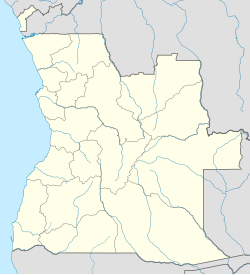
| Country | Angola |
| Province | Namibe |
| Time zone | UTC+1:00 (WAT) |
Caraculo (also known as Finlay) is a town in south-central Angola.
Caraculo | |
|---|---|
Town | |
| Caraculo train station | |
| Caraculo | |
| Coordinates: 15°1′51″S12°39′42″E / 15.03083°S 12.66167°E | |
| Country | Angola |
| Province | Namibe |
| Time zone | UTC+1:00 (WAT) |
Caraculo (also known as Finlay) is a town in south-central Angola.
It is served by a station on the southern line of Angolan Railways (CFM). Near this town the railway has been deviated from its original alignment to avoid steep gradients.
In 2008, a concrete sleeper factory was being established at this town.
Transport in Angola comprises:
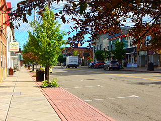
Angola is a village in the town of Evans in Erie County, New York, United States. Located 2 miles (3 km) east of Lake Erie, the village is 22 miles (35 km) southwest of downtown Buffalo. As of the 2010 Census, Angola had a population of 2,127. An unincorporated community known as Angola on the Lake, with a population of 1,675, lies between Angola village and Lake Erie.
Huambo, formerly Nova Lisboa, is the third-most populous city in Angola, after the capital city Luanda and Lubango, with a population of 595,304 in the city and a population of 713,134 in the municipality of Huambo. The city is the capital of the province of Huambo and is located about 220 km E from Benguela and 600 km SE from Luanda. Huambo is a main hub on the Caminho de Ferro de Benguela (CFB), which runs from the port of Lobito to the Democratic Republic of the Congo's southernmost province, Katanga. Huambo is served by the Albano Machado Airport.

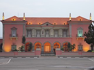
Malanje is the capital city of Malanje Province in Angola, with a population of 455,000, and a municipality, with a population of 506,847. Projected to be the thirteenth fastest growing city on the African continent between 2020 and 2025, with a 5.17% growth. It is located 380 kilometres (240 mi) east of Angola's capital Luanda. Near it are the spectacular Calandula waterfalls, the rock formations of Pungo Andongo, and the Capanda Dam. The climate is mainly humid, with average temperatures between 20 and 24 °C and rainfall 900 to 130 millimetres in the rainy season.

Lubango, formerly known as Sá da Bandeira, is a municipality in Angola, capital of the Huíla Province, with a population of 914,456 in 2022. The city center had a population of 600,751 in 2014 making it the second-most populous city in Angola after the capital city Luanda.

Lobito is a municipality in Angola. It is located in Benguela Province, on the Atlantic Coast north of the Catumbela Estuary. The Lobito municipality had a population of 393,079 in 2014.
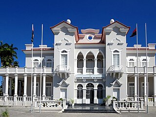
Benguela is a city in western Angola, capital of Benguela Province. Benguela is one of Angola's most populous cities with a population of 555,124 in the city and 561,775 in the municipality, at the 2014 census.
Menongue, formerly Serpa Pinto, is a town, a municipality, and the capital of Cuando Cubango Province in Angola. The municipality had a population of 320,914 in 2014. It is one of the four municipalities in Angola whose inhabitants are predominantly Mbunda.
Caála is a town and a municipality located 23 km west of the city of Huambo, in the namesake province in Angola. It was known as Vila Robert Williams while Angola was a Portuguese colony, after the railroad developer and mining magnate Sir Robert Williams. The town has a population of 130,000 and the municipality a population of 279,792 according to the 2014 census.

Cuíto, formerly known as Silva Porto, is a city and municipality in central Angola, capital of Bié Province. The municipality had a population of 450,881 in 2014. Projected to be the tenth fastest growing city on the African continent between 2020 and 2025, with a 5.56% growth.
Luau is a town and municipality in Angola in the province of Moxico Leste on the border with the Democratic Republic of Congo.
Luacano is a town and municipality in Moxico Leste Province, Angola. The municipality had a population of 20,755 in 2014.
Matala is a town and a municipality in the province of Huíla, Angola. The municipality had a population of 262,763 in 2014.
Ganda is a town and municipality in Benguela Province in Angola. The municipality had a population of 235,486 in 2014.
Cuchi is a town and municipality in Cuando Cubango Province in Angola. The population of the municipality was 42,974 in 2014.
Cubal is a town and municipality in Benguela Province in Angola. The municipality had a population of 305,632 in 2014.

Bibala is a town, with a population of 10,500 (2014), and a municipality in southern Angola. It lies in Namibe Province. The municipality of Bibala covers 7,700 square kilometres (3,000 sq mi) with a population of 64,504 (2014).
Jamba is a town and a municipality, with a population of 105,090, in the province of Huíla, Angola.

Railway stations in Angola include:
Chinguar is a town and municipality in Bié Province in Angola. The municipality had a population of 167,396 in 2022.
| | This Angola location article is a stub. You can help Wikipedia by expanding it. |