
The Aterno-Pescara is a river system in Abruzzo, eastern central Italy. The river is known as the Aterno near its source in the mountains, but takes the name Pescara, actually a tributary, nearer the city of Pescara and the Adriatic Sea.

The Ofanto, known in ancient times as Aufidus or Canna, is a 134 or 170 km river in southern Italy that flows through the regions of Campania, Basilicata, and Apulia, into the Gulf of Manfredonia near Barletta.

The Agri is a river in the Basilicata region of southern Italy. In ancient times it was known as Aciris. The source of the river is in the Lucan Apennines north of Monte Volturino and west of Calvello in the province of Potenza. It is near the source of the Basento. The river flows south near Paterno before curving southeast. It flows near Tramutola, Viggiano, and Grumento Nova before entering a lake. After exiting the lake, the river flows eastward near Armento, Missanello, Aliano, and Sant'Arcangelo. A right tributary, the Racanello, enters the river in this area. The river forms the border between the province of Potenza and the province of Matera for part of this area of the river. It flows into a small lake before entering the province of Matera. The river flows for a short distance before entering Lago di Gannano. After exiting the lake, the river flows southeast near Tursi, Montalbano Jonico, and Scanzano Jonico before flowing into the Gulf of Taranto near Policoro.
The Sinni is a 94 km long river in the Basilicata region of southern Italy. In antiquity, the city of Siris lay at its mouth. Near the town of Senise, a dam on the river was built in 1970-1982, the largest in Europe built with earth. In correspondence of it, it forms the Lago di Monte Cotugno, one of the largest artificial basins in Italy.

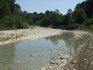
The Basento is a river in the Basilicata region of southern Italy. It rises at Monte Arioso in the southern Apennine Mountains, southwest of Potenza in the province of Potenza. The river flows northeast near Pignola and Potenza before curving east near Vaglio Basilicata. It curves southeast and flows near Brindisi Montagna, Trivigno, and Albano di Lucania. A right tributary coming from Lago di Ponte Fontanelle flows into the river in this area. The river forms the border between the province of Potenza and the province of Matera for a short distance before flowing into the province of Matera. It flows eastward near Tricarico, Calciano, and Grassano before curving southeast. The river flows near Grottole, Miglionico, Pomarico, Ferrandina, and Monte Finese before curving eastward. It flows near Pisticci and Bernalda before flowing into the Gulf of Taranto, which is part of the Ionian Sea, near Metaponto. The main city on the Basento is Potenza, the capital of Basilicata.

The Montone is a river in the historical region of Romagna, which is in the present-day region of Emilia-Romagna in northern Italy. It is the northernmost river on the east-facing slopes of the Apennines to flow directly into the Adriatic Sea rather than entering the Po. Its Latin name was Utis or Vitis.

The Tronto is a 115-kilometre (71 mi) long Italian river that arises at Monti della Laga and ends in the Adriatic Sea at Porto d'Ascoli, San Benedetto del Tronto. It traverses the Lazio, Marche, and Abruzzo regions of Italy.

The Chienti is a river in the Marche region of Italy. Its source is near Serravalle di Chienti in the Appennino Umbro-Marchigiano mountains in the province of Macerata. The river flows northeast through the mountains past Muccia and enters and exits a small reservoir before entering Lago di Pievefavera. After exiting Lago di Pievefavera, the river continues flowing northeast before being joined by the Fiastrone at Belforte del Chienti. The river continues flowing northeast past Tolentino before being joined by the Fiastra south of Macerata. The river flows east near Corridonia and forms the border between the province of Macerata and the province of Fermo before flowing into the Adriatic Sea near Civitanova Marche.
The Cavone is a river in the Basilicata region of southern Italy. It is 49 kilometres (30 mi) long, and has a drainage basin of 675 square kilometres (261 sq mi). Its source is west of Accettura in the province of Matera near the border with the province of Potenza. The river flows northeast near Oliveto Lucano and Garaguso before curving southeast. It flows near Salandra and San Mauro Forte before being joined by a right tributary. The river is joined by a left tributary north of Craco. It flows southeast near Pisticci and empties into the Gulf of Taranto.
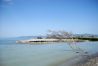
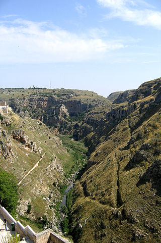
The Bradano is a river in the Basilicata and Apulia regions of southern Italy. Its source is Lago Pesole in the province of Potenza. The river flows southeast near Monte Torretta, Acerenza, and Oppido Lucano. After crossing into the province of Matera, it is joined by a right tributary, the Alvo. The river flows near Irsina before being joined by a left tributary, the Basentello. Shortly after that, it is joined by another right tributary, the Bilioso. The river then enters Lago di San Giuliano. After flowing out of the lake, the Bradano is joined by a left tributary, the Gravina, and flows southeast near Montescaglioso before entering the province of Taranto. It is then joined by a left tributary, the Gravina di Matera, before re-entering the province of Matera after a short distance. The river flows near the border with the province of Taranto before entering the Gulf of Taranto near Lido di Metaponto.
The Bilioso is a river in the province of Matera in the Basilicata region of Italy. Its source is near Tricarico and San Chirico Nuovo and the border with the province of Potenza. The river flows southeast and curves northeast before again flowing southeast. It flows north of Grassano before entering the Bradano as a right tributary near Lago di San Giuliano.
The Gravina is a river in the Apulia and Basilicata regions of southern Italy. Its source is near Poggiorsini and the border of the province of Barletta-Andria-Trani in the province of Bari. The river flows southeast near Gravina in Puglia before crossing into the province of Matera. It flows west of Matera before emptying into the Bradano as a left tributary a short distance after the Bradano exits Lago di San Giuliano.

The Gravina di Matera is a river in the Apulia and Basilicata regions of southern Italy. Its source is between Altamura and Gravina in Puglia in the province of Bari. The river flows southeast and curves east before again flowing southeast. It then flows into the province of Matera and is joined by a left tributary at Matera. The river forms the border between the province of Matera and the province of Taranto near Montescaglioso and Ginosa. Finally, it joins the Bradano as a left tributary in the province of Taranto.
The Calaggio is a river in the province of Avellino in Campania and the province of Foggia in Apulia. The source of the river is north of Vallata in the province of Avellino in the Appennino Napoletano Mountains. It flows northeast and forms the border between the province of Avellino and the province of Foggia for a short distance before flowing into the province of Foggia. It flows through the comuni of Trevico and Candela. At its confluence with the Gennaro, the river Carapelle is formed.
The Carapellotto is a river in the province of Foggia in the Apulia region of Italy. The source of the river is near Deliceto. The river flows northeast and then curves eastward before joining the Carapelle southwest of Ordona as a left tributary of the river.
The Fino is a river in eastern central Italy. Its source is near Monte Camicia in the province of Teramo in the Abruzzo region of Italy. The river flows northeast and then curves east before flowing past Bisenti. It continues flowing eastward and crosses into the province of Pescara near Elice. The river flows southeast until it joins the Tavo river and the two rivers become the Saline river.
The Lamone is a river in the Tuscany and Emilia-Romagna regions of Italy. The source of the river is in the Appennino Tosco-Emiliano mountains in the province of Florence. The river flows northeast near Marradi before crossing the border into the province of Ravenna. It continues flowing northeast near Brisighella, Faenza, Russi and Bagnacavallo before curving eastward north of Ravenna and entering the Adriatic Sea near Marina Romea and Marina di Ravenna.

The Neto is a river in Calabria, southern Italy. It is the second largest river of Calabria after the Crati.
The Vitravo is a river in the Calabria region of southern Italy. The source of the river is in the province of Cosenza near the border with the province of Crotone. The river forms the border between the two provinces for a short distance before entering the province of Crotone. The Vitravo flows southeast near Verzino and Pallagorio before curving east. The river flows north of Rocca di Neto before flowing into the Neto as a left tributary shortly before the Neto flows into the Ionian Sea.
The Mucone is a river in the province of Cosenza, Calabria, southern Italy. The source of the river is in La Sila north of Botte Donato. It flows into Lago di Cecita and flows out of the lake near the western border of Sila National Park. The river flows northwest before curving west near Acri. It flows near Bisignano before flowing into the Crati east of Torano Castello. The Mucone is the largest right tributary of the Crati.
