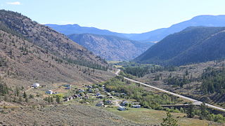
Lillooet is a district municipality in the Squamish-Lillooet region of southwestern British Columbia. The town is on the west shore of the Fraser River immediately north of the Seton River mouth. On BC Highway 99, the locality is by road about 100 kilometres (62 mi) northeast of Pemberton, 64 kilometres (40 mi) northwest of Lytton, and 172 kilometres (107 mi) west of Kamloops.

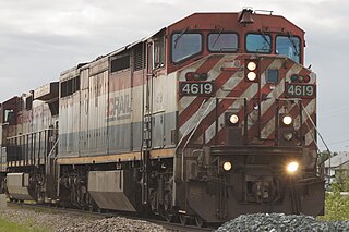
The British Columbia Railway Company, commonly known as BC Rail, is a railway in the Canadian province of British Columbia.

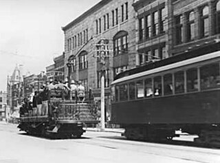
The British Columbia Electric Railway (BCER) was a historic railway which operated in southwestern British Columbia, Canada. Originally the parent company for, and later a division of, BC Electric Company, the BCER assumed control of existing streetcar and interurban lines in southwestern British Columbia in 1897, and operated the electric railway systems in the region until the last interurban service was discontinued in 1958. During and after the streetcar era, BC Electric also ran bus and trolleybus systems in Greater Vancouver and bus service in Greater Victoria; these systems subsequently became part of BC Transit, and the routes in Greater Vancouver eventually came under the control of TransLink. Trolley buses still run in the City of Vancouver with one line extending into Burnaby.

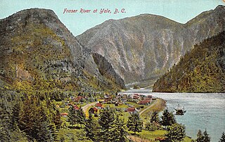
Yale is an unincorporated town in the Canadian province of British Columbia, which grew in importance during the Fraser Canyon Gold Rush.

The Cariboo Road was a project initiated in 1860 by the Governor of the Colony of British Columbia, James Douglas. It was built in response to the Cariboo Gold Rush to facilitate settlement of the area by miners. It involved a feat of engineering stretching from Fort Yale to Barkerville, B.C. through extremely hazardous canyon territory in the Interior of British Columbia.

The Fraser Canyon is a major landform of the Fraser River where it descends rapidly through narrow rock gorges in the Coast Mountains en route from the Interior Plateau of British Columbia to the Fraser Valley. Colloquially, the term "Fraser Canyon" is often used to include the Thompson Canyon from Lytton to Ashcroft, since they form the same highway route which most people are familiar with, although it is actually reckoned to begin above Williams Lake at Soda Creek Canyon near the town of the same name.

Usk is an unincorporated community in the Skeena region of west central British Columbia, Canada. The Usk Ferry connects the two parts of the hamlet that straddle the Skeena River. Just off BC Highway 16, the locality is by road about 182 kilometres (113 mi) west of Smithers and 23 kilometres (14 mi) northeast of Terrace.
Shalalth and South Shalalth are unincorporated communities on the northern shore near the western end of Seton Lake in the Squamish-Lillooet region of southwestern British Columbia. The localities are by road about 63 kilometres (39 mi) northwest of Lillooet, but only 24 kilometres (15 mi) by rail.

Seton Lake is a lake in the Squamish-Lillooet region of southwestern British Columbia. On the northeast side is Mission Ridge. On the southwest is the Cayoosh Range. By road, the eastern end is about 7 kilometres (4.3 mi) southwest of Lillooet.

Anderson Lake is a deep lake in the Squamish-Lillooet region of southwestern British Columbia. On the northwest side are the Bendor Range and Cadwallader Range. On the southeast is the Cayoosh Range. By road, the southern end is about 47 km (29 mi) northeast of Pemberton.
George Matheson Murray, known publicly as George Murray, was a publisher and politician in British Columbia in the first half of the 20th century. He played a role in the founding of the Boy Scouts of Canada. Murray is best known as the husband of Margaret Lally "Ma" Murray.

Pemberton is a village municipality in the Squamish-Lillooet region of southwestern British Columbia. This Pemberton Valley community is on the southwest shore of the Lillooet River and northeast shore of Pemberton Creek. On BC Highway 99, the locality is by road about 153 kilometres (95 mi) north of Vancouver, 33 kilometres (21 mi) northeast of Whistler, and 100 kilometres (62 mi) southwest of Lillooet.

Barnard's Express, later known as the British Columbia Express Company or BX, was a pioneer transportation company that served the Cariboo and Fraser-Fort George regions in British Columbia, Canada from 1861 until 1921.

The Jasper–Prince Rupert train is a Canadian passenger train service operated by Via Rail between Jasper, Alberta, Prince George and Prince Rupert in British Columbia.

Pavilion is an unincorporated community on the eastern side of the Fraser River in the South Cariboo region of southwestern British Columbia. The place is near Mile 21 of the Old Cariboo Road. On BC Highway 99, the locality is by road about 36 kilometres (22 mi) northeast of Lillooet and 135 kilometres (84 mi) west of Kamloops.
Birken is an unincorporated community on the north shore of Gates Lake in the Squamish-Lillooet region of southwestern British Columbia. On Pemberton Portage Road, the locality is by road about 182 kilometres (113 mi) north of Vancouver and 62 kilometres (39 mi) northeast of Whistler.
Parsonville is a ghost town on the east shore of the Fraser River approximately opposite Lillooet. On BC Highway 99, the locality is by road about 100 kilometres (62 mi) northeast of Pemberton, 64 kilometres (40 mi) northwest of Lytton, and 172 kilometres (107 mi) west of Kamloops.

The Kaoham Shuttle is a Lillooet–Seton Portage passenger rail service along the northern shore of Seton Lake in the Squamish-Lillooet region of southwestern British Columbia. By BC Highway 99, the eastern terminus is about 252 kilometres (157 mi) northeast of Vancouver.
A series of ferries and bridges have crossed the Fraser River in the vicinity of Lillooet in the Squamish-Lillooet region of southwestern British Columbia. From the 1850s, these crossings have connected both north–south and local traffic.


