Related Research Articles
Jasper is an opaque mineral.

Rock County is a county at the southwestern corner of the U.S. state of Minnesota. As of the 2020 census, the population was 9,704. Its county seat is Luverne.
Pipestone County is a county in the U.S. state of Minnesota. As of the 2020 census, the population was 9,424. Its county seat is Pipestone.

Colfax is a city in Jasper County, Iowa, United States. Colfax is located approximately 24 miles east of Des Moines. The town was founded in 1866, and was named after Schuyler Colfax, vice president under Ulysses S. Grant. The population was 2,255 at the time of the 2020 census. Newton is the county seat; both were named after Revolutionary War soldiers.

Biwabik is a city in Saint Louis County, Minnesota, United States. The population was 961 at the 2020 census.

Jasper is a city in Pipestone and Rock counties in the State of Minnesota. The population was 633 at the 2010 census. Most of the city lies in Pipestone County, with only a small part of the city extending into Rock County.
Pleasant Valley may refer to:

The Jasper Ridge Biological Preserve is a 483 hectares nature preserve and biological field station formally established as a reserve in 1973. The biological preserve is owned by Stanford University, and is located at 37.408°N 122.2275°W south of Sand Hill Road and west of Interstate 280 in Portola Valley, San Mateo County, California. It is used by students, researchers, and docents to conduct biology research, and teach the community about the importance of that research. The preserve encompasses Jasper Ridge and Searsville Lake and the upper reaches of San Francisquito Creek, along with the latter's Corte Madera Creek and Bear Creek tributaries.

Kendricktown is an unincorporated community in Jasper County, Missouri, United States. It is located on Missouri Supplemental Route V, immediately north of the city limits of Carthage and just south of U.S. Route 71. The main road through town is a former alignment of US 71. Kendricktown was founded by Kendrick Snyder.

The Aitkin Carnegie Library is a Carnegie library in Aitkin, Minnesota, United States. It was designed by architects Claude & Starck and was built in the Classical Revival style. It was listed on the National Register of Historic Places in 1982.
Manley is an unincorporated community in Beaver Creek Township, Rock County, Minnesota, United States.

Minnesota State Highway 269 is a short 2.653-mile-long (4.270 km) highway in southwest Minnesota, which runs from South Dakota Highway 11 at the South Dakota state line to an intersection with State Highway 23 in the city of Jasper.
West Rock is an unincorporated community in Royalton Township, Pine County, Minnesota, United States.

The Sioux Quartzite is a Proterozoic quartzite that is found in the region around the intersection of Minnesota, South Dakota, and Iowa, and correlates with other rock units throughout the upper midwestern and southwestern United States. It was formed by braided river deposits, and its correlative units are thought to possibly define a large sedimentary wedge that once covered the passive margin on the then-southern side of the North American craton. In human history, it provided the catlinite, or pipestone, that was used by the Plains Indians to carve ceremonial pipes. With the arrival of Europeans, it was heavily quarried for building stone, and was used in many prominent structures in Sioux Falls, South Dakota and shipped to construction sites around the Midwest. Sioux Quartzite has been and continues to be quarried in Jasper, Minnesota at the Jasper Stone Company and Quarry, which itself was posted to the National Register of Historic Places on January 5, 1978. Jasper, Minnesota contains many turn-of-the-century quartzite buildings, including the school, churches and several other public and private structures, mostly abandoned.

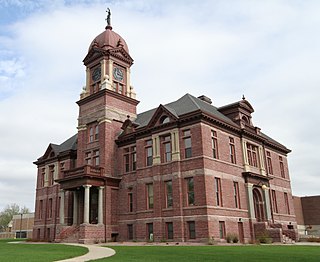
This is a list of the National Register of Historic Places listings in Rock County, Minnesota. It is intended to be a complete list of the properties and districts on the National Register of Historic Places in Rock County, Minnesota, United States. The locations of National Register properties and districts for which the latitude and longitude coordinates are included below, may be seen in an online map.
Pipestone Creek is a 53.2-mile-long (85.6 km) river in southwestern Minnesota and northeastern South Dakota.
Dudenville is an unincorporated community in Dade and Jasper counties in the U.S. state of Missouri. Its elevation is 1,086 feet (331 m), and it is located at 37°18′20″N94°5′0″W.
Castle Rock is an unincorporated community in Castle Rock Township, Dakota County, Minnesota, United States.
East Sioux Falls was a city located in southeastern Minnehaha County, South Dakota located about 6 miles east of Sioux Falls along South Dakota Highway 42 on the Big Sioux River.
References
- ↑ Upham, Warren (2001). Minnesota Place Names, A Geographical Encyclopedia, 3rd Edition. Saint Paul, Minnesota: Minnesota Historical Society. p. 256. ISBN 0-87351-396-7.
Municipalities and communities of Rock County, Minnesota, United States | ||
|---|---|---|
| Cities |  | |
| Townships | ||
| Unincorporated communities | ||
| Ghost towns | ||
| Footnotes | ‡This populated place also has portions in an adjacent county or counties | |
| | This United States ghost town-related article is a stub. You can help Wikipedia by expanding it. |