
Rock County is a county at the southwestern corner of the U.S. state of Minnesota. As of the 2020 census, the population was 9,704. Its county seat is Luverne.

Beaver Creek is a city in Rock County, Minnesota, United States. The population was 297 at the 2010 census.
Prior Lake is an exurban city 20 miles (32 km) southwest of Minneapolis seated next to Savage and Shakopee in Scott County in the state of Minnesota. Surrounding the shores of Lower and Upper Prior Lake, the city lies south of the Minnesota River in an area known as RiverSouth and establishes the urban fringe of the south-southwest portion of Minneapolis-St. Paul, the sixteenth largest metropolitan area in the United States. The population of Prior Lake was 22,796 at the 2010 census.
Bassett Township is a township in Saint Louis County, Minnesota, United States. The township was named for William Bassett, a businessperson in the lumber industry. The population was 41 at the 2010 census.

Brandon is a city in Minnehaha County, South Dakota, United States. Brandon is located five miles east of Sioux Falls. The population was 11,048 as of the 2020 census.

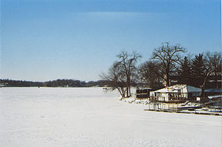
Split Rock Creek State Park is a state park of Minnesota, USA, located in Ihlen, or just south of Pipestone.

Finland is an unincorporated community and census-designated place (CDP) in Crystal Bay and Beaver Bay townships, Lake County, Minnesota, United States. As of the 2020 census, its population was 195.
Booge is an unincorporated community in Red Rock Township, Minnehaha County, South Dakota, United States. The community sits on a major route of the Burlington Northern and Santa Fe Railway, and it is a half-way point between Garretson, South Dakota and Manley, Minnesota.

Lax Lake is an unincorporated community in Beaver Bay Township, Lake County, Minnesota, United States. The community is located north of Beaver Bay and Silver Bay on Lax Lake Road.
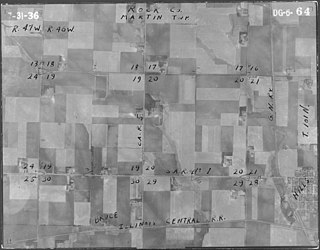
Bruce was the name of a town in Rock County, Minnesota, USA. The town has been completely abandoned, and no trace of it remains.
Ash Creek is an unincorporated community in Clinton Township, Rock County, Minnesota, United States. The community took its name from nearby Ash Creek, a tributary of the Rock River.

Beaver is an unincorporated community in Whitewater Township, Winona County, Minnesota, United States, located near the junction of State Highway 74 and Winona County Road 30. Nearby places include Altura, Elba, Plainview, St. Charles, Weaver, and Whitewater State Park. The Whitewater River and Beaver Creek both flow through the area.
Org is an unincorporated community in Nobles County, Minnesota, United States.

Lawrence County is a county in the Commonwealth of Pennsylvania. As of the 2020 census, the population was 86,070. The county seat is New Castle.
Castle Rock is an unincorporated community in Castle Rock Township, Dakota County, Minnesota, United States.
Acton is an unincorporated community in Acton Township, Meeker County, Minnesota, United States, near Grove City and Litchfield. The community is located along Meeker County Road 23 near State Highway 4. County Road 32 is also in the immediate area.
Ellson is an unincorporated community in Bremen Township, Pine County, Minnesota, United States.
Claybank is an unincorporated community in Goodhue Township, Goodhue County, Minnesota, United States.
McCauley Mountain is a mountain in Columbia County, Pennsylvania, in the United States. Its official elevation is 1,571 feet (479 m) above sea level. The mountain is a synclinal mountain. Main rock formations on and near it include the Mauch Chunk Formation and the Pottsville Formation. There are also coal deposits on it. The coal deposits were discovered in 1826 and mining of them began in the 1850s. However, coal mining on the east side of the mountain proved to be a commercial failure. There are a number of ponds on the mountain, some of which were created during the mining. However, others are natural vernal pools. Some of the ponds are surrounded by hemlocks and deciduous trees. Major streams near the mountain include Scotch Run, Beaver Run, and Catawissa Creek. The mountain is named after Alexander McCauley, who settled there in 1774.


