
Suffolk is a ceremonial county in the East of England and East Anglia. It is bordered by Norfolk to the north, the North Sea to the east, Essex to the south, and Cambridgeshire to the west. Ipswich is the largest settlement and the county town.

East Anglia is an area in the East of England. It comprises the counties of Norfolk and Suffolk, with Cambridgeshire and Essex also included in some definitions. The name derives from the Anglo-Saxon kingdom of the East Angles, a people whose name originated in Anglia, in what is now Northern Germany.
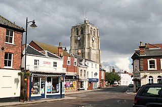
Beccles is a market town and civil parish in the English county of Suffolk. The town is 109 miles (175 km) from London via the A145 and A12 roads, 16 miles (26 km) south-east of Norwich and 33 miles (53 km) north-northeast of Ipswich. Nearby towns include Lowestoft to the east and Great Yarmouth to the north-east. The town lies on the River Waveney on the edge of The Broads National Park.

The River Waveney is a river which forms the boundary between Suffolk and Norfolk, England, for much of its length within The Broads. The "ey" part of the name means "river" thus the name is tautological.
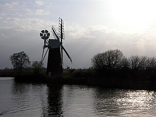
The River Ant is a tributary river of the River Bure in the county of Norfolk, England. It is 27 kilometres (17 mi) long, and has an overall drop of 27 metres from source to mouth. It is said that the Ant was formerly known as the River Smale and that this is the origin of the name of the village of Smallburgh.

Needham Market is a town in the Mid Suffolk district of Suffolk, England. Nearby villages include Barking, Darmsden, Badley and Creeting St Mary. The town of Needham, Massachusetts, was named after Needham Market.
Halesworth is a market town, civil parish and electoral ward in north-eastern Suffolk, England. The population stood at 4,726 in the 2011 Census. It lies 15 miles (24 km) south-west of Lowestoft, on a tributary of the River Blyth, nine miles upstream from Southwold. The town is served by Halesworth railway station on the Ipswich–Lowestoft East Suffolk Line. It is twinned with Bouchain in France and Eitorf in Germany. Nearby villages include Cratfield, Wissett, Chediston, Walpole, Blyford, Linstead Parva, Wenhaston, Thorington, Spexhall, Bramfield, Huntingfield, Cookley and Holton.

Stowmarket is a market town in Suffolk, England, on the busy A14 trunk road between Bury St Edmunds to the west and Ipswich to the southeast. The town lies on the Great Eastern Main Line (GEML) between Diss and Needham Market, and lies on the River Gipping, which is joined by its tributary, the River Rat, to the south of the town.
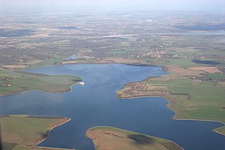
Oulton Broad refers to both the lake and the suburb of Lowestoft in the English county of Suffolk.
East Anglian English is a dialect of English spoken in East Anglia, primarily in or before the mid-20th century. East Anglian English has had a very considerable input into modern Estuary English. However, it has received little attention from the media and is not easily recognised by people from other parts of the United Kingdom. East Anglia is not easily defined and its boundaries are not uniformly agreed upon.
Abberton Reservoir is a pumped storage freshwater reservoir in eastern England near the Essex coast, with an area of 700 hectares. Most of its water is pumped from the River Stour. It is the largest body of freshwater in Essex.
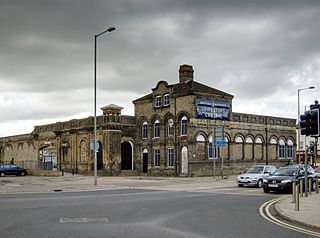
Lowestoft railway station serves the town of Lowestoft, Suffolk. It is the eastern terminus of the East Suffolk Line from Ipswich and is one of two eastern termini of the Wherry Lines from Norwich. Lowestoft is 23 miles 41 chains (37.8 km) down the line from Norwich and 48 miles 75 chains (78.8 km) measured from Ipswich; it is the easternmost station on the National Rail network in the United Kingdom.

Ipswich railway station is on the Great Eastern Main Line in the East of England, serving the town of Ipswich, Suffolk. It is 68 miles 59 chains (110.6 km) down the line from London Liverpool Street and, on the main line, it is situated between Manningtree to the south and Needham Market to the north.
Barnby is a village and civil parish in the East Suffolk district of the English county of Suffolk. The village is 5 miles (8.0 km) west of Lowestoft and 3 miles (4.8 km) east of Beccles in the north of the county. It is effectively merged with the village of North Cove which constitutes a separate parish.

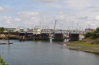
The Port of Ipswich can be dated to c.625. The name Ipswich was originally Gippeswyc, referring to the River Gyppes with a suffix derived from the Scandinavian term vik, which had evolved from meaning bay or inlet to mean landing-place, following the proliferation of merchants requiring places to unload their goods and conduct trade. Since 1997 the port has been run by Associated British Ports.

The Ipswich Waterfront is a cultural and historically significant area surrounding the marina in the town of Ipswich, Suffolk, England. The modern dock was constructed in 1842 and the area was a functioning dock up until the 1970s. At the time of completion, the dock was known as 'the biggest and most important enclosed dock in the kingdom'. Although the dock as it stands was constructed in 1842, the area was used for trade as far back as the 7th century. The decline of industry in the town resulted in the area being transformed into a trendy area of Ipswich, the waterfront is now characterised by its marina, known as Neptune Marina, as well as its mix of classical and postmodern architecture which includes multiple high-rise apartment buildings, restaurants, bars and cafés. The waterfront is also home to the main campus of the region's university, the University of Suffolk.

Stoke is the south west part of Ipswich, Suffolk, bounded by the River Orwell and Belstead Brook. To the west lie the Chantry estates. Stoke is associated with the coming of the railway and consequent industrialisation. Nowadays it is a suburb with many housing developments.

The North Norfolk Coast Site of Special Scientific Interest (SSSI) is an area of European importance for wildlife in Norfolk, England. It comprises 7,700 ha (19,027 acres) of the county's north coast from just west of Holme-next-the-Sea to Kelling, and is additionally protected through Natura 2000, Special Protection Area (SPA) listings; it is also part of the Norfolk Coast Area of Outstanding Natural Beauty (AONB). The North Norfolk Coast is also designated as a wetland of international importance on the Ramsar list and most of it is a Biosphere Reserve.

Cley Marshes is a 176-hectare (430-acre) nature reserve on the North Sea coast of England just outside the village of Cley next the Sea, Norfolk. A reserve since 1926, it is the oldest of the reserves belonging to the Norfolk Wildlife Trust (NWT), which is itself the oldest county Wildlife Trust in the United Kingdom. Cley Marshes protects an area of reed beds, freshwater marsh, pools and wet meadows and is part of the North Norfolk Coast Site of Special Scientific Interest (SSSI), Special Area of Conservation (SAC), Special Protection Area (SPA), and Ramsar Site due to the large numbers of birds it attracts.

Ipswich Blackfriars was a medieval religious house of Friars-preachers (Dominicans) in the town of Ipswich, Suffolk, England, founded in 1263 by King Henry III and dissolved in 1538. It was the second of the three mendicant communities established in the town, the first being the Greyfriars, a house of Franciscan Friars Minors, and the third the Ipswich Whitefriars of c. 1278–79. The Blackfriars were under the Visitation of Cambridge.
 Painting by John Moore: Old Tower Ramparts (lately demolished) Ipswich (1882) illustrating the carnser there
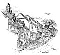 Illustration by Percy E. Stimpson (1888) of the carnser that was in Stoke Street at that time
 Carnser in Blakeney, Norfolk
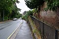 Carnser, Westerfield Road, Ipswich, (2021)


