Related Research Articles

Port Ludlow is an unincorporated community and census-designated place (CDP) in Jefferson County, Washington, United States. It is also the name of the marine inlet on which the community is located. The CDP's population was 2,603 at the 2010 census, up from 1,968 at the 2000 census.
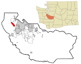
Fox Island is an island and census-designated place (CDP) in Pierce County, Washington, United States, in Puget Sound. It is located approximately 5 miles (8 km) from Gig Harbor. The island was named Fox by Charles Wilkes during the United States Exploring Expedition, to honor J.L. Fox, an assistant surgeon on the expedition. The population was 3,633 at the 2010 census.

Admiralty Inlet is a strait in the U.S. state of Washington connecting the eastern end of the Strait of Juan de Fuca to Puget Sound. It lies between Whidbey Island and the northeastern part of the Olympic Peninsula.
The Kitsap Peninsula lies west of Seattle across Puget Sound, in Washington state in the Pacific Northwest. Hood Canal separates the peninsula from the Olympic Peninsula on its west side. The peninsula, a.k.a. "Kitsap", encompasses all of Kitsap County except Bainbridge and Blake Islands, as well as the northeastern part of Mason County and the northwestern part of Pierce County. The highest point on the Kitsap Peninsula is Gold Mountain. The U.S. Navy's Puget Sound Naval Shipyard, and Naval Base Kitsap are on the peninsula. Its main city is Bremerton.

The Key Peninsula lies along Puget Sound to the south of Kitsap Peninsula in the U.S. state of Washington. It is part of Pierce County and is bordered to the west by Case Inlet and to the east by Carr Inlet. The peninsula is approximately 16 miles (26 km) long and has two Washington State Parks.

Agate Pass or Agate Passage is a high-current tidal strait in Puget Sound connecting Port Madison and mainland Kitsap County in the US state of Washington. It lies between Bainbridge Island and the mainland of the Kitsap Peninsula near Suquamish. It leads south towards Bremerton, extending about one mile (1.6 km) in a straight, southwesterly direction. The depth is about 20 feet (6.1 m). The shores are wooded and fairly steep. The shoreline is mostly rocky and fringed with kelp to Point Bolin. The tidal currents have velocities up to six knots; the flood tide sets southwesterly, and the ebb tide northeasterly.
Stretch Island is an island in Case Inlet in the southern part of Puget Sound in the U.S. state of Washington. It forms part of the unincorporated Mason County community of Allyn-Grapeview. The island has a land area of 1.2179 km2 and a population of 162 persons as of the 2010 census. On the island's north side, it has buoys for overnight mooring, and Stretch Point State Park, a small state park only accessible by boat.

Quartermaster Harbor is a small harbor located in southern Puget Sound, in Vashon Island, Washington state.
Dalco Passage is a tidal strait within Puget Sound in the U.S. state of Washington. Located between the southern end of Vashon Island and the mainland near Tacoma, Dalco Passage connects the northern main Puget Sound basin to the southern basin, via the Tacoma Narrows strait. Colvos Passage, Commencement Bay, and Quartermaster Harbor are also connected to Dalco Passage.

Totten Inlet lies in the southern end of Puget Sound in the U.S. state of Washington. The inlet extends 9 miles (14 km) southwest from the western end of Squaxin Passage, and much of the county line between Mason and Thurston counties runs down the center of it. A spit extends west for about 300 feet (91 m) from Steamboat Island. The inlet shoals gradually to near Burns Point, 100 feet high, on the south shore, where it bares at low tide.
Peale Passage is a strait, in the southern of part of Puget Sound in the U.S. state of Washington. Entirely within Mason County, Washington, Peale Passage separates Hartstine Island from Squaxin Island.

Hammersley Inlet, in southwestern Puget Sound in the U.S. state of Washington, is an arm of water opening north of Arcadia and leading to the city of Shelton and Oakland Bay. Hammersley Inlet is also known as Big Skookum.
Pitt Passage is a strait, in the southern of part of Puget Sound in the U.S. state of Washington. Entirely within Pierce County, Pitt Passage separates Key Peninsula from McNeil Island. Pitt Island lies in the passage.
Case Inlet, in southern Puget Sound in the U.S. state of Washington, is an arm of water between Key Peninsula to the east and Harstine Island to the west. Its northern end, called North Bay, reaches nearly to Hood Canal, creating the defining isthmus of Kitsap Peninsula. Case Inlet is the boundary between Pierce County and Mason County. The southern end of Case Inlet connects to Nisqually Reach, part of the southern basin of Puget Sound. Herron Island lies in Case Inlet.
Eld Inlet is an inlet located at the southern end of Puget Sound in Thurston County, Washington. It is the second southernmost arm of Puget Sound after neighboring Budd Inlet.
Ketron Island is an island and a census-designated place (CDP) in Pierce County, Washington, United States. The island had a population of 24 persons according to the 2000 census, and 17 persons at the 2010 census.
References
- ↑ Phillips, James W. (1971). Washington State Place Names . University of Washington Press. ISBN 0-295-95158-3.