Ireland is an island in Northern Europe in the north Atlantic Ocean. The island, of up to around 480 km (300 mi) north-south, and 275 km (171 mi) east-west, lies near the western edge of the European continental shelf, part of the Eurasian Plate. Its main geographical features include low central plains surrounded by coastal mountains. The highest peak is Carrauntoohil, which is 1,039 metres (3,409 ft) above sea level. The western coastline is rugged, with many islands, peninsulas, headlands and bays, while the southern and northern coasts feature a smaller number of substantial sea inlets, such as Lough Foyle and Cork Harbour; no part of the land is more than around 110 km (68 mi) from the sea. It was administratively divided into 32 counties, gathered in 4 provinces, though current arrangements, especially in Northern Ireland, differ from this model. The island is almost bisected by the River Shannon, which at 360.5 km (224 mi) with a 102.1 km (63 mi) estuary is the longest river in Ireland and flows south from County Cavan in the province of Ulster to form the boundary between Connacht and Leinster, and later Munster, and meet the Atlantic just south and west of Limerick. There are a number of sizeable lakes along Ireland's rivers, of which Lough Neagh is the largest.

The Shannon hydroelectric Scheme was a major development by the Irish Free State in the 1920s to harness the power of the River Shannon. Its product, the Ardnacrusha power plant, is a hydroelectric power station located near Ardnacrusha within County Clare approximately 2.4 kilometres (1.5 mi) from the Limerick border. It is Ireland's largest river hydroelectric scheme and is operated on a purpose built headrace connected to the River Shannon. The plant includes fish ladders so that returning fish, such as salmon, can climb the river safely past the power station.

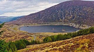
Turlough Hill, also known as Tomaneena, is a 681-metre-high (2,234 ft) mountain in County Wicklow in Ireland and site of Ireland's only pumped-storage hydroelectricity plant. The power station is owned and operated by the ESB and can generate up to 292 megawatts (392,000 hp) of electricity at times of peak demand.

The Electricity Supply Board is a state owned electricity company operating in the Republic of Ireland. While historically a monopoly, the ESB now operates as a commercial semi-state concern in a "liberalised" and competitive market. It is a statutory corporation whose members are appointed by the government of Ireland.

The River Lee is a river in Ireland. It rises in the Shehy Mountains on the western border of County Cork and flows eastwards through Cork, where it splits in two for a short distance, creating an island on which Cork's city centre is built, then passing through Cork Harbour on the south coast, one of the largest natural harbours in the world, to empty into the Celtic Sea. The catchment area of the River Lee is 1,253 km2. The long-term average flow rate of the River Lee is 40.4 cubic metres per second (m3/s)

Shannonbridge is a village located on the River Shannon, at the junction of the R444 and R357 regional roads in County Offaly, Ireland. It lies within the townland of Raghra, at the borders of counties Offaly, Galway and Roscommon, with the majority of the population living east of the bridge in County Offaly. As of the 2016 census, the village had a population of 175. There are two housing estates within the village. Its location along Ireland's largest river and its proximity to Clonmacnoise have contributed to tourism being a key contributor to the local economy. The village is flanked by a Special Area of Conservation – the Shannon Callows. The physical environment consists of the River Shannon, callows, boglands and the Esker Riada. The village has one of the oldest bridges still in use over the River Shannon, completed in 1757.

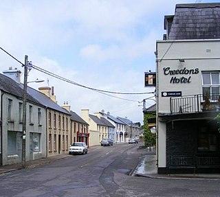
Carrigadrohid is a townland and village in the parish of Aghinagh, County Cork, Ireland. It is situated on the north bank of the River Lee, with the nearby village of Canovee to the south. Carrigadrohid is part of the Dáil constituency of Cork North-West.

Farran is a village in County Cork, Ireland, in the parish of Ovens. It lies on the southside of the River Lee. Farran is 12 miles (19 km) west from Cork City on the N22 road.

Aghada is a village and civil parish in County Cork, Ireland. It is situated on the eastern side of Cork Harbour, around 12 km by road south of Midleton.

The R618 road is a regional road in Ireland which runs west-east from the N22 bypass in Carrigaphooca, west of Macroom along the northern banks of the River Lee to rejoin the N22 at Carrigrohane near Cork City. The road passes through Carrigadrohid, Coachford and Dripsey en route. The point where the R618 leaves the N22 on the outskirts of Cork is known as Kerry Pike. The road was once part of the main route between Cork and Kerry.
Canovee is a rural region, with a village nucleus, in the Lee valley in County Cork, Ireland. The toponym 'Canovee' is synonymous with the official version 'Cannaway', and the electoral division of Cannaway.

Inniscarra Dam is a buttress dam located on the River Lee in the civil parish of Inniscarra in County Cork, Ireland. Construction of the dam started in February 1953 and resulted in the formation of the Inniscarra Reservoir. The dam is owned and operated by the ESB Group and has a generation capacity of 19 MW. It over-flooded in November 2009 and caused around 100 million euros worth of damage to the city, with University College Cork saying it damaged 20 million euros worth of property.

Dripsey Castle is a country house in the townland of Carrignamuck, situated 3.3 km (2.1 mi) north-east of Coachford village and 2.5 km (1.6 mi) north-west of Dripsey village. The house and demesne were dominant features in the rural landscape of Ireland, throughout the eighteenth and nineteenth centuries. Location often reflected the distribution of better land, and this is evidenced in mid-Cork, where many of these houses are situated along the valley of the River Lee and its tributaries.

The Turlough Hill Power Station is a pumped storage power station in Ireland, owned and operated by the Electricity Supply Board (ESB).

Inchigeelagh is a small village, townland and civil parish in County Cork, Ireland. The village is just outside a Gaeltacht area. Inchigeelagh is part of the Dáil constituency of Cork North-West.

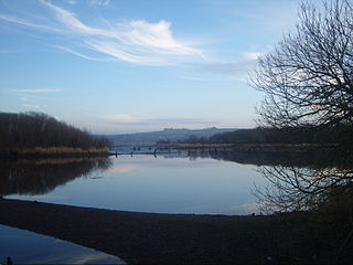
Inniscarra Lake is located along the River Lee in County Cork, Ireland. It is a man-made reservoir formed in the 1950s when Inniscarra Dam was constructed by the Electricity Supply Board. Construction of the dam commenced in 1953, with its floodgates first closed in 1956 and the reservoir fully formed by late 1957.

The Gearagh is a submerged glacial woodland and nature reserve two kilometres southwest of Macroom, County Cork, in Kilmichael parish, Ireland. It is located at the point where the River Lee descends from the mountains and widens at an alluvial plain, and stretches for roughly five kilometres, bounded by the townlands of Toonsbridge, Illaunmore and Anahala.

Carrigadrohid hydroelectric power station is a hydroelectric plant located on the River Lee in County Cork, Ireland. It is owned and operated by the ESB Group. The dam is 130 m (427 ft) long and has a single 8 MW (11,000 hp) Kaplan turbine which produces an average of 22 GWh (79 TJ) each year. Built between 1952 and 1957. the construction of Carrigadrohid required the destruction of over half of the Gearagh, an ancient alluvial forest, and initially harmed local wildlife. However, subsequently the area has seen the growth of an ecosystem with kingfishers, otters, salmon and swans, which has been designated European Union Special Area of Conservation.

Cathaleen's Fall hydroelectric power station is a hydroelectric plant located on the River Erne at Ballyshannon in County Donegal, Ireland. Also known as Ballyshannon, it is owned and operated by the ESB Group. The plant consists of two Kaplan turbines providing a combined capacity of 45 MW (60,000 hp) within a concrete gravity dam 257 m (843 ft) long. Constructed between 1946 and 1955, it is the larger of two hydroelectric plants built between Belleek and Ballyshannon at the same time. Despite construction of the dam meaning the destruction of Assaroe Falls, a local beauty spot, Camlin Castle and many other dwellings, there was no local or national resistance to the project. It was the Ireland's first act of major co-operation with Northern Ireland since independence. The site appears in Conor McPherson's The Weir, to represent the fictional location in the play.


