Related Research Articles

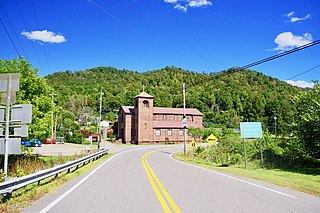
Olive Hill is a home rule-class city along Tygarts Creek in Carter County, Kentucky, in the United States. The population was 1,599 during the year 2010 U.S. Census.

Hyden is a home rule-class city in and the county seat of Leslie County, Kentucky, United States. The population was 365 at the 2010 census. It is located at the junction of U.S. Route 421 and Kentucky Route 80, along the Middle Fork of the Kentucky River.
Buckhorn is a home rule-class city in Perry County, Kentucky, in the United States. The population was 162 at the 2010 census. It is centered on the Buckhorn Presbyterian Church, a log structure listed on the National Register of Historic Places. The Buckhorn Children's Center and Buckhorn Lake State Resort Park are also located here.

Kentuckiana, a portmanteau of Kentucky and Indiana, is the area in the Upland South region of the United States containing metropolitan areas with counties in both Kentucky and Indiana. Kentuckiana is primarily the Louisville metropolitan area, including eight counties in Kentucky and five counties in Southern Indiana. This area "is regularly referred to as Kentuckiana".

The Sheltowee Trace Trail is a 333-mile (535.91 km) National Recreation Trail that was created in 1979 and stretches from the Burnt Mill Bridge Trail Head in the Big South Fork National River and Recreation Area in Tennessee to northern Rowan County, Kentucky. The trail is named after Daniel Boone, who was given the name Sheltowee when he was adopted as the son of the great warrior Chief Blackfish of the Shawnee tribe.

Harrods Creek is a neighborhood of Louisville, Kentucky centered near Harrods Creek at the intersection of River Road and Wolf Pen Branch Road. It is roughly bordered by the Ohio River to the west and US 42 to the east. Its ZIP code is 40027. Formerly an unincorporated community, it was designated a neighborhood of Louisville when the city merged with Jefferson County in 2003.
Goose Creek is a neighborhood of Louisville, Kentucky located where Goose Creek meets the Ohio River. It should not be confused with the adjacent incorporated city of Goose Creek.
The Red Bird River is a tributary of the South Fork Kentucky River, located in the Daniel Boone National Forest in extreme southeastern portion of the U.S. state of Kentucky. It is 34.3 miles (55.2 km) long and drains an area of 195.7 square miles (507 km2).

The Simon Kenton Council (#441) is a Boy Scouts of America council created in 1994 that serves members of the Cub Scouts, Scouts BSA, Venturing, Exploring and in-school programs in central and southern Ohio, and northern Kentucky. The council is divided into ten districts with headquarters in Columbus, Ohio and additional service centers located in Chillicothe and Portsmouth, Ohio. Simon Kenton Council is part of Area 4 of the Central Region, and is named in honor of frontiersman Simon Kenton.
Williba is an unincorporated community in Lee County, Kentucky, United States, located on Fraley Creek, one-half mile from the confluence of the North Fork and the Kentucky River.
Turkey is an unincorporated community in Breathitt County, Kentucky. It is located on Kentucky Route 30, between the communities of Lerose and Shoulderblade.

Fourmile is an unincorporated community located in Bell County, Kentucky.
Troublesome Creek is a creek in Breathitt, Perry and Knott counties, Kentucky. The surrounding watershed is also named for it. The creek joins the North Fork Kentucky River downstream near the unincorporated community of Haddix.
Stinking Creek is a stream in Knox County, Kentucky, in the United States.
Clear Creek is a stream in Bell County, Kentucky, in the United States. It is a tributary of the Cumberland River.
Salt Lick Creek is a stream in Lewis County, Kentucky, in the United States. It is a tributary of the Ohio River.
Lawrence Creek is a stream in Mason County, Kentucky, in the United States. It is a tributary of the Ohio River.
Barcreek is an unincorporated community in Clay County, in the U.S. state of Kentucky.
Bear Creek is a stream Clay County, in the U.S. state of Kentucky. It is a tributary of Red Bird River.
References
- ↑ U.S. Geological Survey Geographic Names Information System: Cassidy Creek
- ↑ Collins, Lewis (1877). History of Kentucky. p. 233.
Coordinates: 38°22′50″N83°44′45″W / 38.3806332°N 83.7457523°W
| This Fleming County, Kentucky state location article is a stub. You can help Wikipedia by expanding it. |
| This article related to a river in Kentucky is a stub. You can help Wikipedia by expanding it. |