Related Research Articles

The Androscoggin River is a river in the U.S. states of Maine and New Hampshire, in northern New England. It is 178 miles (286 km) long and joins the Kennebec River at Merrymeeting Bay in Maine before its water empties into the Gulf of Maine on the Atlantic Ocean. Its drainage basin is 3,530 square miles (9,100 km2) in area. The name "Androscoggin" comes from the Eastern Abenaki term Ammoscocongon, which referred to the entire portion of the river north of the Great Falls in Lewiston, Maine. The Anglicization of the Abenaki term is likely an analogical contamination with the colonial governor Edmund Andros.

Milford Sound Airport is a small but very busy airport in Milford Sound, in New Zealand's Fiordland region of the South Island. It is mainly used by tourist / flightseeing operators.
Hook River is a natural watercourse in the southern Canterbury region of New Zealand's South Island. The river flows east from its source to the Wainono Lagoon, a fresh water lake beside the Pacific Ocean. On the way, it passes through the localities of Waiariari and Hook and is crossed by State Highway 1 and the Main South Line railway. Water from the river and an associated aquifer is used for agricultural purposes.
The Clinton River is a river in the Southland Region of the South Island of New Zealand. There is also a Clinton River in Canterbury, which is a tributary of the Puhi Puhi River.

The Irwin River is a river in the Mid West region of Western Australia. It was named on 9 April 1839 by the explorer George Grey, while on his second disastrous exploration expedition along the Western Australian coast, after his friend Major Frederick Irwin, the Commandant of the Swan River settlement, and later acting Governor of Western Australia from 1847 to 1848.

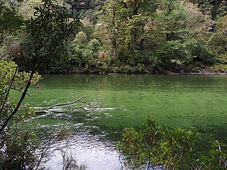
The Cleddau River is a river of New Zealand. It flows into the head of Milford Sound.
The Dark River, New Zealand is a river of Fiordland, New Zealand. It rises west of Barrier Peak and flows westward through Fiordland National Park into Lake Grave, which drains into Te Hāpua / Sutherland Sound.

The Donne River is a river in the Southland Region of New Zealand. It arises in the Darran Mountains, and flows south-west to join the Cleddau River. State Highway 94 crosses the Donne just before it reaches the Cleddau. The river was named by W. G. Grave in 1907 after Thomas Edward Donne, the General Manager of the Tourism Department.
The Edith River is a river of Fiordland, New Zealand. It rises to the west of the Edith Saddle and flows westward into Lake Alice, which drains into George Sound.
The George River is a river of Fiordland, New Zealand. It rises south of Lake Beddoes and flows westward into George Sound at Anchorage Cove.
The Glaisnock River is a river in the Southland Region of New Zealand. It arises between the Stuart and Franklin Mountains, and flows east and south-east into the North Fiord of Lake Te Anau.
The John o'Groats River is a river in northern Fiordland, New Zealand. It flows west to the Tasman Sea north of Milford Sound.
The Kaipo River is a river of New Zealand, flowing into Kaipo Bay, northern Fiordland. The river is very large. Fly fishing is popular there.
The Light River is a river of Fiordland, New Zealand. It rises west of Lake Quill and flows westward into Te Hāpua / Sutherland Sound.
The Pitt River is a river in Fiordland, New Zealand. It rises north-west of Oilskin Pass and flows north-westward into Lake Beddoes and Wild Natives River.
The Talbot River is a river in northern Fiordland, New Zealand. A tributary of Joes River, it rises west of Gulliver Peak.
The Thurso River is a river in northern Fiordland, New Zealand. It rises west of Mount Pembroke and flows westward into the Tasman Sea north of Milford Sound.
The Transit River is a river in New Zealand, flowing into Milford Sound.

The Tūtoko River is a river located in the Darran Mountains in New Zealand. Originating from the western flank of Mount Tūtoko it is a tributary of the Cleddau River.
The Upukerora River is a river in New Zealand, flowing into Lake Te Anau north of Te Anau township.
References
- ↑ New Zealand 1:50000 Topographic Map Series sheet CB08 – Homer Saddle