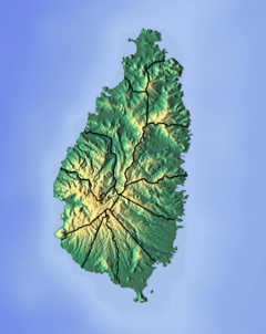
Saint Lucia is an island country in the West Indies in the eastern Caribbean Sea on the boundary with the Atlantic Ocean. The island was previously called Iyonola, the name given to the island by the native Arawaks, and later Hewanorra, the name given by the native Caribs, two separate Amerindian peoples. Part of the Windward Islands of the Lesser Antilles, it is located north/northeast of the island of Saint Vincent, northwest of Barbados and south of Martinique. It covers a land area of 617 km2 and reported a population of 165,595 in the 2010 census. St. Lucia's largest city is Castries, its current capital, and its second largest is Soufrière, the first French colonial capital on the island.

Saint Lucia is one of many small land masses composing the insular group known as the Windward Islands. Unlike large limestone areas such as Florida, Cuba, and the Yucatan Peninsula, or the Bahamas, which is a small island group composed of coral and sand, St. Lucia is a typical Windward Island formation of volcanic rock that came into existence long after much of the region had already been formed.

Castries is the capital and largest city of Saint Lucia, an island country in the Caribbean. The urban area had the population of approximately 20,000, while the eponymous district had a population of 70,000 on 22 May 2013. The city stretches over an area of 80 km2 (31 sq mi).

The island nation of Saint Lucia is divided into 10 districts. The name Quarters or Quartiers originally came from the French period in Saint Lucia. The 2001 and 2010 Census of Saint Lucia refers to the first level administrative divisions as districts. The FIPS and ISO standards regularly called these divisions quarters or quartiers in French. The former district of Dauphin Quarter was merged into Gros Islet District and the former district of Praslin Quarter was merged into Micoud District.

The Saint Lucia Football Association is the governing body of football in Saint Lucia. The FA was founded in 1979, the same year the island gained independence, and is headquartered in Castries, the nation's capital. It runs the Saint Lucia men's and women's junior and senior national teams, as well as its domestic football competitions, which include both men's and women's professional leagues and youth championships.

Castries District is one of 10 districts of the Caribbean island nation of Saint Lucia. According to the 2012 census, the population of the district was 80,573, having shown a slow but steady increase over the past ten years. The capital of Saint Lucia, the city of Castries, is located in this district. During the Saint Lucia Jazz Festival, the city of Castries plays host to several stages.

Philip Joseph Pierre is a Saint Lucian politician currently serving as the prime minister of Saint Lucia since 28 July 2021. Pierre serves as the Minister for Finance, Economic Development and the Youth Economy. He is the Leader of the Saint Lucia Labour Party since 18 June 2016. He has represented the Castries East constituency in the House of Assembly since 1997.

The Cul De Sac River is a river in Castries Quarter of the island country of Saint Lucia. It flows north and then west from the central highlands in the south of the island, reaching the Caribbean Sea in Grand Cul de Sac Bay, south of the capital, Castries. It is one of the longest rivers in Saint Lucia.
The Canelles River is a river in Saint Lucia. It flows southeast from the central highlands in the south of the island, reaching the Atlantic Ocean to the south of the town of Micoud.
The Roseau River is a river in the Anse-la-Raye Quarter of the island country of Saint Lucia. It flows north and then west from the central highlands in the south of the island, reaching the Caribbean Sea to the north of the town of Anse la Raye. The Roseau river is also the longest in the country and is dammed by the John Compton Dam near Millet.

Saint Lucia, an island nation in the Caribbean islands, has a relatively large and lucrative tourism industry. Due to the relatively small land area of the country, most of the governmental promotion is performed by the state-operated Saint Lucia Tourism Authority, led by Executive Chairperson Agnes.

The Balembouche River is a coastal river in Laborie Quarter, Saint Lucia that flows into the Caribbean Sea.

Anse La Raye or Anse-La-Raye is the largest town and seat of the Anse la Raye District of Saint Lucia. It is located on the island's western side, near Marigot Bay, and has several examples of French and English colonial architecture.
Education in St Lucia is compulsory from the ages of 5 to 15 years. Before Independence schools in St Lucia were managed by different religious denominations, in particular, the Roman Catholic Church, the Seventh-day Adventist, and Methodist churches. St Lucia has achieved universal primary education, and universal secondary education. School hours in St Lucia are normally from 9 a.m. to 3 p.m., with secondary schools starting at 8 a.m. and ending at 2:30 p.m. There are approximately 73 primary schools in St Lucia, and 23 secondary schools. St Lucia has a number of medical schools and universities. The Sir Arthur Lewis Community College is located in Castries, where most St Lucians go to further their studies. The St Lucia government had begun to provide all Form 4 students on the island with laptops, but stopped in 2016 due to the new UWP guidelines. The literacy rate in St Lucia is estimated to be 90%.
The Choc River is a river in the Soufrière Quarter of the island country of Saint Lucia. It flows to the Caribbean Sea.
The Esperance River is a river in Gros Islet Quarter in the island country of Saint Lucia.
The Jeremy River is a river of Saint Lucia. It drains from the forest area to the east coast.
The Louvet River is a river of Saint Lucia. It drains from the forest area to the east coast.

Mexico–Saint Lucia relations refers to the diplomatic relations between the United Mexican States and Saint Lucia. Both nations are members of the Association of Caribbean States, Organization of American States and the United Nations.