Caswell County is a county in the U.S. state of North Carolina. It is located in the Piedmont Triad region of the state. At the 2020 census, the population was 22,736. Its county seat is Yanceyville.

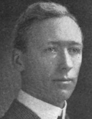
John Hart was the 23rd premier of British Columbia, Canada, from December 9, 1941, to December 29, 1947.

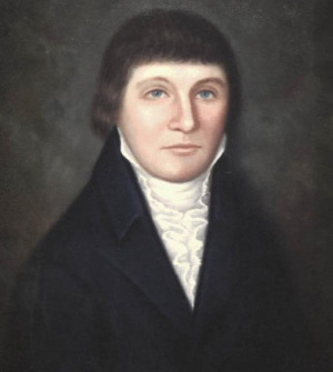
Richard Caswell was an American politician and lawyer who served as the first and fifth governor of the U.S. state of North Carolina from 1776 to 1780 and from 1785 to 1787. He also served as a senior officer of militia in the Southern theater of the American Revolutionary War. As a delegate to the First Continental Congress, he was a signatory of the 1774 Continental Association.
Highway 97 is a major highway in the Canadian province of British Columbia. It is the longest continuously numbered route in the province, running 2,081 km (1,293 mi) and is the only route that runs the entire north–south length of British Columbia, connecting the Canada–United States border near Osoyoos in the south to the British Columbia–Yukon boundary in the north at Watson Lake, Yukon.
Highway 2, known locally as the Tupper Highway, is one of the two short connections from Dawson Creek to the border between British Columbia and Alberta.

Dawson Creek is a city in northeastern British Columbia, Canada. The municipality of 24.37 square kilometres (9.41 sq mi) had a population of 12,978 in 2016. Dawson Creek derives its name from the creek of the same name that runs through the community. The creek was named after George Mercer Dawson by a member of his land survey team when they passed through the area in August 1879. Once a small farming community, Dawson Creek became a regional centre after the western terminus of the Northern Alberta Railways was extended there in 1932. The community grew rapidly in 1942 as the US Army used the rail terminus as a transshipment point during construction of the Alaska Highway. In the 1950s, the city was connected to the interior of British Columbia via a highway and a railway through the Rocky Mountains. Since the 1960s, growth has slowed, but the area population has increased.

The Peace River is a 1,923-kilometre-long (1,195 mi) river in Canada that originates in the Rocky Mountains of northern British Columbia and flows to the northeast through northern Alberta. The Peace River joins the Athabasca River in the Peace-Athabasca Delta to form the Slave River, a tributary of the Mackenzie River. The Finlay River, the main headwater of the Peace River, is regarded as the ultimate source of the Mackenzie River. The combined Finlay–Peace–Slave–Mackenzie river system is the 13th longest river system in the world.

Chetwynd is a district municipality located in the eastern foothills of the Rocky Mountains, in northeastern British Columbia, Canada. Situated on an ancient floodplain, it is the first town eastbound travellers encounter after emerging from the Rockies along Highway 97, and acts as the gateway to the Peace River Country. The town developed during the construction of infrastructure through the Rocky Mountains in the 1950s; additionally, it was used as a transshipment point during the building of hydroelectric dams, in the 1960s and 1970s, and the new town of Tumbler Ridge, in the early 1980s. Home to approximately 2,600 residents, the town’s population has increased little—if at all—since the 1980s, but is significantly younger than the provincial average.

The Battle of Moore's Creek Bridge was a minor conflict of the American Revolutionary War fought near Wilmington, North Carolina, on February 27, 1776. The victory of the North Carolina Provincial Congress' militia force over British governor Josiah Martin's and Tristan Worsley's reinforcements at Moore's was a turning point in the war; American independence was declared less than five months later.

Kakwa Provincial Park and Protected Area is a 170,890 ha provincial park in northeastern British Columbia, Canada. The park preserves the southernmost portion of the Hart Ranges and the northernmost portion of the Continental Ranges. The park also preserves significant marine fossil deposits located in the region.
Pine Le Moray Provincial Park is a provincial park in British Columbia, Canada. The park, 70 km southwest of Chetwynd covers 43,289 hectares. It is located within the Hart Ranges ecosection near the Rocky Mountains. It is within the Engelmann Spruce-Subalpine Fir biogeoclimatic zone. Water courses include Link and Mountain Creeks, the Pine River, and Heart Lake. It provides habitat for trout, Arctic grayling, mountain whitefish, high elevation caribou, moose, wolverine, and grizzly bear. It is recognized by the province as an area traditionally used by First Nations people. Its topography has examples of Karst topography and alpine areas.

The Hart Ranges are a major subrange of the Canadian Rockies located in northeastern British Columbia and western Alberta. The mountains constitute the southernmost portion of the Northern Rocky Mountains.
James Moore was an American military officer who served in the Continental Army during the American Revolutionary War. Moore was born into a prominent political family in the colonial Province of North Carolina, he was one of only five generals from North Carolina to serve in the Continental Army. He spent much of his childhood and youth on his family's estates in the lower Cape Fear River area, but soon became active in the colonial military structure in North Carolina.
Ron White was a Canadian film and television actor. During his career, he was nominated for two Genie Awards and six Gemini Awards.
The Misinchinka River is a river in the north-central Interior of British Columbia, Canada, rising in the northern Hart Ranges to flow northwest to join the Parsnip River just before that river's estuary into the Parsnip Reach of Lake Williston, part of the Peace-Mackenzie Rivers drainage.

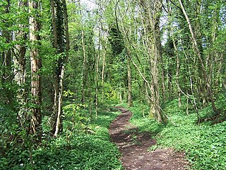
Shorn Cliff And Caswell Woods is a 69.2-hectare (171-acre) biological Site of Special Scientific Interest in Gloucestershire, notified in 1986. The site is listed in the 'Forest of Dean Local Plan Review' as a Key Wildlife Site (KWS).
Negro Creek may refer to:

Murray Range is a subdivision range of the Hart Ranges, of the Northern Rockies in British Columbia, Canada. The majority of the range lies within the Pine-Lemoray Provincial Park and is noted for its snowmobiling, hiking and ski touring opportunities. The boundaries of the Murray Range generally lie between the Misinchinka River to the west and Mountain Creek to the east; the Pine River to the north and Mount Reynolds to the south.
Solitude Range is a subdivision range of the Misinchinka Ranges of the Hart Ranges of the Northern Rockies in British Columbia, Canada. The boundaries of the Solitude Range generally lie between the Murray Range and Mountain Creek to the west, Le Moray Creek to the east, the Pine River to the north and Mount Merrick to the south.


