
Quedlinburg is a town situated just north of the Harz mountains, in the district of Harz in the west of Saxony-Anhalt, Germany. As an influential and prosperous trading centre during the early Middle Ages, Quedlinburg became a center of influence under the Ottonian dynasty in the 10th and 11th centuries. The castle, church and old town with around 2,100 timber houses, dating from this time of influence, were added to the UNESCO World Heritage List in 1994 because of their exceptional preservation and outstanding Romanesque architecture.

Wernigerode is a town in the district of Harz, Saxony-Anhalt, Germany. Until 2007, it was the capital of the district of Wernigerode. Its population was 32,181 in 2020.

Saxony-Anhalt is a state of Germany, bordering the states of Brandenburg, Saxony, Thuringia and Lower Saxony. It covers an area of 20,451.7 square kilometres (7,896.4 sq mi) and has a population of 2.17 million inhabitants, making it the 8th-largest state in Germany by area and the 11th-largest by population. Its capital and most populous city is Magdeburg.

The Harz, also called the Harz Mountains, is a highland area in northern Germany. It has the highest elevations for that region, and its rugged terrain extends across parts of Lower Saxony, Saxony-Anhalt, and Thuringia. The name Harz derives from the Middle High German word Hardt or Hart. The name Hercynia derives from a Celtic name and could refer to other mountain forests, but has also been applied to the geology of the Harz. The Brocken is the highest summit in the Harz with an elevation of 1,141.1 metres (3,744 ft) above sea level. The Wurmberg is the highest peak located entirely within the state of Lower Saxony.
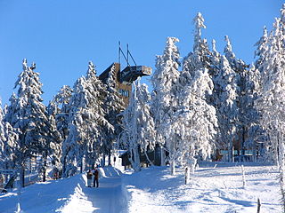
Goslar is a district in Lower Saxony, Germany. It is bounded by the districts of Göttingen, Northeim, Hildesheim and Wolfenbüttel, the city of Salzgitter, and by the states of Saxony-Anhalt and Thuringia (Nordhausen).
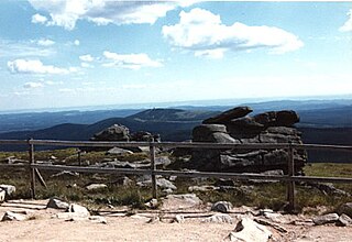
Harz National Park is a nature reserve in the German federal states of Lower Saxony and Saxony-Anhalt. It comprises portions of the western Harz mountain range, extending from Herzberg and Bad Lauterberg at the southern edge to Bad Harzburg and Ilsenburg on the northern slopes. 95% of the area is covered with forests, mainly with spruce and beech woods, including several bogs, granite rocks and creeks. The park is part of the Natura 2000 network of the European Union.
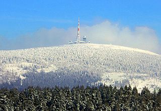
The Brocken, also sometimes referred to as the Blocksberg, is the highest peak in the Harz mountain range and also the highest peak in Northern Germany; it is near Schierke in the German state of Saxony-Anhalt between the rivers Weser and Elbe. Although its elevation of 1,141 metres (3,743 ft) is below alpine dimensions, its microclimate resembles that of mountains of about 2,000 m (6,600 ft). The peak above the tree line tends to have a snow cover from September to May, and mists and fogs shroud it up to 300 days of the year. The mean annual temperature is only 2.9 °C (37.2 °F). It is the easternmost mountain in northern Germany; travelling east in a straight line, the next prominent elevation would be in the Ural Mountains in Russia.

The Rammelsberg is a mountain, 635 metres (2,083 ft) high, on the northern edge of the Harz range, south of the historic town of Goslar in the North German state of Lower Saxony. The mountain is the location of an important silver, copper, and lead mine. When it closed in 1988, it had been the only mine still working continuously for over 1,000 years. Because of its long history of mining and testimony to the advancement and exchange of technology over many centuries, the visitor mine of Rammelsberg was inscribed as a UNESCO World Heritage Site in 1992.

Thale is a town in the Harz district in Saxony-Anhalt in central Germany. Located at the steep northeastern rim of the Harz mountain range, it is known for the scenic Bode Gorge stretching above the town centre.

Harzgerode is a town in the district of Harz in Saxony-Anhalt, Germany.
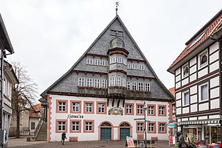
Osterode am Harz, often simply called Osterode, is a town in south-eastern Lower Saxony in central Germany on the south-western edge of the Harz mountains. It was the seat of government of the district of Osterode. Osterode is located on the German Timber-Frame Road.

The Harz Narrow Gauge Railways is a railway company that operates a 1,000 mmmetre gauge network in the Harz mountains, in central Germany. The company was formed after the Second World War as a merger of two earlier companies. It owns about 140 kilometres of track, connecting the principal towns of Wernigerode, Nordhausen and Quedlinburg and several smaller settlements in the area. Much of the network is steeply graded and picturesque, but its most popular destination is the Brocken, the highest mountain in the region. The company runs a significant number of its trains with steam haulage, mostly employing 1950s vintage 2-10-2 tank locomotives, hauling traditional open-platform bogie carriages. The company is mainly owned by the various local authorities whose territories it serves.

Blankenburg (Harz) is a town and health resort in the district of Harz in Saxony-Anhalt, Germany, at the north foot of the Harz Mountains, 12 miles (19 km) southwest of Halberstadt.
Harz is a district in Saxony-Anhalt, Germany. Its area is 2,104.9 km2 (812.7 sq mi).

Bundesstraße 27 or B27 is a German federal road. It connects Blankenburg am Harz with Rafz in Switzerland.

The B 242 is a federal highway in Germany. It runs from Seesen to Mansfeld.

The Upper Harz is the northwestern and higher part of the Harz mountain range in Germany. The exact boundaries of this geographical region may be defined differently depending on the context. In its traditional sense, the term Upper Harz covers the area of the seven historical mining towns (Bergstädte) - Clausthal, Zellerfeld, Andreasberg, Altenau, Lautenthal, Wildemann and Grund - in the present-day German federal state of Lower Saxony. Orographically, it comprises the Harz catchment areas of the Söse, Innerste and Grane, Oker and Abzucht mountain streams, all part of the larger Weser watershed.

The Upper Harz Water Regale is a system of dams, reservoirs, ditches and other structures, much of which was built from the 16th to 19th centuries to divert and store the water that drove the water wheels of the mines in the Upper Harz region of Germany. The term regale, here, refers to the granting of royal privileges or rights in this case to permit the use of water for mining operations in the Harz mountains of Germany.
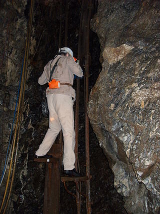
The Samson Pit or Samson Mine is an historic silver mine in Sankt Andreasberg in the Upper Harz region of central Germany.

Transdev Sachsen-Anhalt is a regional railway company, a subsidiary of Transdev Germany. It provided passenger services on the North Harz network from 2005 to 2018 under the name HEX (HarzElbeExpress).


