Related Research Articles

Tiruchirappalli, also called Tiruchi or Trichy, is a major tier II city in the Indian state of Tamil Nadu and the administrative headquarters of Tiruchirappalli district. The city is credited with being the best livable city, the cleanest city of Tamil Nadu, as well as the fifth safest city for women in India. It is the fourth largest city as well as the fourth largest urban agglomeration in the state. Located 322 kilometres (200 mi) south of Chennai and 374 kilometres (232 mi) north of Kanyakumari, Tiruchirappalli sits almost at the geographic centre of Tamil Nadu state. The Cauvery Delta begins 16 kilometres (9.9 mi) west of the city where the Kaveri river splits into two, forming the island of Srirangam which is now incorporated into the Tiruchirappalli City Municipal Corporation. The city occupies an area of 167.23 square kilometres (64.57 sq mi) and had a population of 916,857 in 2011.

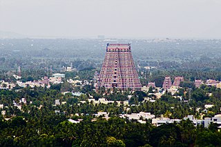
Srirangam is a neighbourhood in the city of Tiruchirappalli in the Indian state of Tamil Nadu. A river island, Srirangam is bounded by the Kaveri River on one side and its distributary Kollidam on the other side. Considered as the first among the 108 Divya Desams, a group of Vishnu temples, it is famous for the Sri Ranganathaswamy Temple, the largest temple complex in India and the biggest functioning Hindu temple in the world. Srirangam is also home to a significant population of Sri Vaishnavas.

Erode District is one of the 38 districts in the state of Tamil Nadu in India. It was the largest district by area in the state before the formation of Tirupur District in 2009. The headquarters of the district is Erode. It is divided into two revenue divisions, Erode and Gobichettipalayam, and is further subdivided into 10 taluks. Erode District was a part of Coimbatore District before its division into two on 17 September 1979. It covers an area of 5,722 square kilometres (2,209 sq mi), and as of 2011, had a population of 2,251,744.

Erode, is a city in the Indian state of Tamil Nadu. Erode is the seventh largest urban agglomeration in the state, after Chennai, Coimbatore, Madurai, Tiruchirapalli, Tiruppur and Salem. It is also the administrative headquarters of the Erode district. Administered by a city municipal corporation since 2008, Erode is a part of Erode Lok Sabha constituency that elects its member of parliament. Located on the banks of River Kaveri, it is situated centrally on South Indian Peninsula, about 400 kilometres (249 mi) southwest of its state capital Chennai, 250 kilometres (155 mi) south of Bengaluru, 100 kilometres (62 mi) east of Coimbatore and 275 kilometres (171 mi) east of Kochi. Erode is an agricultural, textile and a BPO hub and among the largest producers of turmeric, hand-loom and knitwear, and food products.

Bhavani is an interstate Indian river which flows through Indian states of Kerala and Tamil Nadu, India. It originates from the Western Ghats and is one among the three rivers of Kerala which flows in eastward direction.

Bhavani is a Municipality in Erode District, Tamil Nadu, India. It is located at the northern periphery of Erode City Municipal Corporation and is around 105 km (65 mi) from Coimbatore and 60 km (37 mi) from Tiruppur and Salem. Bhavani is also known as "Carpet City" as it is known for its carpet industry; blankets and carpets manufactured in the town are known as Bhavani Jamakkalam. As of 2011, the town covers an area of 2.17 square kilometres (0.84 sq mi) and has a population of 39,225. It is a grade II municipality.

Kallanai is an ancient dam built by Karikala of Chola dynasty in 150 CE. It is built across the Kaveri river flowing from Tiruchirapalli District to Thanjavur district, Tamil Nadu, India. The dam is located in Thanjavur district, 15 km from Tiruchirapalli and 45 km from Thanjavur. It is the fourth oldest water-diversion or water-regulator structure in the world and the oldest in India that is still in use. Because of its spectacular architecture, it is one of the prime tourist spots in Tamil Nadu.

Tiruchirappalli District is one of the 38 districts, located along the Kaveri River, in Tamil Nadu, India. The headquarters of the district is the city of Tiruchirappalli.
Paramathi Velur, a town in Paramathi-Velur taluk, Namakkal District, Tamil Nadu, India is situated just off the Srinagar - Kanyakumari National Highway 44 (India). This town is also called as Paramathi Velur, with STD Code 04268 & Postal code 638182.
Muttharasanallur is a village in Tiruchirapalli in the state of Tamil Nadu, India. It is located approximately 7 km to the west of Trichy City on the road to the town of Karur. Mutharasanallur is a main agricultural village with water source from the River Kaveri.

Tamil Nadu has the largest tourism industry in India with a percentage share of 21.31% and 21.86% of domestic and foreign tourist visits in the country. According to the 2020 Ministry of Tourism report, the number of domestic arrivals was at 494.8 million making the state the second most popular tourist destination in the country, and foreign arrivals numbered 6.86 million, the highest in the country, making it the most popular state for tourism in the country.
Erode city being the headquarters of Erode district, in Tamil Nadu, India, has an extensive road and rail transport network in all radial directions, as it lies landlocked.

Tiruchchirappalli Junction railway station, also known as Trichy Junction railway station is a junction station in Tiruchirappalli, Tamil Nadu. It serves as the headquarters for Tiruchirappalli railway division of the Southern Railway zone. The station code is TPJ, used for official purposes. Daily approximately 15,000 passengers are using this Tiruchirappalli Junction. TPJ is the only railway station in southern railway to host diesel–electric multiple unit (DEMU) shed. Tiruchirappalli Junction is the second largest railway station in Tamil Nadu and one of the busiest railway stations in India. The station was awarded ‘Gold’ rating in March 2020 by the Confederation of Indian Industries (CII) for implementing various environment-friendly measures. It is the first and only station in Southern Railway to get "Gold" certification and fifth across Indian Railways.

Tiruchirappalli has a well-developed transport infrastructure. Being located almost at the geographic centre of the state Tamil Nadu India, Tiruchirappalli is well connected by Road, Rail and Air with most cities.

Kaveri railway station is a railway station in Pallipalayam in Namakkal district of Tamil Nadu. It is also called Kaveri/Cauveri railway station or Cauvery RS. The name is obtained because of its proximity to the Kaveri River. It is also known officially by its code:CV.

The Upper Anaicut, also known as Mukkombu is a dam built on the Kaveri River in the state of Tamil Nadu in southern India. The regulator dam was constructed between 1836 and 1838 by Sir Arthur Cotton, a British irrigation engineer who was inspired by the architectural beauty of Grand Anaicut canal built by Karikala Chola in Kallanai of Thanjavur district in the second century.

Coimbatore is a city in the state of Tamil Nadu, India. Most transportation in the city and suburbs is by road. Coimbatore is well-connected to most cities and towns in India by road, rail, and air, but not through waterways. The city has successful transport infrastructure compared to other Indian cities, though road infrastructures are not well maintained and developed according to the growing needs of transport, making traffic congestion a major problem in the city. A comprehensive transport development plan has been made to address many traffic problems.

The Lower Anaicut or Anaikkarai is a dam and bridge built on the Kollidam in the Indian state of Tamil Nadu.
The Outer Ring Road is a 15-kilometer (9.3 mi) long semi ring road laid around the South Indian city of Erode in Tamil Nadu. It also acts as a southern Bypass to Erode and connects the suburban areas in Namakkal district with the city core areas.
Perumpallam Canal is an irrigation canal in the city of Erode in Tamil Nadu. The canal traverses from west to east across the city and flows into River Kaveri. It runs for a length of about 20 kilometres (12 mi).
References
- ↑ "Traffic hit as lorry breakdown on Cauvery bridge". The Hindu . Retrieved 22 December 2017.
- ↑ "State to construct new bridge across Cauvery". The Hindu . Retrieved 22 December 2016.
- ↑ "Additional bridge work across Cauvery makes slow progress". The Hindu . Retrieved 22 December 2016.
- ↑ "Hydro project barrage nearing completeion" . Retrieved 22 December 2016.
- ↑ "HIGHWAYS DEPARTMENT HIGH LEVEL BRIDGE ACROSS CAUVERY RIVER, ERODE". Archived from the original on 29 September 2014. Retrieved 29 September 2014.
11°21′38.2″N77°44′36.1″E / 11.360611°N 77.743361°E