Cañacao Bay

Last updated
Cañacao Bay

Naval Station Sangley Point aerial1 c1964.jpg

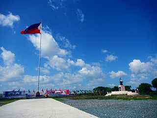
Cañacao Bay is the body of water left of the Sangley Point airstrip.
Philippines relief location map (Luzon).svg
Red pog.svg
Cañacao Bay
Location within the Philippines
Philippines relief location map (square).svg
Red pog.svg
Cañacao Bay
Cañacao Bay (Philippines)
Location Luzon Island, Philippines
Coordinates 14°29′20″N120°51′06″E / 14.4889°N 120.8518°E / 14.4889; 120.8518 Coordinates: 14°29′20″N120°51′06″E / 14.4889°N 120.8518°E / 14.4889; 120.8518
Type bay
Part of Manila Bay
Settlements

Cañacao Bay is a small bay located within the larger Manila Bay in Luzon island in the Philippines.

Manila Bay natural harbour, industrial port of Manila on Luzon

Manila Bay is a natural harbour which serves the Port of Manila, in the Philippines. Strategically located around the capital city of the Philippines, Manila Bay facilitated commerce and trade between the Philippines and its neighbouring countries, becoming the gateway for socio-economic development even prior to Spanish occupation. With an area of 1,994 km2 (769.9 sq mi), and a coastline of 190 km (118.1 mi), Manila Bay is situated in the western part of Luzon and is bounded by Cavite and Metro Manila on the east, Bulacan and Pampanga on the north, and Bataan on the west and northwest. Manila Bay drains approximately 17,000 km2 (6,563.7 sq mi) of watershed area, with the Pampanga River contributing about 49% of the freshwater influx. With an average depth of 17 m (55.8 ft), it is estimated to have a total volume of 28.9 billion cubic metres. Entrance to the bay is 19 km (11.8 mi) wide and expands to a width of 48 km (29.8 mi). However, width of the bay varies from 22 km (13.7 mi) at its mouth and expanding to 60 km (37.3 mi) at its widest point.

Luzon largest island of the Philippines

Luzon is the largest and most populous island in the Philippines. It is ranked 15th largest in the world by land area. Located in the northern region of the archipelago, it is the economic and political center of the nation, being home to the country's capital city, Manila, as well as Quezon City, the country's most populous city. With a population of 53 million as of 2015,, it is the fourth most populous island in the world containing 52.5% of the country's total population.

Philippines Republic in Southeast Asia

The Philippines, officially the Republic of the Philippines, is an archipelagic country in Southeast Asia. Situated in the western Pacific Ocean, it consists of about 7,641 islands that are categorized broadly under three main geographical divisions from north to south: Luzon, Visayas, and Mindanao. The capital city of the Philippines is Manila and the most populous city is Quezon City, both part of Metro Manila. Bounded by the South China Sea on the west, the Philippine Sea on the east and the Celebes Sea on the southwest, the Philippines shares maritime borders with Taiwan to the north, Vietnam to the west, Palau to the east, and Malaysia and Indonesia to the south.

It is located along the northeastern end of the Cavite Peninsula and Cavite City, in the Province of Cavite. [1]

Cavite Peninsula

The Cavite Peninsula is a peninsula extending northeast into Manila Bay from the coastal town of Noveleta in Cavite province in the Philippines. The northern tip of the peninsula is geographically the northernmost part of the Province of Cavite.

Cavite City Component City in Calabarzon, Philippines

Cavite City, officially the City of Cavite,, is a 4th class city in the province of Cavite, Philippines. According to the 2015 census, it has a population of 102,806 people.

The Provinces of the Philippines are the primary political and administrative divisions of the Philippines. There are 81 provinces at present, further subdivided into component cities and municipalities. The National Capital Region, as well as independent cities, are independent of any provincial government. Each province is governed by an elected legislature called the Sangguniang Panlalawigan and by an elected governor.

Section of Manila Bay near Manila showing the location of Canacao Bay from Manila Cavite Boulevard sketch by Burnham.jpg
Section of Manila Bay near Manila showing the location of Cañacao Bay from Manila

The bay is a good anchorage and it is bordered to the north by the Danilo Atienza Air Base of the Philippine Air Force and by the Naval Base Cavite of the Philippine Navy to the south. Both military bases previously were comprised by the Naval Station Sangley Point of the United States.

Danilo Atienza Air Base

Danilo Atienza Air Base is a military base used by the Philippine Air Force, located on the northern end of Cavite Peninsula in Manila Bay, Luzon Island, the Philippines. It is adjacent to Cavite City, in Cavite Province.

Philippine Air Force Air warfare branch of the Armed Forces of the Philippines

The Philippine Air Force is the aerial warfare service branch of the Armed Forces of the Philippines.

Naval Base Cavite

Naval Station Pascual Ledesma, also known as Cavite Naval Base or Cavite Navy Yard, is a military installation of the Philippine Navy in Cavite City in the Province of Cavite. The 9-hectare (22-acre) naval base is located at the easternmost end of Cavite Point in the San Roque district of the city. It was the former U.S. Naval Station Sangley Point, transferred to the Philippines in 1971. In 2009 it was named after Cmdre. Pascual Ledesma, a leader of the Philippine revolution and the first Officer-In-Command of the Philippine Navy.

The Cavite City Hall is on the south side of the bay, with a pier for public ferry service to Metro Manila.

Metro Manila Metropolis & Region in Metropolitan Manila Development Authority, Philippines

Metropolitan Manila is the seat of government and one of the three defined metropolitan areas of the Philippines. It is officially known as the National Capital Region (NCR), and is commonly known as Metro Manila or simply Manila. It is made up of 16 cities namely: the City of Manila, Quezon City, Caloocan, Las Piñas, Makati, Malabon, Mandaluyong, Marikina, Muntinlupa, Navotas, Parañaque, Pasay, Pasig, San Juan, Taguig, and Valenzuela, as well as the municipality of Pateros.

The shore of the bay near the former Cavite Royal Arsenal was where the province's patron saint, an icon known as Our Lady of Solitude of Porta Vaga, was found during the Spanish colonial period following an alleged Marian apparition.

Patron saint saint regarded as the tutelary spirit or heavenly advocate of a nation, place, craft, activity, class, clan, family, or person

A patron saint, patroness saint, patron hallow or heavenly protector is a saint who in Roman Catholicism, Anglicanism or Eastern Orthodoxy, is regarded as the heavenly advocate of a nation, place, craft, activity, class, clan, family or person.

History of the Philippines (1521–1898) The Philippines Spanish colonial period

The history of the Philippines from 1521 to 1898, also known as the Spanish colonial period, was a period during which Spain controlled the Philippine islands as the Captaincy General of the Philippines, initially under New Spain until Mexican independence in 1821, which gave Madrid direct control over the area. It was also known as Spanish East Indies to the colonialists. It started with the arrival in 1521 of European explorer Ferdinand Magellan sailing for Spain, which heralded the period when the Philippines was a colony of the Spanish Empire, and ended with the outbreak of the Philippine Revolution in 1898, which marked the beginning of the American colonial era of Philippine history.

Marian apparition Supernatural appearance by the Virgin Mary

A Marian apparition is a reported supernatural appearance by the Blessed Virgin Mary. The figure is often named after the town where it is reported, or on the sobriquet given to Mary on the occasion of the apparition.

See also

Related Research Articles

Calabarzon Region in Luzon, Philippines

Calabarzon, also spelled as CALABARZON, formally known as Southern Tagalog Mainland and designated as Region IV-A, is an administrative region in the Philippines. The region comprises five provinces: Cavite, Laguna, Batangas, Rizal, and Quezon, and one highly urbanized city, Lucena. The region is the most populous region in the Philippines, having 14,414,774 inhabitants in 2015, and is also the country's second most densely populated after Metro Manila.

Tagaytay Component City in Calabarzon, Philippines

Tagaytay, officially the City of Tagaytay,, or simply known as Tagaytay City, is a 2nd class city in the province of Cavite, Philippines. According to the 2015 census, it has a population of 71,181 people.

Bacoor Component City in Calabarzon, Philippines

Bacoor[bakoʔˈoɾ], officially the City of Bacoor,, or simply known as Bacoor City, is a first 1st class city in the province of Cavite, Philippines. According to the 2015 census, it has a population of 600,609 people.

Imus Component City in Calabarzon, Philippines

Imus, officially the City of Imus,, or simply known as Imus City, is a 3rd class city in the province of Cavite, Philippines. According to the 2015 census, it has a population of 403,785 people.

Macapagal Boulevard road in the Philippines

Macapagal Boulevard is a modern eight-lane road parallel to Roxas Boulevard running from Cultural Center of the Philippines Complex in Pasay to Marina Bay Village in Asia World City, Parañaque in Metro Manila, Philippines. It was named after former President Diosdado Macapagal. It is located in the reclamation areas. This road has 3 major bridges, crossing the 'channels', of which the largest is the Libertad Channel, where the Libertad Water Pumping Station is situated. Thanks to intersection reconfiguring around EDSA to relieve traffic, Macapagal Boulevard is now often used to access the SM Mall of Asia to the north and Cavite to the south. It is also the main major road in Metro Manila's reclamation area called Bay City.

Philippine Navy naval warfare branch of the Armed Forces of the Philippines

The Philippine Navy is the naval warfare service branch of the Armed Forces of the Philippines. It has an estimated strength of 24,000 active service personnel, including the 7,500-strong Philippine Marine Corps. It shares the responsibility of patrolling the maritime borders with the Philippine Coast Guard, its former attached unit until the latter became a separate maritime law enforcement agency on 1998.

General Mariano Alvarez Municipality in Calabarzon, Philippines

General Mariano Alvarez, officially the Municipality of General Mariano Alvarez,, is a 1st class municipality in the province of Cavite, Philippines. According to the 2015 census, it has a population of 155,143 people.

Mendez, Cavite Municipality in Calabarzon, Philippines

Mendez, officially the Municipality of Mendez-Nuñez,, is a 4th class municipality in the province of Cavite, Philippines. According to the 2015 census, it has a population of 31,529 people.

Noveleta Municipality in Calabarzon, Philippines

Noveleta, officially the Municipality of Noveleta,, is a 3rd class municipality in the province of Cavite, Philippines. According to the 2015 census, it has a population of 45,846 people.

Bacoor Bay

Bacoor Bay is a large inlet of southeastern Manila Bay, situated within Cavite province of Luzon Island in the Philippines.

Naval Station Sangley Point

Naval Station Sangley Point was a communication and hospital facility of the United States Navy which occupied the northern portion of the Cavite City peninsula and is surrounded by Manila Bay, approximately eight miles southwest of Manila, the Philippines. The station was a part of the Cavite Navy Yard across the peninsula. The naval station had a runway that was built after World War II, which was used by U.S. Navy Lockheed P-2 Neptune, Lockheed P-3 Orion, and Martin P4M Mercator maritime patrol and anti-submarine warfare aircraft. An adjacent seaplane runway, ramp area and seaplane tender berths also supported Martin P5M Marlin maritime patrol aircraft until that type's retirement from active naval service in the late 1960s. NAS Sangley Point/NAVSTA Sangley Point was also used extensively during the Vietnam War, primarily for U.S. Navy patrol squadrons forward deployed from the United States on six-month rotations. The naval station was turned over to the Philippine government in 1971. It is now operated by the Philippine Air Force and Philippine Navy.

U.S. Naval Base Subic Bay former naval base in the Philippines used by the United States

Naval Base Subic Bay was a major ship-repair, supply, and rest and recreation facility of the Spanish Navy and subsequently the United States Navy located in Zambales, Philippines. The base was 262 square miles, about the size of Singapore. The Navy Exchange had the largest volume of sales of any exchange in the world, and the Naval Supply Depot handled the largest volume of fuel oil of any navy facility in the world. The naval base was the largest overseas military installation of the United States Armed Forces after Clark Air Base in Angeles City was closed in 1991. Following its closure in 1992, it was transformed into the Subic Bay Freeport Zone by the Philippine government.

Battle of Alapan

The Battle of Alapan was fought on May 28, 1898 and was the first military victory of Emilio Aguinaldo after his return to the Philippines from Hong Kong. After American naval victory of the Battle of Manila Bay, Aguinaldo returned from exile in Hong Kong, reconstituted the Philippine Revolutionary Army, and fought against a small garrison of Spanish troops in Alapan, Imus, Cavite. The battle lasted for five hours, from 10:00 A.M. to 3:00 P.M.

Fort San Felipe (Cavite) military fortress in Cavite City, in the Province of Cavite, Philippines

Fort San Felipe is a military fortress in Cavite City, in the Province of Cavite, Philippines. It was constructed by Spanish military in 1609 in the first port town of Cavite, the historic core of the present and larger Cavite City, for its protection. Less than half of the original historic structure survives today. The remaining structure is made of granite blocks with 30-foot high walls and features a wide stairway leading to the top of the bastions and remaining walls. Naval memorabilia including antique cannons and cannonballs decorate the lawns of the fortification. Fort San Felipe is located within the 9-hectare (22-acre) Naval Base Cavite of the Philippine Navy and is not open to the public.

References

  1. Webster's New Geographical Dictionary, p. 210.