The geography of France consists of a terrain that is mostly flat plains or gently rolling hills in the north and west and mountainous in the south and the east.
Podkantorówka is a village in the administrative district of Gmina Sokółka, within Sokółka County, Podlaskie Voivodeship, in north-eastern Poland, close to the border with Belarus.
Zalesie PGR is a settlement in the administrative district of Gmina Zadzim, within Poddębice County, Łódź Voivodeship, in central Poland.

Słowik is a village in the administrative district of Gmina Zgierz, within Zgierz County, Łódź Voivodeship, in central Poland. It lies approximately 9 kilometres (6 mi) north-west of Zgierz and 17 km (11 mi) north-west of the regional capital Łódź.
Adamów Rososki is a village in the administrative district of Gmina Chynów, within Grójec County, Masovian Voivodeship, in east-central Poland. It lies approximately 4 kilometres (2 mi) east of Chynów, 20 km (12 mi) east of Grójec, and 35 km (22 mi) south of Warsaw.
Grobice is a village in the administrative district of Gmina Chynów, within Grójec County, Masovian Voivodeship, in east-central Poland.
Henryków is a village in the administrative district of Gmina Chynów, within Grójec County, Masovian Voivodeship, in east-central Poland.
Jurandów is a village in the administrative district of Gmina Chynów, within Grójec County, Masovian Voivodeship, in east-central Poland. It lies approximately 7 kilometres (4 mi) east of Chynów, 23 km (14 mi) east of Grójec, and 36 km (22 mi) south of Warsaw.
Ludwików is a village in the administrative district of Gmina Chynów, within Grójec County, Masovian Voivodeship, in east-central Poland. It lies approximately 7 kilometres (4 mi) east of Chynów, 23 km (14 mi) east of Grójec, and 35 km (22 mi) south of Warsaw.
Marianów is a village in the administrative district of Gmina Chynów, within Grójec County, Masovian Voivodeship, in east-central Poland.
Nowe Grobice is a village in the administrative district of Gmina Chynów, within Grójec County, Masovian Voivodeship, in east-central Poland.

Pieczyska is a village in the administrative district of Gmina Chynów, within Grójec County, Masovian Voivodeship, in east-central Poland. It lies approximately 5 kilometres (3 mi) west of Chynów, 13 km (8 mi) north-east of Grójec, and 33 km (21 mi) south of Warsaw.
Sułkowice is a village in the administrative district of Gmina Chynów, within Grójec County, Masovian Voivodeship, in east-central Poland. It lies approximately 3 kilometres (2 mi) north of Chynów, 18 km (11 mi) north-east of Grójec, and 33 km (21 mi) south of Warsaw.
Wola Pieczyska is a village in the administrative district of Gmina Chynów, within Grójec County, Masovian Voivodeship, in east-central Poland. It lies approximately 3 kilometres (2 mi) north-west of Chynów, 15 km (9 mi) north-east of Grójec, and 34 km (21 mi) south of Warsaw.
Jasieniec-Kolonia is a village in the administrative district of Gmina Zwoleń, within Zwoleń County, Masovian Voivodeship, in east-central Poland.
Miodne-Leśniczówka is a settlement in the administrative district of Gmina Zwoleń, within Zwoleń County, Masovian Voivodeship, in east-central Poland.
Grabce Wręckie is a village in the administrative district of Gmina Mszczonów, within Żyrardów County, Masovian Voivodeship, in east-central Poland.
Nowy Oryszew is a village in the administrative district of Gmina Wiskitki, within Żyrardów County, Masovian Voivodeship, in east-central Poland.

The Zum Friedefürsten church is a baroque Lutheran round church in Klingenthal, Saxony, south-eastern Germany. It has an octagonal floorplan and is the largest of its kind in Saxony. The church is the most important historical monument in Klingenthal and dominates the town center. The church was officially finished in 1737.
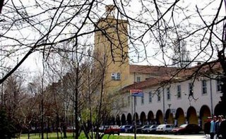
This is an article to be translated from Bulgarian to English about the University of Chemical Technology and Metallurgy in Sofia, Bulgaria.