
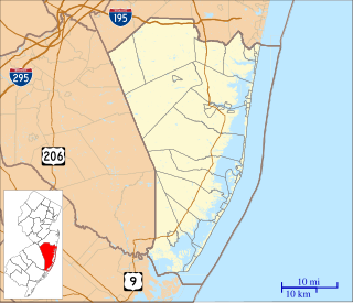
The Toms River is a 41.7-mile-long (67.1 km) freshwater river and estuary in Ocean County, New Jersey in the United States.

The Great Egg Harbor River is a 55.0-mile-long (88.5 km) river in southern New Jersey in the United States. It is one of the major rivers that traverse the largely pristine Pinelands, draining 308 square miles (800 km2) of wetlands into the Atlantic Ocean at Great Egg Harbor, from which it takes its name.
The West Branch Wading River is a 22.7-mile-long (36.5 km) tributary of the Wading River in Burlington County in the southern New Jersey Pine Barrens in the United States.
Friendship Creek is a 9.4-mile-long (15.1 km) tributary of the South Branch Rancocas Creek in southern New Jersey in the United States.
Burrs Mill Brook is a 7.9-mile-long (12.7 km) tributary of Friendship Creek in southern New Jersey in the United States.
Manantico Creek, spelled Menantico on federal maps, is an 11.1-mile-long (17.9 km) tributary of the Maurice River in Cumberland County, New Jersey in the United States.

The Oswego River is a 23.7-mile-long (38.1 km) tributary of the Wading River in the southern New Jersey Pine Barrens in the United States.
West Creek is a 12.3-mile-long (19.8 km) tributary of Delaware Bay in Cape May County, New Jersey in the United States.
Dennis Creek is an 8.8-mile-long (14.2 km) tributary of Delaware Bay in Cape May County, New Jersey in the United States.
Stephen Creek is an 8.3-mile-long (13.4 km) tributary of the Great Egg Harbor River in southeast New Jersey in the United States.
English Creek is a 6.0-mile-long (9.7 km) tributary of the Great Egg Harbor River in southeast New Jersey in the United States.
Tulpehocken Creek is a 7.7-mile-long (12.4 km) tributary of the Wading River in Burlington County in the southern New Jersey Pine Barrens in the United States.
Oyster Creek is a 10.4-mile-long (16.7 km) tributary of Barnegat Bay in southeastern New Jersey in the United States.
The Hospitality Branch is a 15.8-mile-long (25.4 km) tributary of the Great Egg Harbor River in southeastern New Jersey in the United States.
Pochuck Creek is an 8.1-mile-long (13.0 km) tributary of the Wallkill River in Orange County, New York and Sussex County, New Jersey, in the United States.
Bisphams Mill Creek is a 5.9-mile-long (9.5 km) tributary of Greenwood Branch in the southern New Jersey Pine Barrens in the United States.
Great Swamp Brook is a 9.1-mile-long (14.6 km) tributary of Nescochague Creek in the southern New Jersey Pine Barrens in the United States.
The Seaside Heights School District is a community public school district for students in kindergarten through sixth grade from Seaside Heights, in Ocean County, New Jersey, United States. The district's Board of Education is made up of five members, each elected to three-year terms.
Gilford Park is an unincorporated community located within Toms River in Ocean County, New Jersey, United States.


