Related Research Articles

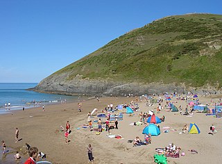
Cardigan Bay is a large inlet of the Irish Sea, indenting the west coast of Wales between Bardsey Island, Gwynedd in the north, and Strumble Head, Pembrokeshire at its southern end. It is the largest bay in Wales.
The Hirnantian is the final internationally recognized stage of the Ordovician Period of the Paleozoic Era. It was of short duration, lasting about 1.4 million years, from 445.2 to 443.8 Ma. The early part of the Hirnantian was characterized by cold temperatures, major glaciation, and a severe drop in sea level. In the latter part of the Hirnantian, temperatures rose, the glaciers melted, and sea level returned to the same or to a slightly higher level than it had been prior to the glaciation.

The geology of Wales is complex and varied; its study has been of considerable historical significance in the development of geology as a science. All geological periods from the Cryogenian to the Jurassic are represented at outcrop, whilst younger sedimentary rocks occur beneath the seas immediately off the Welsh coast. The effects of two mountain-building episodes have left their mark in the faulting and folding of much of the Palaeozoic rock sequence. Superficial deposits and landforms created during the present Quaternary period by water and ice are also plentiful and contribute to a remarkably diverse landscape of mountains, hills and coastal plains.
The Ceredigion Coast Path is a waymarked long distance footpath in the United Kingdom, on the coast of Ceredigion, Wales. It is 65 miles (105 km) in length, running along the coast of Cardigan Bay from Cardigan (52.0810°N 4.6608°W) to Ynyslas (52.5271°N 4.0495°W).

The London Basin is an elongated, roughly triangular sedimentary basin approximately 250 kilometres (160 mi) long which underlies London and a large area of south east England, south eastern East Anglia and the adjacent North Sea. The basin formed as a result of compressional tectonics related to the Alpine orogeny during the Palaeogene period and was mainly active between 40 and 60 million years ago.
The Lachlan Fold Belt (LFB) or Lachlan Orogen is a geological subdivision of the east part of Australia. It is a zone of folded and faulted rocks of similar age. It dominates New South Wales and Victoria, also extending into Tasmania, the Australian Capital Territory and Queensland. It was formed in the Middle Paleozoic from 450 to 340 Mya. It was earlier known as Lachlan Geosyncline. It covers an area of 200,000 km2.

The Meguma terrane, also known as Megumia, is a terrane exposed in southern Nova Scotia, that became joined to the present North American landmass as part of the Appalachian orogeny.
In geology, a disturbance is a linear zone of disturbed rock strata stretching for many miles across country which comprises a combination of folding and faulting. The British Geological Survey record a number of such features in South Wales including the Neath Disturbance, Pontyclerc Disturbance, Carreg Cennen Disturbance and the Cribarth Disturbance, the latter sometimes also known as the Tawe Valley or Swansea Valley Disturbance. The southwestward continuation of the Carreg Cennen Disturbance is known as the Llandyfaelog Disturbance.

The Bala Fault is a SW-NE trending geological fault in Wales that extends offshore into Cardigan Bay. In the offshore area it is a major normal fault and forms the bounding structure to the Cardigan Bay Basin, with a fill including about 2,500 metres (8,200 ft) of Lias Group. Onshore it is responsible for the lineament which runs through Bala and south of Cadair Idris to the coast at Tywyn. At its northeastern end it links to the similarly orientated Llanelidan Fault.

The Dent Fault is a major fault zone on the boundary between the counties of Cumbria and North Yorkshire in northern England. It is named after the village of Dent in Dentdale, on the western margin of the Yorkshire Dales.

Ceibwr Bay is a bay opening into the Irish Sea in Pembrokeshire, west Wales. It is about 7 km west of Cardigan, and 3 km south of the headland of Cemaes Head. It is owned by the National Trust, and lies within the Pembrokeshire Coast National Park and on the Pembrokeshire Coast Path.
The Welsh Basin was a northeast-southwest aligned back-arc depositional basin during the Cambrian, Ordovician and Silurian periods during which a considerable thickness of marine sediments was laid down in the area. To the southeast lay the Midland Platform and to the northwest, within the Iapetus Ocean, through what is now Ireland and the Lake District, was an island arc; a northeast-southwest aligned Irish Sea landmass which was associated with volcanic activity. Examination of the sediments and associated fossils allows the deeper centre of the basin to be distinguished from shallower 'platform' areas along its southeastern margins. From the middle Silurian onwards, collision of Avalonia with the more northerly continent of Laurentia occurred giving rise to the Caledonian Orogeny. The inversion of the basin occurred at that time i.e. its uplift and deformation.

The Aberystwyth Grits Group is a Silurian lithostratigraphic group in mid Wales. The name is derived from Aberystwyth in northern Ceredigion where the strata are well exposed in coastal cliffs. The Group comprises the Trefechan Formation and the underlying Mynydd Bach Formation. The rocks of the Aberystwyth Grits Group have also previously been known as the Aberystwyth Grits Formation
The geology of the Isle of Man consists primarily of a thick pile of sedimentary rocks dating from the Ordovician period, together with smaller areas of later sedimentary and extrusive igneous strata. The older strata was folded and faulted during the Caledonian and Acadian orogenies The bedrock is overlain by a range of glacial and post-glacial deposits. Igneous intrusions in the form of dykes and plutons are common, some associated with mineralisation which spawned a minor metal mining industry.

The Nod Glas Formation is an Ordovician lithostratigraphic group in Mid Wales. The rock of the formation is made up of pyritous, graptolitic mudstone that is generally black in colour. It weathers to a soft, very well cleaved and coal-like material. The formation runs from Conwy in the north, down to Cardigan Bay in the area around Aberdyfi and Tywyn, though it is not a continuous over this area.

The Garnedd-Wen Formation is an Ordovician lithostratigraphic group in Mid Wales. The rock of the formation is a mixture of mudstones, siltstones, fine- to coarse-grained sandstones, greywackes and conglomerates. The formation extends from Dinas Mawddwy in the north-east to Tywyn in the south-west.

The geology of Snowdonia National Park in North Wales is dominated by sedimentary and volcanic rocks from the Cambrian and Ordovician periods with intrusions of Ordovician and Silurian age. There are Silurian and Cenozoic sedimentary rocks on the park's margins. The succession was intensely faulted and folded during the Caledonian Orogeny. The region was uplifted as the North Atlantic Ocean opened during the Cenozoic. The current mountainous landscape arises from repeated glaciations during the Quaternary period.
The bedrock geology of Ceredigion in west Wales consists wholly of a considerable thickness of Ordovician and Silurian age sedimentary rocks of marine origin. Unconsolidated deposits of Quaternary age include a widespread cover of glacial till, valley floor alluvium and scattered peat deposits in both upland and lowland settings.
References
- ↑ Sheppard, T.H. (2005). "The geology of the Qinetiq/Ministry of Defence firing range at Aberporth, Ceredigion" (PDF). Geological Survey Internal Report, IR/05/011. British geological Survey. pp. 1–6. Retrieved 17 December 2010.
- 1 2 Brenchley, P.J.; Rushton, A.W.A; Howells, M.; Cave R. (2006). "Cambrian and Ordovician: the early Palaeozoic tectonostratigraphic evolution of the Welsh Basin, Midland and Monian Terranes of Eastern Avalonia". In Brenchley P.J. & Rawson P.F. (ed.). The geology of England and Wales (2 ed.). London: Geological Society. p. 64. ISBN 978-1-86239-200-7 . Retrieved 17 December 2010.
52°05′N4°39′W / 52.09°N 4.65°W
| | This article about a specific United Kingdom geological feature is a stub. You can help Wikipedia by expanding it. |
| | This article about a location in Wales is a stub. You can help Wikipedia by expanding it. |