Devolution is the statutory delegation of powers from the central government of a sovereign state to govern at a subnational level, such as a regional or local level. It is a form of administrative decentralization. Devolved territories have the power to make legislation relevant to the area.
The Indian Act is a Canadian act of Parliament that concerns registered Indians, their bands, and the system of Indian reserves. First passed in 1876 and still in force with amendments, it is the primary document which defines how the Government of Canada interacts with the 614 First Nation bands in Canada and their members. Throughout its long history the Act has been an ongoing subject of controversy and has been interpreted in different ways by both Aboriginal Canadians and non-Aboriginal Canadians. The legislation has been amended many times, including "over twenty major changes" made by 2002.
The Electoral district of Pilbara is a Legislative Assembly electorate in the state of Western Australia. Pilbara is named for the region of Western Australia in which it is located. It is one of the oldest electorates in Western Australia, with its first member having been elected to the Second Parliament of the Legislative Assembly at the 1894 elections.

Kimberley Land Division is one of five land divisions of Western Australia recognised in the Land Administration Act 1997. It occupies roughly the same area as the Kimberley region of the state.

The Shire of Leonora is a local government area in the Goldfields-Esperance region of Western Australia, about 240 kilometres (149 mi) north of the city of Kalgoorlie and about 830 kilometres (516 mi) northeast of the state capital, Perth. The Shire covers an area of 32,189 square kilometres (12,428 sq mi), and its seat of government is the town of Leonora.
The electoral district of Gippsland West was an electoral district of the Legislative Assembly in the Australian state of Victoria. It was created by the Electoral Act Amendment Act 1888 along with Gippsland Central and Gippsland East. Gippsland North and Gippsland South were resized at the same time. The electorate was dissolved in 2002.
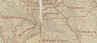
The Shire of Stephens was a local government area in the inner southern suburbs of Brisbane, Queensland, Australia. The shire, administered from Annerley, covered an area of 9 square miles (23 km2), and existed as a local government entity from 1886 until 1925, when it was amalgamated into the City of Brisbane under the City of Brisbane Act 1924.

The borders of the oceans are the limits of the Earth's oceanic waters. The definition and number of oceans can vary depending on the adopted criteria.

Marmion Land District is a land district of Western Australia, located within the Eastern Land Division.
Hampton Land District is a land district of Western Australia, located within the Eastern Land Division in the Goldfields region of the state.
Murray Land District is a land district of Western Australia, located within the South-West Land Division on the state's west coast. It spans roughly 32°25'S - 32°56'S in latitude and 115°25'E - 116°30'E in longitude, and is located on the Indian Ocean coast, taking in the Shires of Murray and Waroona, the eastern part of the Serpentine-Jarrahdale and the western suburbs of Mandurah.
Thadoona Land District is a land district of Western Australia and a subdivision of the North-West Land Division located in the Mid West region of the state.
Nurina Land District is a land district of Western Australia, located within the Eucla Land Division on the Nullarbor Plain. It spans roughly 31°00'S - 32°20'S in latitude and 125°30'E - 127°30'E in longitude.
Esperance Land District is a land district of Western Australia, located within the Eucla Land Division on the state's south coast. It spans roughly 33°15'S - 34°00'S in latitude and 121°00'E - 122°20'E in longitude.
Nuyts Land District is a land district of Western Australia, located within the Eastern and Eucla land divisions on the Nullarbor Plain. It spans roughly 31°00'S - 32°50'S in latitude and 124°00'E - 125°30'E in longitude.
Gascoyne Land Division was a land division of Western Australia defined under the Land Regulations of 2 March 1887. It included almost all of the modern Gascoyne region of the State. In the Land Act 1898, it was renamed Western to avoid confusion with the Gascoyne Land District which had just been created by the Department of Lands and Surveys, and on 1 February 1907, section 26 of the Land Act Amendment Act 1906 merged it into North-West Land Division.
Wells Land District is a land district of Western Australia, located within the Eastern Land Division of the state. It spans roughly 24°00'S - 26°20'S in latitude and 121°40'E - 123°20'E in longitude. Its name honours Lawrence Allen Wells, an explorer of the area in 1896–1897.

The Shire of Balmoral is a former local government area of Queensland, Australia, located in eastern Brisbane.

The European Union (Withdrawal) Act 2018 is an Act of the Parliament of the United Kingdom that provides for repealing the European Communities Act 1972, and for Parliamentary approval of the withdrawal agreement being negotiated between HM Government and the European Union.