Related Research Articles

Tourism in Nicaragua has grown considerably recently, and it is now the second largest industry in the nation. Nicaraguan President Daniel Ortega has stated his intention to use tourism to combat poverty throughout the country.

The protected areas of Nicaragua are areas that have natural beauty or significance and are protected by Nicaragua. Nicaragua has 78 protected areas that cover 22,422 km2, about 17.3% of the nations landmass. The National System of Protected Areas (SINAP) is administered by the Ministry of the Environment and Natural Resources (MARENA).

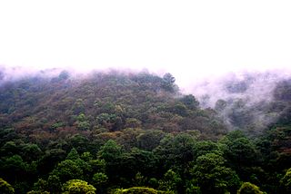
Chocoyero-El Brujo Natural Reserve is located in the municipality of Ticuantepe in the Managua department of Nicaragua. Chocoyero-El Brujo is one of 78 protected areas in Nicaragua, and at just 455 acres (1.8 km2) this tropical forest is one of the smallest in size. Chocoyero-El Brujo was declared a natural reserve in 1993 is managed by the Ministry of the Environment and Natural Resources (MARENA).
Cerro Arenal Natural Reserve is a natural reserve with an area of 14.28 square kilometres in the Cordillera Dariense, it is located in the Matagalpa department in central Nicaragua.

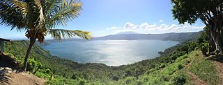
Laguna de Apoyo Nature Reserve is a nature reserve located between the departments of Masaya and Granada in Nicaragua. Lake Apoyo was declared a nature reserve in 1991 and is managed by the Ministry of the Environment and Natural Resources (MARENA) and comprises one of 78 protected areas of Nicaragua. Activities within the Laguna de Apoyo Nature Reserve are regulated by its management plan, approved in 2010, which prohibits the construction of housing within the reserve and use of motorized vehicles on the lake. Geological data suggests that Lake Apoyo originated about 23,000 years ago.

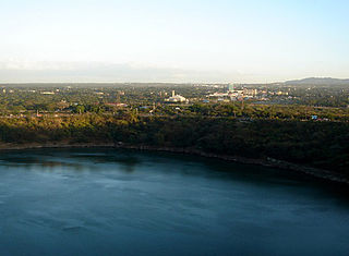
Tiscapa Lagoon is a lagoon of volcanic origin that formed over 10,000 years ago. It is located in the capital city of Managua in Nicaragua, and covers an area of 0.13 km2. Tiscapa Lagoon was protected as a natural reserve on October 31, 1991. The reserve is managed by the Ministry of the Environment and Natural Resources (MARENA) and comprises one of the 78 protected areas of Nicaragua.

The Central American pine–oak forests is a tropical and subtropical coniferous forests ecoregion in the mountains of northern Central America and Chiapas state in southern Mexico.
Cerro Apante Natural Reserve is a nature reserve in Nicaragua near Matagalpa. It is one of the 78 reserves that are under official protection in the country.
Cerro Cola Blanca Natural Reserve is a nature reserve in Nicaragua. It is one of the 78 reserves that are under official protection in the country.
Cerro Cumaica-Cerro Alegre Natural Reserve is a nature reserve in Nicaragua. It is one of the 78 reserves that are under official protection in the country.
Cerro Kilambé Natural Reserve is a nature reserve in Nicaragua. It is one of the 78 reserves that are under official protection in the country.
Cerro Mombachito – La Vieja Natural Reserve is a nature reserve in Nicaragua. It is one of the 78 reserves that are under official protection in the country.
Cerro Musún Natural Reserve is a nature reserve in Nicaragua. It is one of the 78 reserves that are under official protection in the country.
Cerro Pancasan Natural Reserve is a nature reserve in Nicaragua. It is one of the 78 reserves that are under official protection in the country.
Cerro Quiabuc-Las Brisas Natural Reserve is a nature reserve in Nicaragua. It is one of the 78 reserves that are under official protection in the country.
Cerro Silva Natural Reserve is a nature reserve in Nicaragua. It is one of the 78 reserves that are under official protection in the country.
Volcán Telica Rota Natural Reserve is a nature reserve in Nicaragua. It is one of the 78 reserves that are under official protection in the country.
Yulu Natural Reserve is a nature reserve in Nicaragua. It is one of the 78 reserves that are under official protection in the country.

The Savegre River is a river in Costa Rica that flows to the Pacific Ocean. The source is at Quebrada Providencia in the Cerro de la Muerte, Cordillera de Talamanca, at 3,491 m (11,453 ft) above sea level, and after receiving the Division River, it travels 41 linear kilometers of rugged topography to flow into the Pacific Ocean. Its basin covers 590 km2 (230 sq mi) and runs through four cantons: Dota, Tarrazú, Pérez Zeledón and Quepos. It is considered one of the cleanest rivers in the country. Its basin is one of the most eco-diverse regions of Costa Rica: 47 different ecosystems have been identified in it, of which 9 are natural, 15 semi-natural and 23 cultural, for what most of the basin is protected by the Los Quetzales National Park and the Manuel Antonio National Park. On June 14, 2017, the Savegre river basin was declared a Biosphere Reserve by UNESCO.

The Planadas-Yeyesa Nature Reserve is a protected nature reserve located in the Sierra de Cayey, in the municipality of Salinas in central Puerto Rico. The reserve is located close to the famous Cerro Las Tetas. Two of the most prominent features of the reserve are Cerro Planada, a 2,480 feet high mountain peak, and La Yeyesa, a heavily forested canyon formed by the Lapa River and other streams which feed into the Nigua River. La Yeyesa can be accessed through a lightly trafficked yet moderate trail.
References
- ↑ "Protected Planet | Cerro Wawashang". Protected Planet. Retrieved 2024-03-14.