Ch'alla Jawira (Callapa)

Last updated
Ch'alla Jawira
Etymology Aymara
Location
Country Bolivia
Region La Paz Department, Pacajes Province,
Callapa Municipality
Physical characteristics
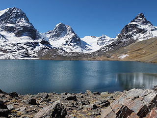
Source Andes
  locationCalapa Municipality
  coordinates 17°19′00″S68°12′45″W / 17.31667°S 68.21250°W / -17.31667; -68.21250
Mouth Desaguadero River
  location
Calapa Municipality
  coordinates
17°28′30″S68°18′55″W / 17.47500°S 68.31528°W / -17.47500; -68.31528 Coordinates: 17°28′30″S68°18′55″W / 17.47500°S 68.31528°W / -17.47500; -68.31528

The Ch'alla Jawira (Aymara ch'alla sand, jawira river, [1] "sand river", also spelled Challa Jahuira) which upstream successively is named Chilla Jawira, Pichini Jawira, Janq'u Quta and Siwinqa [2] is a river in the La Paz Department in Bolivia. It is a left tributary of the Desaguadero River. [2] [3] [4]

Aymara language native language in South America

Aymara is an Aymaran language spoken by the Aymara people of the Andes. It is one of only a handful of Native American languages with over one million speakers. Aymara, along with Spanish, is an official language of Bolivia. It is also spoken, to a much lesser extent, by some communities in southern Peru and in northern Chile, where it is a recognized minority language.

La Paz Department (Bolivia) Department in Nuestra Señora de La Paz, Bolivia

The La Paz Department of Bolivia comprises 133,985 square kilometres (51,732 sq mi) with a 2012 census population of 2,706,359 inhabitants. It is situated at the western border of Bolivia, sharing Lake Titicaca with adjacent Peru. It contains the Cordillera Real, which reaches altitudes of 6.6 kilometers (4.1 mi). Northeast of the Cordillera Real are the Yungas, the steep eastern slopes of the Andes Mountains that make the transition to the Amazon River basin to the northeast. The capital of the department is the city of La Paz and is the administrative city and seat of government/national capital of Bolivia.

Bolivia Country in South America

Bolivia, officially the Plurinational State of Bolivia, is a landlocked country located in western-central South America. The capital is Sucre, while the seat of government and financial center is located in La Paz. The largest city and principal industrial center is Santa Cruz de la Sierra, located on the Llanos Orientales, a mostly flat region in the east of the country.

Named Chilla Jawira the river originates from an intermittent stream at 17°19′00″S68°12′45″W / 17.31667°S 68.21250°W / -17.31667; -68.21250 near another river named Ch'alla Jawira and a mountain named Jallawani in the Pacajes Province, Callapa Municipality. [2] [5] At first its direction is to the south. It flows along Romero Pampa and Pichini where it receives the name Pichini Jawira and shortly afterwards Janq'u Quta [3] ("white lake"). North of Janq'u Qalani it turns to the southwest and gets the name Siwinqa. Near Jarana Pampa it turns to the west and changes its name to Ch'alla Jawira. It keeps this name up to its confluence with the Desaguadero River east of Callapa at 17°28′30″S68°18′55″W / 17.47500°S 68.31528°W / -17.47500; -68.31528 . [4]

Pacajes Province Province in La Paz Department, Bolivia

Pacajes is a province in the Bolivian department of La Paz. Its capital is Coro Coro.

Santiago de Callapa Municipality Municipality in La Paz Department, Bolivia

Santiago de Callapa Municipality or Callapa Municipality is the eighth municipal section of the Pacajes Province in the La Paz Department, Bolivia. Its seat is Callapa.

Callapa Town in La Paz Department, Bolivia

Callapa is a location in the La Paz Department in Bolivia. It is the seat of the Santiago de Callapa Municipality, the eighth municipal section of the Pacajes Province.

Related Research Articles

Ingavi Province Province in La Paz Department, Bolivia

Ingavi is a province in the La Paz Department in Bolivia. This is where the Battle of Ingavi occurred on November 18, 1841 and where the World Heritage Site of Tiwanaku is situated.

Batallas Municipality is the third municipal section of the Los Andes Province in the La Paz Department, Bolivia. Its capital is Batallas.

Ch'uxña Quta is a lake in the Apolobamba mountain range of Bolivia situated in the La Paz Department, Bautista Saavedra Province, Curva Municipality, Calaya Canton. It lies about 5,543 metres (18,186 ft) above sea level, 4 km northwest of the mountain Iskillani (Isquillani).

Jacha Jawira (Los Andes)

Jach'a Jawira which downstream is named Japha Jawira is a Bolivian river east of Lake Titicaca in the La Paz Department, Los Andes Province, Batallas Municipality and in the Omasuyos Province, Achacachi Municipality. Its waters flow to Lake Titicaca via the Qiqa Jawira.

The Jach'a Jawira is a river in the La Paz Department of Bolivia, south of Wiñaymarka, the southern branch of Lake Titicaca. It is a tributary of the Desaguadero River.

Katari River which upstream successively is named Jach'a Jawira, Colorado, Mani and then Colorado again is a river in the La Paz Department of Bolivia, about 90 km long, southeast of Lake Titicaca. It empties into Wiñaymarka Lake, the southern part of Lake Titicaca.

Chilla-Kimsa Chata mountain range

The Chilla-Kimsa Chata mountain range is situated in Bolivia south east of Wiñaymarka Lake, the southern part of Lake Titicaca, in the La Paz Department, Ingavi Province. The range is named after one of highest mountains, the Kimsa Chata complex rising up to 4,735 metres (15,535 ft) about 15 km south of Tiwanaku.

Janq'u Qala is a lake on the western side of the Apolobamba mountain range of Bolivia situated in the La Paz Department, Bautista Saavedra Province, Curva Municipality. It lies about 4,489 metres (14,728 ft) above sea level. The lake is about 3.25 km long and 0.47 km at its widest point.

Janqu Qullu (Potosí)

Janq'u Qullu is a mountain in the Andes of Bolivia, about 5,120 metres (16,798 ft) high. It is situated in the Potosí Department, Antonio Quijarro Province, in the east of the Uyuni Municipality. Janq'u Qullu lies south of the mountain Warachi Qullu. The river Ch'iyar Juqhu Q'awa (Chiar Jokho Khaua) which later is named Juqhu Jawira (Jokho Jahuiri), Jalsullani and Chiqapa (Chicapa) originates north of the mountain. Its waters flow to Qullpa Jawira in the northeast.

Challa Qullu (La Paz) mountain in Bolivia

Ch'alla Qullu is a mountain in the Chilla-Kimsa Chata mountain range in the Andes of Bolivia which reaches a height of about 4,660 m (15,290 ft). It is located in the La Paz Department, Ingavi Province, Jesús de Machaca Municipality. Ch'alla Qullu lies northwest of Chhuxlla Willk'i. The Ch'uñu Jawira originates near the mountain. It flows to the south as a right affluent of the Jach'a Jawira.

Wila Quta (Larecaja)

Wila Quta is a mountain in the Andes of Bolivia, about 4,960 metres (16,273 ft) high. It is situated in the La Paz Department, Larecaja Province, Sorata Municipality, north of the massif of Janq'u Uma and Illampu of the Cordillera Real. The river Janq'u Uma Jawira originates south of the mountain. It flows to the north-east.

Ch'uch'u Jawira is a Bolivian river in the La Paz Department, Larecaja Province, Sorata Municipality. Its waters flow the Kaka River which belongs to the watershed of the Beni River.

Chuxñani

Ch'uxñani is a 4,680-metre-high (15,354 ft) mountain in the Andes of Bolivia. It is located in the La Paz Department, Larecaja Province, Sorata Municipality, in the northern extensions of the Cordillera Real southeast of the mountain Jach'a Waylla Punta. Ch'uxñani lies near the confluence of the rivers Ch'uch'u Jawira which comes from the northwest and Jach'a Uma Jawira which originates between the mountain Wila Quta and the Janq'u Uma-Illampu massif.

The Qullpa Jawira is a river in the La Paz Department in Bolivia. It is a right affluent of the Desaguadero River.

Janqu Qalani (Pacajes) mountain in Bolivia

Janq'u Qalani is a mountain in the Bolivian Andes which reaches a height of approximately 4,200 m (13,800 ft). It is located in the La Paz Department, Pacajes Province, Coro Coro Municipality. Janq'u Qalani lies on the bank of the Ch'alla Jawira.

The Ch'alla Jawira which upstream is named Ch'api K'uchu and downstream successively is called Tupa Jawira and Qura Jawira is a river in the La Paz Department in Bolivia. It is a right affluent of the Aqhuya Jawira whose waters flow to the Desaguadero River.

Wila Qullu (Pacajes)

Wila Qullu is a 4,658-metre-high (15,282 ft) mountain in the southern part of the Chilla-Kimsa Chata mountain range in the Andes of Bolivia. It is located in the La Paz Department, Pacajes Province, Waldo Ballivián Municipality. This is where the Ch'alla Jawira originates. Its waters flow to the Desaguadero River.

The Llallawa Jawira which upstream successively is named Patu Uma, Ch'alla Jawira, Jach'a Qura, Lupipi and Chuqi Phuju is a river in the La Paz Department in Bolivia. It is a left tributary of the Desaguadero River.

The Ch'alla Jawira is a river in the La Paz Department in Bolivia. It is a left tributary of the Tiwanaku River which empties into Wiñaymarka Lake, the southern part of Lake Titicaca.

References

  1. Radio San Gabriel, "Instituto Radiofonico de Promoción Aymara" (IRPA) 1993, Republicado por Instituto de las Lenguas y Literaturas Andinas-Amazónicas (ILLLA-A) 2011, Transcripción del Vocabulario de la Lengua Aymara, P. Ludovico Bertonio 1612 (Spanish-Aymara-Aymara-Spanish dictionary)
  2. 1 2 3 Bolivian IGM map 1:50,000 Cañaviri 5942-II
  3. 1 2 Bolivian IGM map 1:50,000 Umala 5941-I
  4. 1 2 Bolivian IGM map 1:50,000 Callapa 5941-IV
  5. "Callapa". INE, Bolivia. Archived from the original on February 7, 2016. Retrieved February 7, 2016. (unnamed)