
Gaborone is the capital and largest city of Botswana with a population of 246,325 based on the 2022 census, about 10% of the total population of Botswana. Its agglomeration is home to 421,907 inhabitants at the 2011 census. Gaborone has per capita income of US$32,000 (PPP), the highest in Africa.
Serowe is an urban village in Botswana's Central District. A trade and commercial centre, it is Botswana's third largest village. Serowe has played an important role in Botswana's history, as capital for the Bamangwato people in the early 20th century and as birthplace of several of Botswana's presidents. More recently it has undergone significant development as the town and as Botswana continues to grow.

Maun is the fifth-largest town in Botswana. As of 2011, it had a population of 55,784. Maun is the "tourism capital" of Botswana and the administrative centre of Ngamiland district. Francistown and Maun are linked by the A3 highway. Maun is also the headquarters of numerous safari and air-charter operations who run trips into the Okavango Delta.

Palapye is a growing town in Botswana, situated about halfway between Francistown and Gaborone. Over the years its position has made it a convenient stopover on one of Southern Africa's principal north–south rail and road routes.

Francistown is the second-largest city in Botswana, with a population of about 103,417 and 147,122 inhabitants for its agglomeration at the 2022 census. It is located in eastern Botswana, about 400 kilometres (250 mi) north-northeast from the capital, Gaborone. Francistown is located at the confluence of the Tati and Ntshe rivers, and near the Shashe River and 90 kilometres (56 mi) from the international border with Zimbabwe.

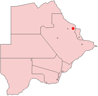
The North-East District is one of the administrative districts of Botswana. Its capital is Francistown. In 2011, North-East had a population of 60,264 people. The district is predominantly occupied by Kalanga-speaking people, the BaKalanga. The district is administered by a district administration and district council, which are responsible for local administration.

Kweneng is one of the districts of Botswana and is the recent historical homeland of the Bakwena people, the first group in Botswana converted to Christianity by famed missionary David Livingstone. Various landmarks, including Livingstone's Cave, allude to this history. The seat of the district's government is Molepolole, Botswana's most populous village.

The North-West District or Ngamiland is one of the first-level administrative subdivisions of Botswana. For census and administrative purposes Ngamiland is subdivided into Ngamiland East, Ngamiland West and Ngamiland Delta (Okavango). It is governed by a District Commissioner, appointed by the national government, and the elected North-West District Council. The administrative centre is Maun.

Central is the largest of Botswana's districts in terms of area and population. It encompasses the traditional homeland of the Bamangwato people. Some of the most politically connected Batswana have come from the Central District, including former President Sir Seretse Khama, former President Festus Mogae, and former President Lt. General Seretse Ian Khama. The district borders the Botswanan districts of Chobe in the north, North-West in the northwest, Ghanzi in the west, Kweneng in southwest, Kgatleng in the south and North-East in the northeast, as well as Zimbabwe also in the northeast and South Africa in the southeast.
Bobonong is a town in the Central District of Botswana 80 km from Selibe Phikwe town. Bobonong has a population of around 19,000. The Babirwa tribe can be found in this town. The Botswana Pink semi-precious stones can be found in Bobonong region. The Babirwa are known for harvesting the mophane worm. The locals refer to the town as Bobcity or formerly Lekgarapeng, which was derived from the stoney landscape of the town.

Kasane is a town in Botswana, close to Africa's 'Four Corners', where the borders of Botswana, Namibia, Zambia and Zimbabwe almost meet. The town is at the far northeastern corner of Botswana where it serves as the administrative center of the Chobe District. The population of Kasane was 9,244 at the 2011 census.

Tonota is a village located in the Central District of Botswana.
Tutume is a large Bakalanga village located in the Tutume District of Botswana, about 50 km from the Zimbabwe border gate at Maitengwe. The nearest city is Francistown, about 100 km away. The village is a district headquarters and has a population of 23,000 .It is made up of wards: Sitabule(Madikwe),Tjilagwani(Selolwane), Thini and Madandume (Magapatona). In each ward there is a headman and his advisers in the kgotla. The main kgotla is located in Madikwe ward near Tutume Central Primary School. The village was named after the river "TUTUME", in Kalanga they will say "gwizi go Tutuma", meaning that the river was overflowing.
Plumtree is a town in Zimbabwe. Marula trees, wild plum trees grow abundantly in the area. The town was once called Getjenge by baKalanga. Another name by which it is often called, is Titji, meaning station and referring to the railway station which was operating in the area around 1897.
Mathangwane is a village in the Central District of Botswana administered under Tutume Sub-district Council. The village is located at the confluence of the Shashe and Vukwi rivers, 25 kilometres west of the City of Francistown along the A3 highway and almost entirely on the left bank of Shashe River. The population of the village was 5,075 in the 2011 national population and housing census. The village is characterised by many river valleys, mostly tributaries to Shashe River and used for identifying the village community wards (dikgotlana) boundaries.
Serule is a village in Central District of Botswana. Serule, with a latitude of -21.95 and a longitude of 27.3, is a streets, highways, roads, or railroad. The village is located along the road between Francistown and Palapye, and is an important railroad junction with rails leading towards north to Francistown, south to Palapye and east to the mining town of Selebi-Phikwe, 72 km from Palapye north up the A1 road, 88 km from Francistown down south the A1 road and 60 km west of Selibe Phikwe to the T-junction. The location is situated 340 kilometres east (90°) of the approximate centre of Botswana and 332 kilometres north east (26°) of the capital Gaborone.

The people of the country called Botswana are all referred to as Batswana(pl)/ Motswana(s) in reference to the country name or the land they all hail from, that is regardless of ethnicity, language, skin colour or heritage.
Mandunyane is named after Kgosi Harry Mandunyane I, who ruled since 1973 when the village was established. The village is located in the Central District of Botswana in Tonota subdistrict. It is approximately 8 km (5.0 mi) north west of Tonota and roughly 30 km (19 mi) south west of Francistown.
Zwenshambe is a village in the North-East District of Botswana. It is situated between Gungwe village in the west, Nlapkhwane village in the east, Mulambakwena village in the south and the Zimbabwe border in the north. It is not far from the Ramokgwebana Border Post. The nearest city to Zwenshambe is Francistown which is also the second largest city in Botswana.
