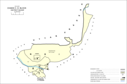
Chausa is a village and corresponding community development block in Buxar district, Bihar, India. It is located 11 km west of the district headquarters, Buxar, on the bank of the river Ganga. As of 2011, the population of the village of Chausa was 9,011, in 1,362 households, while the total block population was 103,670, in 15,817 households.

Nokha is a nagar panchayat town and corresponding community development block in Rohtas district in the Indian state of Bihar. As of 2011, the population of the town of Nokha was 27,302 in 4,381 households. The rural population of Nokha block was 146,025, thus bringing the total block population 173,327. The economic situation of this region is mainly dependent on parboiled rice processed by number of rice mills in this area.

Nawanagar is a village and corresponding community development block situated in the Buxar district of Bihar, India, and one of the developing settlements of the district. It is one of several minor villages governed and administered by the Nawanagar panchayat. The village has the only chauki among other nearby villages. Nawangar is one of the seven blocks making up the Dumraon sub-division.
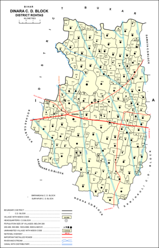
Dinara is a regional market in Rohtas district, Bihar, India, near the National Highway 30. The birthplace of the famous poet Dariya Saheb is just 5 km from Dinara.
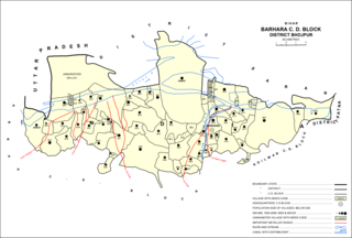
Barhara, also spelled Badahar, Barahara, or Barahra, is a village and corresponding community development block in Bhojpur District of Bihar, India. It is situated on the bank of the river Ganges. By the time of July–August most of the villages under this block are affected by deluge. As of 2011, its population was 6,889, in 927 households, while the total block population was 240,636, in 35,185 households.
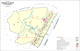
Rohtas is a community development block in Rohtas district of Bihar, India. The block headquarters is in the village of Akbarpur, 5 km east of the historic Rohtas Fort. As of 2011, the population of Rohtas block was 86,049.
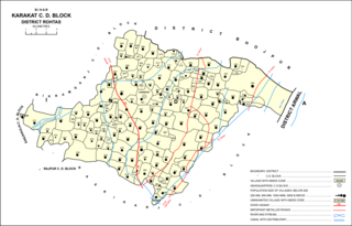
Kārākāt is a village and corresponding Community Development Block in Rohtas district of Bihar, India. As of 2011, the village of Karakat has a population of 2563, in 400 households; the total population of Karakat block is 209,284.

Kesath is a village and corresponding community development block in Buxar district of Bihar, India. It is the least populous of Buxar's 11 blocks, with a population of 33,820, in 5,304 households. The population of Kesath itself is 14,843, in 2,351 households.

Rajpur is a village and corresponding community development block in Buxar district of Bihar, India.
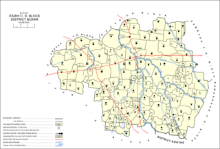
Itarhi is a Nagar Panchayat and corresponding community development block in Buxar district of Bihar, India. According to the 2011 Census of India, its population is 10,275, in 1,711 households, while the total block population is 170,629, in 25,557 households.

Chaugain is a village and corresponding community development block in Buxar district of Bihar, India.

Simri is a village and corresponding community development block in Buxar district of Bihar, India.
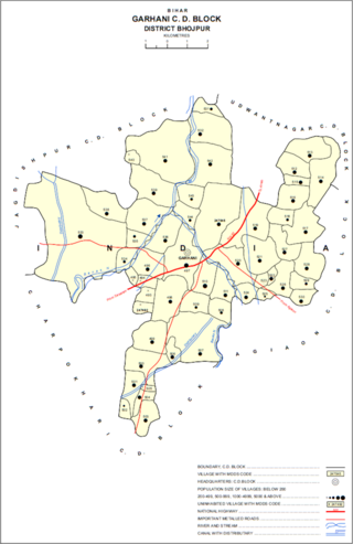
Garhani is a village and corresponding community development block in Bhojpur district of Bihar, India. As of 2011, its population was 5,597, in 959 households. The total block population was 103,262, in 16,427 households.

Udwantnagar is a village and corresponding community development block in Bhojpur district of Bihar, India. As of 2011, its population was 9,000, in 1,496 households. The total block population was 157,809, in 24,336 households.

Charpokhari is a village and corresponding community development block in Bhojpur district of Bihar, India. As of 2011, its population was 1,874, in 314 households. The total block population was 101,363, in 15,961 households.

Agiaon is a village and corresponding community development block in Bhojpur district of Bihar, India. As of 2011, its population was 4,801, in 835 households. The total block population was 148,373, in 23,117 households.
Chand is a village and corresponding community development block in Kaimur district, Bihar, India. As of 2011, its population was 4,432, in 700 households. The total block population was 133,682 in 20,413 households.
Nuaon, also spelled Noawan or Noan, is a village and corresponding community development block in Kaimur district of Bihar, India. As of 2011, its population was 5,292, in 798 households, while the overall block population was 106,530, in 15,263 households.
Bhagwanpur is a village and corresponding community development block in Kaimur district of Bihar, India. As of 2011, its population was 6,213, in 1,081 households, while the total block population was 91,113, in 15,145 households.
Rampur is a village and community development block in Kaimur district of Bihar, India. As of 2011, it had a population of 575, in 94 households. The total block population was 88,876, in 14,110 households.