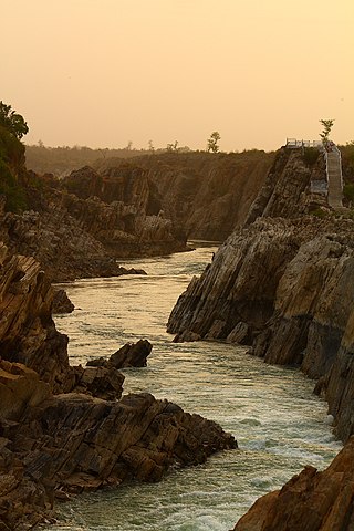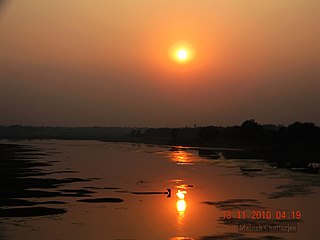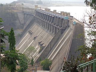
The Krishna River is a river in the Deccan plateau and is the third-longest river in India, after the Ganges and Godavari. It is also the fourth-largest in terms of water inflows and river basin area in India, after the Ganges, Indus and Godavari. The river, also called Krishnaveni, it is 1,400 kilometres (870 mi) long and its length in Maharashtra is 282 kilometres. It is a major source of irrigation in the Indian states of Maharashtra, Karnataka, Telangana and Andhra Pradesh.

The Narmada River, also called the Reva and previously also known as Narbada or anglicised as Nerbudda, is the 5th longest river and overall longest west-flowing river in India. It is also the largest flowing river in the state of Madhya Pradesh. This river flows through the states of Madhya Pradesh and Gujarat in India. It is also known as the "Life Line of Madhya Pradesh and Gujarat" due to its huge contribution to the two states in many ways. The Narmada River rises from the Amarkantak Plateau in Anuppur district Madhya Pradesh. It forms the traditional boundary between North India and South India and flows westwards over a length of 1,312 km (815.2 mi) before draining through the Gulf of Khambhat into the Arabian Sea, 30 km (18.6 mi) west of Bharuch city of Gujarat.

Buldhana district is located in the Amravati division of Maharashtra, India. It is situated at the western border of Vidarbha region and is 500 km away from the state capital, Mumbai. The district has towns and cities like Shegaon, Jalgaon Jamod, Malkapur, Khamgaon, Lonar, Mehkar, and Chikhli. It is surrounded by Madhya Pradesh in the north, Akola, Washim, and Amravati districts on the east, Jalna district on the south, and Jalgaon and Aurangabad districts on the west. Khamgaon is the largest city in the district. Latitudes are 19.51° to 21.17° N and longitudes are 75.57° to 76.59° E.

The Wainganga is a river in India originating in the Mahadeo Hills in Mundara near the village Gopalganj in Seoni, Madhya Pradesh. It is a key tributary of the Godavari. The river flows south in a winding course through the states of Madhya Pradesh and Maharashtra, roughly 580 km (360 mi). After joining the Wardha River, the united stream, which is known as the Pranahita River, empties into the Godavari River at Kaleshwaram, Telangana.

Nizam Sagar Dam is an Indian dam named after the Nizam of Hyderabad. It is a reservoir constructed across the Manjira River, a tributary of the Godavari River, between Achampet and BanjePally villages of the Kamareddy district in Telangana, India. It is located at about 144 km (89 mi) north-west of Hyderabad. Nizam Sagar is the oldest dam in the state of Telangana.

The Sriram Sagar Project is also known as the Pochampadu Project is an Indian flood-flow project on the Godavari. The Project is located in Nizamabad district, 3 km away from National Highway 44. It has been described by The Hindu as a "lifeline for a large part of Telangana".
Pusad is a city in the Yavatmal district located in Vidarbha region of Maharashtra state of India. It is named after the Pus river. Its ancient name was 'Pushpawanti'. Pusad is second largest city of yavatmal district. For last 20 years Pusad is being tried to be promoted to the stature of district but due to lack of administration of governing bodies it is only a dream of the people.

Kangsabati River (Pron:) rises from the Chota Nagpur plateau in the state of West Bengal, India and passes through the districts of Purulia, Bankura, Paschim Medinipur and Purba Medinipur in West Bengal before draining in the Bay of Bengal.

Ujjani Dam, also known as Bhima Dam or Bhima Irrigation Project, on the Bhima River, a tributary of the Krishna River, is an earthfill cum Masonry gravity dam located near Ujjani village of Madha Taluk in Solapur district of the state of Maharashtra in India.

Totladoh dam, is a gravity dam on the Pench river near Ramtek in Nagpur district in the state of Maharashtra and adjoining Madhya Pradesh in India.

Ramtek Dam, is an earthfill dam on Sur River near Ramtek, Nagpur district in the state of Maharashtra in India.
Ekburji Dam, is an earthfill dam on Chandrabhaga river near Washim in the state of Maharashtra in India.
Upper Pus Dam, also called Pus Dam is an earthfill dam on Pus river near Pusad, Yavatmal district in the state of Maharashtra in India. There is another downstream dam near Mahagaon called Lower Pus Dam which was built in 1983. Other nearby dams are Arunawati Dam in Digras built in 1994 and Isapur Dam built in 1982.
Kanholibara Dam is an earthfill dam on a local river Krishna near Hingana, Nagpur district in state of Maharashtra in India.
Makardhokada Dam, is an earthfill dam on Amb river near Umred, Nagpur district in state of Maharashtra in India.

Kolar Dam is an earthfill dam on Kolar river near Saoner, Nagpur district in the state of Maharashtra in India.
Khekaranalla Dam is an earthfill dam on KhekaraNalla river near Saoner, Nagpur district in state of Maharashtra in India.
Jam Dam, is an earthfill dam on Jam river near Katol, Nagpur district in state of Maharashtra in India.
Utawali Dam, is an earthfill dam on Utawali river near Mehkar, Buldhana district in the state of Maharashtra in India.
Chandrabhaga Dam, is an earthfill dam on Chandrabhaga river near Amravati in state of Maharashtra in India.


