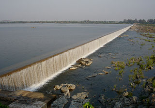
Yellandu is a town in Bhadradri Kothagudem district of the Indian state of Telangana. It is located in Yellandu mandal of Kothagudem revenue division.

Bhadrachalam is a census town in the Indian state of Telangana, Bhadradri Kothagudem district. It is an important Hindu pilgrimage town with an existence of the Bhadrachalam Temple of Lord Rama, situated on the banks of Godavari river. It is located 312 kilometres (194 mi) from east of state capital, Hyderabad,115 kilometres (71 mi) from Khammam, 165 kilometres (103 mi) from Rajamahendravaram, 177 kilometres (110 mi) from Suryapet, 180 kilometres (112 mi) from Warangal and 178 kilometres (111 mi) from the Andhra Pradesh State Capital Amaravathi.

Kothagudem is a town in Telangana state. Kothagudem is the headquarters of the Bhadradri Kothagudem district of the Indian state of Telangana.

Manuguru is a census town and mandal in Bhadradri Kothagudem district in the Indian state of Telangana. It comes under Mahaboobabad parliamentary constituency and Pinapaka Assembly constituency. Manuguru is an urban area, situated on the banks of Godavari River. The town is famous for Singareni coal mines. The singareni had provided a lot of employment opportunities. Since there is a availability of coal the TS government has taken an action to construct a power plant(BTPS) in the coal city MANUGURU Pin code of Manuguru is 507117.

Chunchupalle is a census town in Bhadradri Kothagudem district of the Indian state of Telangana. It is located in Chunchupalli mandal of Kothagudem revenue division.

Palwancha is a town in Bhadradri district of the Indian state of Telangana. It is located in Palwancha mandal of Kothagudem revenue division.

Cherla is a mandal in Bhadradri Kothagudem district. It is located on the banks of River Godavari. Prior to 30 November 1959, it was a part of Bhadrachalam constancy in Khammam district.

Burgampahad is the headquarters of Burgampahad mandal in Bhadradri Kothagudem district of the Indian state of Telangana.

Gundala is a mandal of Bhadradri Kothagudem District of Telangana state in India. It is located at and is near the town of Kothagudem. The headquarters of the sub-division are in the village of Gundala. The sub-division has 17 villages under its administration. Markode, Muthapuram and Lingagudem are the other populated regions in the mandal.

Dummugudem is a village in Bhadradri Kothagudem district of the Indian state of Telangana. It is located in Dummugudem mandal of Bhadrachalam revenue division.

Dammapeta is a mandal in Bhadradri Kothagudem district, Telangana.
Pinapaka is a Mandal in Bhadradri Kothagudem district, Telangana.

Aswaraopeta is a mandal in Bhadradri Kothagudem district, Telangana.

Aswapuram or Ashwapuram is a Mandal in Bhadradri Kothagudem district, Telangana State, India.
Julurpad or Julurpadu is a mandal in Bhadradri Kothagudem district, Telengana, India.

Mulkalapalle, Mulakalapalli or Mulakalapally is a Mandal in Bhadradri Kothagudem district of Telangana, India.
Tekulapalle, Tekulapalli or Tekulapally is a Mandal in Bhadradri Kothagudem district of Telangana state, India.

Mahabubabad is a district in the Indian state of Telangana. It was a part of the Warangal district prior to the re-organisation of districts in the state in October 2016.The district shares boundaries with Suryapet, Khammam, Bhadradri Kothagudem, Warangal Rural, Jayashankar Bhupalpalle and Jangaon districts. It consists of Dornakal, Mahabubabad, Maripeda, Thorrur Municipalities.
Kothagudem Airport is a proposed Greenfield Airport at Kothagudem in Bhadradri Kothagudem District of Telangana, India. The Government of Telangana has identified 1,600 acres of land at Punukuduchelka village in Kothagudem mandal for the purpose.


