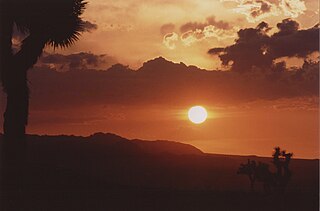
San Bernardino County, officially the County of San Bernardino and sometimes abbreviated as S.B. County, is a county located in the southern portion of the U.S. state of California, and is located within the Inland Empire area. As of the 2020 U.S. Census, the population was 2,181,654, making it the fifth-most populous county in California and the 14th-most populous in the United States. The county seat is San Bernardino.

Adelanto is a city in San Bernardino County, California, United States. It is approximately 9 miles (14 km) northwest of Victorville in the Victor Valley area of the Mojave Desert, in the northern region of the Inland Empire. The population was 38,046 at the 2020 census.

The Victor Valley is a valley in the Mojave Desert and subregion of the Inland Empire, in San Bernardino County in Southern California.
Piñon Hills is a census-designated place in San Bernardino County, California, near the Los Angeles County line. It is located along Pearblossom Highway, 28 miles east of Palmdale, and 15 miles west of the Cajon Pass where Pearblossom Highway meets Interstate 15. The town lies within 25 miles of Hesperia and Victorville. Piñon Hills is in a tri-community that consists of Piñon Hills, Phelan, and Wrightwood. The elevation is 4,173 feet (1,272 m). The population was 7,272 at the 2010 census.
Phelan is an unincorporated community and census-designated place in San Bernardino County, California, in the Victor Valley of the Mojave Desert, north of the San Gabriel Mountains. The population was 14,304 in the 2010 census.

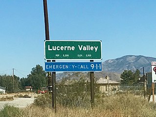
Lucerne Valley is a census-designated place (CDP) and valley landform in the southern Mojave Desert, in western San Bernardino County, California.

The San Bernardino Valley is a valley in Southern California located at the south base of the Transverse Ranges. It is bordered on the north by the eastern San Gabriel Mountains and the San Bernardino Mountains; on the east by the San Jacinto Mountains; on the south by the Temescal Mountains and Santa Ana Mountains; and on the west by the Pomona Valley. Elevation varies from 590 feet (180 m) on valley floors near Chino to 1,380 feet (420 m) near San Bernardino and Redlands. The valley floor is home to over 80% of the more than 4 million people in the Inland Empire region.

Victor Valley College is a public community college in Victorville, California. It is part of the California Community College System. The Victor Valley Community College district includes Victorville, Hesperia, Apple Valley, Phelan and Adelanto.

Alta Loma is one of three unincorporated areas that became part of the city of Rancho Cucamonga, California, United States in 1977. The community is located at 34.15°N 117.60°W in the foothills of the south face of the San Gabriel Mountain range, near Cucamonga Peak and Mount San Antonio. Its ZIP codes are 91701 and 91737. Elevation ranges from 1,400 feet (430 m) to 3,000 feet (910 m). The name comes from the Spanish words for "high hill." Alta Loma had previously been known as "Iamosa".
Wildwood Canyon is a canyon and California state park in the eastern foothills of the San Bernardino Mountains, within San Bernardino County, southern California.
California's 23rd congressional district is a congressional district in the U.S. state of California. The district is represented in the 118th United States Congress by Jay Obernolte.

International Polytechnic High School, commonly referred to as iPoly, is a public college-preparatory demonstration high school (9-12) found in the California State Polytechnic University, Pomona campus and operated by the Los Angeles County Office of Education (LACOE) in collaboration with the College of Education and Integrative Studies at the university. iPoly's curriculum is fully accredited by the Western Association of Schools and Colleges and is approved by the University of California and California State University. It runs hand-in-hand with the Los Angeles County High School for the Arts (LACHSA), which is also run by LACOE. Since iPoly does not lie in a fixed school district, it draws students from all over Los Angeles, San Bernardino, Orange and Riverside counties. Most of the students come from the Pomona and San Gabriel valleys. In 2009, 2013, and 2019, iPoly was honored as a California Distinguished School by the California Department of Education.
Chaparral High School is the main continuation high school located in El Cajon, California for the Grossmont Union High School District (GUHSD). Currently GUHSD serves 24,456 students at 12 high schools. Located in the city of El Cajon, it provides an alternative educational setting for an average of 300 students, eighty of which are designated Special Education, in grades nine through twelve.
Valley View High School is a public secondary school in Ontario, California. It is one of the eleven schools of the Chaffey Joint Union High School District. Valley View is one of two continuation schools in the district and enrolls more than 500 students. Valley View High School was named a Model Continuation High School in 2018 by California State Superintendent of Public Instruction, Tom Torlakson. The school colors are green and gold.

High Desert is a vernacular region with non-discrete boundaries covering areas of the western Mojave Desert in Southern California. The region encompasses various terrain with elevations generally between 2,000 and 4,000 ft above sea level, and is located just north of the San Gabriel, San Bernardino, and Little San Bernardino Mountains.
The Yuhaaviatam of San Manuel Nation is a federally recognized tribe of Serrano people in San Bernardino County, California.

California's 33rd State Assembly district is one of 80 California State Assembly districts. It is currently represented by Republican Devon Mathis.

California Southern Law School (CSLS) was a private part-time evening law school in Riverside, California. It admitted its last entering class in Fall 2016 and closed after the Spring 2020 semester. It is registered with the California State Bar Committee of Bar Examiners (CBE), but is not accredited by the CBE or approved by the American Bar Association. As a registered law school, CSLS graduates may take the California Bar Examination and upon passing the Bar, they are authorized to practice law in California.
Jurupa Unified School District is grade K-12 school district in Riverside County, California. It has an enrollment of approximately 20,500 students. The geographic location of the Jurupa Valley area is the upper western corner of Riverside County, California, north and west of the Santa Ana River and south of the San Bernardino-Riverside County line. The superintendent is Elliott Duchon.

The Snowline Joint Unified School District (SJUSD) is the school district for part of the Victor Valley in the Mojave Desert and northeastern San Gabriel Mountains, located within San Bernardino County, California.


