
The Konkan is a stretch of land by the western coast of India, bound by the river Daman Ganga at Damaon in the north, to Anjediva Island next to Karwar town in the south; with the Arabian Sea to the west and the Deccan plateau to the east. The hinterland east of the coast has numerous river valleys, riverine islands and the hilly slopes known as the Western Ghats; that lead up into the tablelands of the Deccan. The region has been recognised by name, since at least the time of Strabo in the third century CE. It had a thriving mercantile port with Arab tradesmen from the 10th century. The best-known islands of Konkan are Ilhas de Goa, the site of the Goa state's capital at Panjim; also, the Seven Islands of Bombay, on which lies Mumbai, the capital of Maharashtra and the headquarters of Konkan Division.

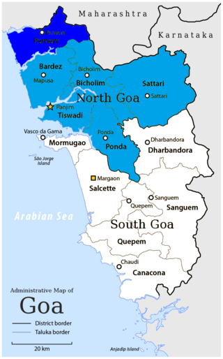
The Zuari RiverZuvari, pronounced ) is the largest river in the state of Goa, India. It is a tidal river which originates at Hemad-Barshem in the Western Ghats. The Zuari is also referred to as the Aghanashani in the interior regions. It flows in a south-westerly direction through the talukas of Tiswadi, Ponda, Mormugao, Salcete, Sanguem and Quepem.
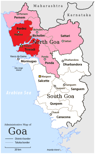
North Goa district is one of the two districts that constitutes the state of Goa, India. The district has an area of 1,736 square kilometres, and is bounded by Kolhapur and Sindhudurg districts of Maharashtra state to the north and by Belgavi district of Karnataka to the east, by South Goa district to the south, and by the Arabian Sea to the west.

Bardez or Bardes is a taluka of the North Goa district in the Indian state of Goa.
Pernem is a northmost administrative region or sub-district in North Goa in India. It acts as the Gateway of Goa from Maharashtra side. It is also the name of the town of Pernem, which is its headquarters. It has a Municipal Council. Geographically, Pernem is surrounded by Sawantwadi sub-district on East, Arabian Sea on West, Bardez and Bicholim sub-district on south and Sawantwadi sub-district on north. The two rivers which decide the boundary of this sub-district are Terekhol River and Chapora River. Terekhol river acts as a border of Maharashtra and Goa while Chapora river acts as a border of Pernem sub-district and Bardez sub-district.
Anjuna is a village located on the coast of North Goa, India. It is a Census Town, one of the twelve Brahmin comunidades of Bardez. It is mostly a tourist destination.
Vagator Beach a beach in Bardez Taluka, in the state of Goa, India. It is located across the Chapora River from the town of Morjim.

Siolim is a village in Bardez taluka, and a census town on the central west coast of India, in the North Goa district of Goa. The 2001 population was 10,311, and 10,936 in 2011. Siolim is also the name of a constituency in the Goa assembly, which includes Assagao, Anjuna and Oxel, in addition to Siolim. A person from Siolim is known as a Siolcar or even as Shivalkar.
Morjim is a Census Town in Pernem, Goa, India. It is situated on the northern bank of the Chapora River estuary. It is home to a variety of birds and is a nesting site for Olive Ridley sea turtles. The village has become known as "Little Russia" because of the concentration of Russian immigrants living there.

Baga a seaside town in Bardez, Goa, India. It comes under the jurisdiction of Calangute, which is 2 km south. Baga is known for its popular beach and Baga Creek. It is visited by thousands of tourists annually.

The Western Coastal Plains is a narrow stretch of landmass lying between the western part of the Deccan plateau and the Arabian in India. The plains stretch from the Kutch region to Kaniyakumari at the southern tip of the Indian peninsula with the Western Ghats forming its eastern boundary. It traverses the states of Gujarat, Maharashtra, Goa, Karnataka, and Kerala.

Chapora is a coastal village at Chapora River estuary lying alongside a beach stretch in North Goa that is around 10 km. from Mapusa, a City in Northern Goa. It is close to Chapora Fort, an old Adilshahi fort. Chapora is also close to a trawler-fishing jetty.
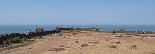
Chapora Fort, located in Bardez, Goa, rises high above the Chapora River. The site is the location of a fort built by Adil Shahi dynasty ruler Adil Shah and called Shahpoora, whose name was altered to Shapora (chapora) by Malvankar on the request of the Portuguese. It is now become a popular tourist spot and offers a view north across the Chapora river to Morjim

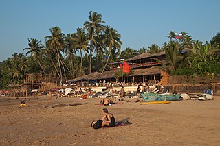
The state of Goa, in India, is famous for its beaches and places of worship. Tourism is its primary industry, and is generally focused on the coastal areas of Goa, with decreased tourist activity inland.
Chapora is a Goan placename that can mean:

Mandrem is a coastal village famous as a tourist spot in Pernem taluka in North Goa district of Goa state in India. It is 21 km from the capital Panaji.

Goa is a state on the southwestern coast of India within the Konkan region, geographically separated from the Deccan highlands by the Western Ghats. It is bound by the Indian states of Maharashtra to the north, and Karnataka to the east and south, with the Arabian Sea in the west. It is India's smallest state by area and fourth-smallest by population. Goa has the highest GDP per capita among all Indian states, two and a half times as high as the GDP per capita of the country as a whole. The Eleventh Finance Commission of India named Goa the best-placed state because of its infrastructure, and India's National Commission on Population rated it as having the best quality of life in India. It is the second-highest ranking among Indian states in the human development index.

Agonda is a large village located in Canacona in South Goa district, India. Agonda is famous for its beach and It is one of the only four beaches designated as turtle nesting sites under the Coastal Regulation Zone 2011 notification.
Oxel is a village in Bardez sub-district, North Goa, India. The nearest airport is Mopa Airport and railway station is at Tivim. Oxel has been described as a "picturesque village" and is located in North Goa's Bardez sub-district or taluka. Oxel is a small, green and water-surrounded village. It is located approximately 25 km (16 mi) away from the State capital Panjim or Panaji. Its panchayat puts down its area to around 2.8 km2 (1.1 sq mi).

