India is the second most populated country in the world with nearly a fifth of the world's population. According to the 2017 revision of the World Population Prospects, the population stood at 1,324,171,354.

This is a list of local government areas (LGAs) in Victoria, sorted by region. Also referred to as municipalities, the 79 Victorian LGAs are classified as cities (34), shires (38), rural cities (6) and boroughs (1). In general, an urban or suburban LGA is called a city and is governed by a City Council, while a rural LGA covering a larger rural area is usually called a shire and is governed by a Shire Council. Local councils have the same administrative functions and similar political structures, regardless of their classification. The sorting of LGAs into regions is for presentation purposes only, and has no legal or administrative significance.
Race and ethnicity in the United States Census, defined by the federal Office of Management and Budget (OMB) and the United States Census Bureau, are self-identification data items in which residents choose the race or races with which they most closely identify, and indicate whether or not they are of Hispanic or Latino origin.

A nationwide census, known as Census 2001, was conducted in the United Kingdom on Sunday, 29 April 2001. This was the 20th UK census and recorded a resident population of 58,789,194.
The 2001 Canadian Census was a detailed enumeration of the Canadian population. Census day was May 15, 2001. On that day, Statistics Canada attempted to count every person in Canada. The total population count of Canada was 30,007,094. This was a 4% increase over 1996 Census of 28,846,761. In contrast, the official Statistics Canada population estimate for 2001 was 31,021,300. This is considered a more accurate population number than the actual count.

The Welsh are a Celtic nation and ethnic group native to, or otherwise associated with, Wales, Welsh culture, Welsh history and the Welsh language. Wales is a country that is part of the United Kingdom, and the majority of people living in Wales are British citizens.

Sant Kabir Nagar district is one of the 75 districts of Uttar Pradesh state in northern India. Khalilabad city is the district headquarters. Sant Kabir Nagar district is a part of Basti division.
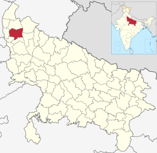
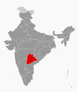
Meerut district, is one of the districts of Uttar Pradesh state of India, and Meerut is the district headquarters. Meerut district is also a part of the Meerut division. The administrative head of district of Meerut is a District Magistrate while the administrative head of Meerut Division is Divisional Commissioner, an IAS officer.
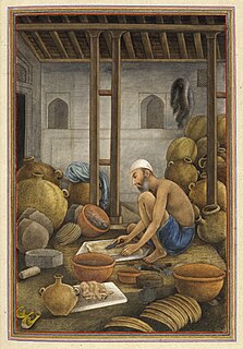
Chamar is one of the native communities of India which after Independence has been categorized under Scheduled Castes. This is also one of the many marginalized communities who were treated as "untouchables" and were denied basic human rights under the infamous Caste-System (Varna-Vyavastha) of Hindu Brahmans. These communities were often addressed as "Harijan" by Gandhi or "Dalit" in Indian Media although Prime Minister Narendra Modi's Government Ministry of Information and Broadcasting has found the term offensive and advised media publications to refrain from using the term and to use the constitutional term “Scheduled Caste” in English and appropriate translations in other languages instead.
The decennial Census of India has been conducted 15 times, As of 2011. While it has been conducted every 10 years, beginning in 1872, the first complete census was taken in the year 1881. Post 1949, it has been conducted by the Registrar General and Census Commissioner of India under the Ministry of Home Affairs, Government of India. All the census since 1951 are conducted under 1948 Census of India Act. The last census was held in 2011 and next census will be held in 2021.
A census town is a type of town that satisfies certain characteristics, depending on the country in which it is located.
The Delimitation commission or Boundary commission of India is a commission established by the Government of India under the provisions of the Delimitation Commission Act. The main task of the commission is redrawing the boundaries of the various assembly and Lok Sabha constituencies based on a recent census. The representation from each State is not changed during this exercise. However, the number of SC and ST seats in a state are changed in accordance with the census. The present delimitation of constituencies has been done on the basis of 2001 census under the provisions of Delimitation Act, 2002.
The 1991 Nepal census was a widespread national census conducted by the Nepal Central Bureau of Statistics.
The 15th Indian Census was conducted in two phases, house listing and population enumeration. House listing phase began on 1 April 2010 and involved collection of information about all buildings. Information for National Population Register was also collected in the first phase, which will be used to issue a 12-digit unique identification number to all registered Indian residents by Unique Identification Authority of India (UIDAI). The second population enumeration phase was conducted between 9 and 28 February 2011. Census has been conducted in India since 1872 and 2011 marks the first time biometric information was collected. According to the provisional reports released on 31 March 2011, the Indian population increased to 1.21 billion with a decadal growth of 17.70%. Adult literacy rate increased to 74.04% with a decadal growth of 9.21%. The motto of the census was 'Our Census, Our future'.
Ingalagi is a panchayat village in Belgaum district in the southern state of Karnataka, India.