Char Amtali

Last updated
Amtali Paurosava
Bangladesh adm location map.svg
Red pog.svg
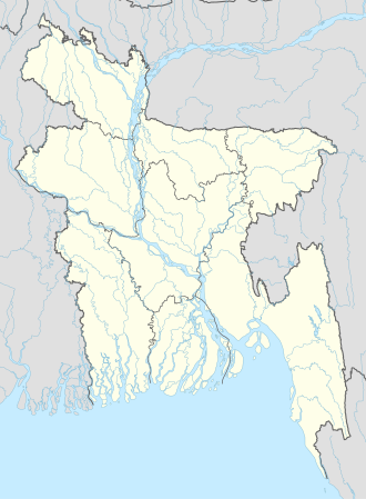
Amtali Paurosava
Location in Bangladesh
Coordinates: 22°31′N90°15′E / 22.517°N 90.250°E / 22.517; 90.250
CountryFlag of Bangladesh.svg  Bangladesh
Division Barisal Division
District Barguna District
Time zone UTC+6 (Bangladesh Time)
Websitewww.amtali.com

Amtali Paurasava is a Paurasava in Amtali Upazila in Barguna District in the Barisal Division of southern-central Bangladesh. It's famous for Amtali M.U High School and Amtali Degree College.It Stands on the bank of Payra River. It is the main Upazila of Barguna District [1]

Amtali Upazila Upazila in Barisal Division, Bangladesh

Amtali is an Upazila of Barguna District in the division of Barisal, Bangladesh.

Barguna District District in Barisal Division, Bangladesh

Barguna is a district in the division of Barisal, Bangladesh. It is situated in the southern part of Bangladesh. Barguna subdivision was established in 1969 and promoted to district in 28 February 1984.

Barisal Division Division of Bangladesh

Barisal Division, officially known as Barishal Division, is one of the eight administrative divisions of Bangladesh. Located in the south-central part of the country, it has an area of 13,644.85 km2 (5,268.31 sq mi), and a population of 8,325,666 at the 2011 Census. It is bounded by Dhaka Division on the north, the Bay of Bengal on the south, Chittagong Division on the east and Khulna Division on the west. The administrative capital, Barisal city, lies in the Ganges (Padma) River delta on an offshoot of the Arial Khan River. Barisal division is criss-crossed by numerous rivers that earned it the nickname 'Dhan-Nodi-Khal, Ei tine Borishal'.

Related Research Articles

Jhalokati District District in Barisal Division, Bangladesh

Jhalokathi is a district in southern Bangladesh. It is located in the Barisal Division and covers an area of 758.06 km2 It is bounded by Barisal district to the north and east, Barguna district and the Bishkhali river in the south, Lohagara Upazila and Pirojpur district to the west. Annual average temperatures: maximum 33.3 °C, minimum 12.1 °C; annual rainfall 2506 mm. Main rivers in this district are Bishkhali, Sugandha, Dhanshiri, Gabkhan, Jangalia and Bamanda, Bajitpur River.

Barguna Sadar Upazila Upazila in Barisal Division, Bangladesh

Barguna Sadar is an Upazila of Barguna District in the Division of Barisal, Bangladesh.

Betagi Upazila Upazila in Barisal Division, Bangladesh

Betagi is an Upazila of Barguna District in the Division of Barisal, Bangladesh.

Patharghata Upazila Upazila in Barisal Division, Bangladesh

Patharghata is an Upazila of Barguna District in the Division of Barisal, Bangladesh.

Patuakhali Sadar Upazila Upazila in Barisal Division, Bangladesh

Patuakhali Sadar is an Upazila of Patuakhali District in the Division of Barisal, Bangladesh.

Rajasthali Upazila Upazila in Chittagong Division, Bangladesh

Rajasthali is an Upazila of Rangamati District in the Division of Chittagong, Bangladesh.

Sayestaganj is a Upazila of Habiganj District.

Ashar Char is an island in the western Bay of Bengal, and is about two miles long. It is located along the path of the Pyra river in the Amtali Upazila, Barguna District of Bangladesh.

The Haringhata River is located in Bangladesh. It is one of the large coastal rivers of the Ganges-Padma system south of the confluence of the Bhola and the Baleshwar, and sets part of the boundary between Bagerhat District and Barguna District before emptying into the Bay of Bengal. The river flows between Sarankhola Upazila in Bagerhat District, and Patharghata Upazila of Barguna District.

Barguna massacre

The Barguna massacre was the mass execution of unarmed residents of Barguna in the Barguna sub-divisional jail by the Pakistan Armed Forces on 29 and 30 May 1971. More than 100 people were killed. Seventy-two of them were identified; the majority were Bengali Hindus, the rest Muslims, mostly supporters of the Bangladesh Awami League and sovereign Bangladesh. In 1992, a memorial was constructed with a marble plaque containing the names of the 72 victims and six other victims killed elsewhere.

Taltali Upazila Upazila in Barisal Division, Bangladesh

Taltali is an Upazila of Barguna District in the division of Barisal, Bangladesh.

Narail-1 is a constituency represented in the Jatiya Sangsad of Bangladesh since 2008 by Kabirul Haque Mukti of the Awami League.

Narail-2 is a constituency represented in the Jatiya Sangsad of Bangladesh since 2019 by Mashrafe Mortaza of the Awami League.

Barguna-1 is a constituency represented in the Jatiya Sangsad of Bangladesh since 2008 by Dhirendra Debnath Shambhu of the Awami League.

Barguna-2 is a constituency represented in the Jatiya Sangsad of Bangladesh since 2013 by Showkat Hasanur Rahman of the Awami League.

Amtali(Bengali: আমতলী) is a town in Barguna District in the division of Barisal, Bangladesh. It is the administrative headquarter and urban centre of Amtali Upazila.

References

  1. "NGA GeoName Database". National Geospatial Intelligence Agency. Archived from the original on 2008-06-08. Retrieved 2008-07-17.

Coordinates: 22°31′N90°15′E / 22.517°N 90.250°E / 22.517; 90.250

Geographic coordinate system Coordinate system

A geographic coordinate system is a coordinate system that enables every location on Earth to be specified by a set of numbers, letters or symbols. The coordinates are often chosen such that one of the numbers represents a vertical position and two or three of the numbers represent a horizontal position; alternatively, a geographic position may be expressed in a combined three-dimensional Cartesian vector. A common choice of coordinates is latitude, longitude and elevation. To specify a location on a plane requires a map projection.

Maru Hasan Hira, Mushfiqur Rahman Remans