You can help expand this article with text translated from the corresponding article in Spanish. (October 2025)Click [show] for important translation instructions.
|
Charagua | |
|---|---|
 | |
 Charagua | |
| Coordinates: 18°42′S63°1′W / 18.700°S 63.017°W | |
| Country | |
| Department | Santa Cruz Department |
| Province | Cordillera |
| Time zone | UTC-4 (BOT) |
| Climate | BSh |
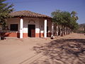
Charagua, also referred to as Charagua Iyambae, is a town in the southern part of Bolivia where the majority of inhabitants are Guarani people. In 2015, Charagua became the first Bolivian municipality to have autonomous self-governance by the indigenous population. [1] It is the principal village of the Cordillera province. Most inhabitants speak Guaraní.