Chazel | |
---|---|
Municipality | |
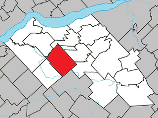
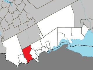
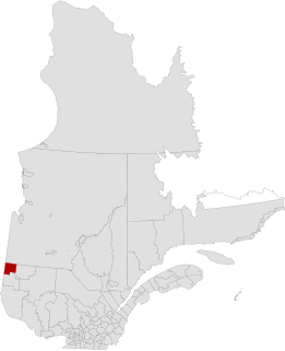
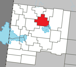
![]() Location within Abitibi-Ouest RCM. | |
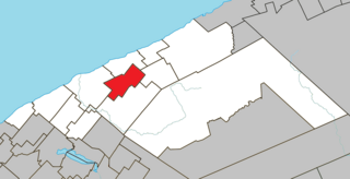
Coordinates: 48°52′N79°03′W / 48.867°N 79.050°W Coordinates: 48°52′N79°03′W / 48.867°N 79.050°W [1] | |
Country | ![]() |
Province | ![]() |
Region | Abitibi-Témiscamingue |
RCM | Abitibi-Ouest |
Settled | 1917 |
Constituted | February 19, 1938 |
Government [2] | |
• Mayor | Daniel Favreau |
• Federal riding | Abitibi—Témiscamingue |
• Prov. riding | Abitibi-Ouest |
Area [2] [3] | |
• Total | 138.90 km2 (53.63 sq mi) |
• Land | 134.30 km2 (51.85 sq mi) |
Population (2011) [3] | |
• Total | 289 |
• Density | 2.2/km2 (6/sq mi) |
• Pop 2006-2011 | ![]() |
• Dwellings | 125 |
Time zone | EST (UTC−5) |
• Summer (DST) | EDT (UTC−4) |
Postal code(s) | J0Z 1N0 |
Area code(s) | 819 |
Highways | No major routes |
Website | www |
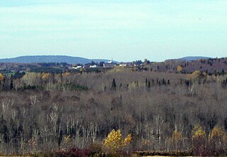
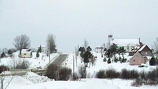
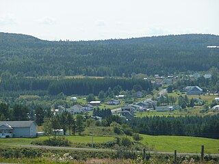
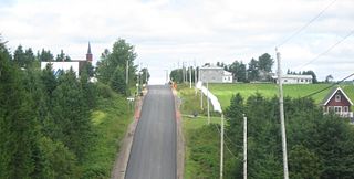
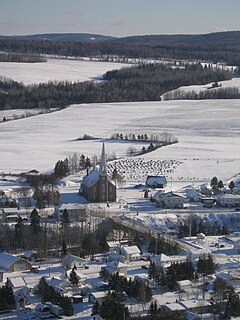
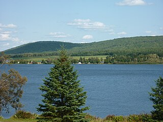
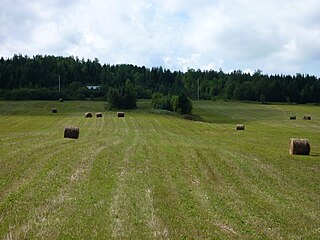
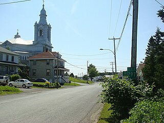
Chazel is a municipality in northwestern Quebec, Canada, in the Abitibi-Ouest Regional County Municipality. It had a population of 289 in the Canada 2011 Census.
Quebec is one of the thirteen provinces and territories of Canada. It is bordered to the west by the province of Ontario and the bodies of water James Bay and Hudson Bay; to the north by Hudson Strait and Ungava Bay; to the east by the Gulf of Saint Lawrence and the province of Newfoundland and Labrador; and to the south by the province of New Brunswick and the U.S. states of Maine, New Hampshire, Vermont, and New York. It also shares maritime borders with Nunavut, Prince Edward Island, and Nova Scotia. Quebec is Canada's largest province by area and its second-largest administrative division; only the territory of Nunavut is larger. It is historically and politically considered to be part of Central Canada.
Canada is a country in the northern part of North America. Its ten provinces and three territories extend from the Atlantic to the Pacific and northward into the Arctic Ocean, covering 9.98 million square kilometres, making it the world's second-largest country by total area. Canada's southern border with the United States is the world's longest bi-national land border. Its capital is Ottawa, and its three largest metropolitan areas are Toronto, Montreal, and Vancouver. As a whole, Canada is sparsely populated, the majority of its land area being dominated by forest and tundra. Consequently, its population is highly urbanized, with over 80 percent of its inhabitants concentrated in large and medium-sized cities, many near the southern border. Canada's climate varies widely across its vast area, ranging from arctic weather in the north, to hot summers in the southern regions, with four distinct seasons.
Abitibi-Ouest Regional County Municipality is a regional county municipality located in the Abitibi-Témiscamingue region of Quebec. Its seat is La Sarre.
The municipality was incorporated on February 19, 1938, as the Municipality of Saint-Janvier, and commonly known as Saint-Janvier-de-Chazel. In 1991, it was renamed to Chazel, named after Guillaume Chazel, a French soldier who died in 1725 near Cape Breton. [1]
Canada census – Chazel, Quebec community profile | |||
---|---|---|---|
2011 | 2006 | ||
Population: | 289 (-10.0% from 2006) | 321 (-2.7% from 2001) | |
Land area: | 134.30 km2 (51.85 sq mi) | 134.24 km2 (51.83 sq mi) | |
Population density: | 2.2/km2 (5.7/sq mi) | 2.4/km2 (6.2/sq mi) | |
Median age: | 44.4 (M: 45.0, F: 44.2) | 42.1 (M: 42.7, F: 41.0) | |
Total private dwellings: | 125 | 133 | |
Median household income: | $56,800 | $53,565 | |
References: 2011 [4] 2006 [5] earlier [6] |
Historical Census Data - Chazel, Quebec [7] | ||||||||||||||||||||||||||
---|---|---|---|---|---|---|---|---|---|---|---|---|---|---|---|---|---|---|---|---|---|---|---|---|---|---|
|
|
|
Canada Census Mother Tongue - Chazel, Quebec [7] | ||||||||||||||||||
---|---|---|---|---|---|---|---|---|---|---|---|---|---|---|---|---|---|---|
Census | Total | French | English | French & English | Other | |||||||||||||
Year | Responses | Count | Trend | Pop % | Count | Trend | Pop % | Count | Trend | Pop % | Count | Trend | Pop % | |||||
2011 | 290 | 290 | ![]() | 100.00% | 0 | ![]() | 0.00% | 0 | ![]() | 0.00% | 0 | ![]() | 0.00% | |||||
2006 | 320 | 320 | ![]() | 100.00% | 0 | ![]() | 0.00% | 0 | ![]() | 0.00% | 0 | ![]() | 0.00% | |||||
2001 | 330 | 320 | ![]() | 96.97% | 10 | ![]() | 3.03% | 0 | ![]() | 0.00% | 0 | ![]() | 0.00% | |||||
1996 | 390 | 390 | n/a | 100.00% | 0 | n/a | 0.00% | 0 | n/a | 0.00% | 0 | n/a | 0.00% |
Saint-Janvier-de-Joly is a municipality in the Municipalité régionale de comté de Lotbinière in Quebec, Canada. It is part of the Chaudière-Appalaches region and the population is 889 as of 2009. It is named after reverend Janvier Lachance, missionary who will serve the parish from 1914 to 1926. "Joly" honours Quebec premier Henri-Gustave Joly de Lotbinière and owner of the seigneurie of Lotbinière, in which part of Saint-Janvier-de-Joly's territory lay.
Saint-Alexis-de-Matapédia is a village and municipality in the Gaspésie–Îles-de-la-Madeleine region of eastern Quebec, Canada.
Sainte-Thérèse-de-Gaspé is a municipality in the Gaspésie-Îles-de-la-Madeleine region of the province of Quebec in Canada. It is the smallest municipality, in land area and population, of the Le Rocher-Percé Regional County Municipality.
Sainte-Gertrude-Manneville is a municipality in the Canadian province of Quebec, located in Abitibi Regional County Municipality. It includes the population centres of Sainte-Gertrude-de-Villeneuve and Manneville.
Saint-Adelme is a parish municipality in the Canadian province of Quebec, located in La Matanie Regional County Municipality in the Bas-Saint-Laurent region.
Saint-Jean-de-Cherbourg is a parish municipality in the Canadian province of Quebec, located in La Matanie Regional County Municipality.
Saint-Léandre is a parish municipality in the Canadian province of Quebec, located in La Matanie Regional County Municipality.
Saint-Vianney is a municipality in the Canadian province of Quebec, located in La Matapédia Regional Council Municipality. It was known as Saint-Jean-Baptiste-Vianney until 1988.
Saint-Godefroi is a township municipality in the Canadian province of Quebec, located within the Bonaventure Regional County Municipality. The township had a population of 405 in the Canada 2011 Census.
Saint-Siméon is a parish municipality in Quebec, Canada. It is also sometimes called Saint-Siméon-de-Bonaventure to avoid confusion with Saint-Siméon in the Capitale-Nationale region.
Saint-André-de-Restigouche is a municipality in Quebec, Canada.
Saint-François-d'Assise is a municipality in Quebec, Canada.
Saint-Léon-le-Grand is a parish municipality in Quebec, Canada.
Saint-Zénon-du-Lac-Humqui is a parish municipality in Quebec, Canada.
Saint-Alexandre-des-Lacs is a parish municipality in Quebec, Canada.
Saint-Tharcisius is a parish municipality in Quebec, Canada.
Saint-Moïse is a parish municipality in Quebec, Canada. It is located at the intersection of routes 132 and 297.
Saint-Damase is a parish municipality in Quebec, Canada.
Les Méchins is a municipality in Quebec, Canada, about 47 kilometres (29 mi) east of Matane along Quebec Route 132.
Saint-Ulric is a municipality in Quebec, Canada.