
Proddatur is a city in the YSR Kadapa District of Andhra Pradesh.
Nagayalanka is a village in Krishna district of Indian state of Andhra Pradesh. It is the mandal headquarters of Nagayalanka mandal in Machilipatnam revenue division.
Ibrahimpatnam is a part of Vijayawada in NTR district of the Indian state of Andhra Pradesh. It is also the mandal headquarters of Ibrahimpatnam mandal. Dr Narla Tata Rao Thermal Power Station, one of the major Thermal power stations of the state is located near the town. Railway Wagon Workshop at Rayanapadu is also located very near to Ibrahimpatnam at a distance of 4 km.
Gurla is a village in Vizianagaram district of the Indian state of Andhra Pradesh, India.
Komarada is a village in Vizianagaram district of the Indian state of Andhra Pradesh.
Gummalaxmipuram is a village in Parvathipuram Manyam district of the Indian state of Andhra Pradesh.
Laveru is a village in Srikakulam district of the Indian state of Andhra Pradesh. Laveru is located on Subhadrapuram-Cheepurupalli road that connects National Highway-5 to Cheepurupalli railway station on Howrah-Chennai mainline. The village is located in Pedda Gedda river basin.
Polaki is a village in Srikakulam district of Andhra Pradesh in India.
Bommanahal is a village in Anantapur district of the Indian state of Andhra Pradesh. It is the headquarters of Bommanahal mandal in Kalyandurg revenue division.
Krosuru is a village in Guntur district of the Indian state of Andhra Pradesh. It is the mandal headquarters of Krosuru mandal in Guntur revenue division.
D.Hirehal is a village in Anantapur district of the Indian state of Andhra Pradesh. It is the headquarters of D. Hirehal mandal in Kalyandurg revenue division.
Bukkarayasamudram is a village in Anantapur district of the Indian state of Andhra Pradesh. It is the mandal headquarters of Bukkarayasamudram mandal in Anantapur revenue division. It is named after Bukkaraya I.
Bukkapatnam is a village in Sri Sathya Sai district of the Indian state of Andhra Pradesh. It is the headquarters of Bukkapatnam mandal in Puttaparthi revenue division
Chilamathur is a village in Sri Sathya Sai district of Andhra Pradesh in India.

Guntupalli is a suburb of Vijayawada located in the NTR district of the Indian state of Andhra Pradesh. It is located in Ibrahimpatnam mandal of Vijayawada revenue division.
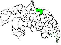
Amaravathi mandal is one of the 57 mandals in Guntur district of the Indian state of Andhra Pradesh. It is under the administration of Guntur revenue division and the headquarters are located at Amaravathi. The mandal is located on the banks of Krishna River, at a distance 27 km from the district headquarters. It is bounded by Atchampet, Krosuru, Pedakurapadu, Tadikonda and Thullur mandals.
Edurumondi is a village in Krishna district of Indian state of Andhra Pradesh. It is located in Nagayalanka mandal of Machilipatnam revenue division. The village is situated at the mouths of River Krishna, where it empties into Bay of Bengal.
Etimoga is a village in Krishna district of Indian state of Andhra Pradesh. It is located in Nagayalanka mandal of Machilipatnam revenue division. The village is situated at the mouths of River Krishna, where it empties into Bay of Bengal.

Thullur mandal is one of the 57 mandals in Guntur district of the Indian state of Andhra Pradesh. It is under the administration of Guntur Revenue Division and the headquarters are located at Thullur. The mandal is situated on the banks of Krishna River, bounded by Amaravathi, Tadikonda, Tadepalle and Mangalagiri mandals. The mandal is also a part of the new capital city of Andhra Pradesh to be developed. 18 villages from the mandal fall under the jurisdiction of Andhra Pradesh Capital City.

Pedaparimi is a village in Guntur district of the Indian state of Andhra Pradesh. It is located in Thullur mandal of Guntur revenue division. It lies adjacent to state capital Amaravati.

