Related Research Articles

Chepstow is a town and community in Monmouthshire, Wales, adjoining the border with Gloucestershire, England. It is located on the tidal River Wye, about 2 miles (3 km) above its confluence with the River Severn, and adjoining the western end of the Severn Bridge. It is the easternmost settlement in Wales, situated 16 miles (26 km) east of Newport, 28 miles (45 km) east-northeast of Cardiff, 18 miles (29 km) northwest of Bristol and 110 miles (180 km) west of London.

Monmouthshire is a county in the south east of Wales. It borders Powys to the north; the English counties of Herefordshire and Gloucestershire to the north and east; the Severn Estuary to the south, and Torfaen, Newport and Blaenau Gwent to the west. The largest town is Abergavenny, and the administrative centre is Usk.
Monmouthshire, also known as the County of Monmouth, is one of thirteen historic counties of Wales and a former administrative county. It corresponds approximately to the present principal areas of Monmouthshire, Blaenau Gwent, Newport and Torfaen, and those parts of Caerphilly and Cardiff east of the Rhymney River.
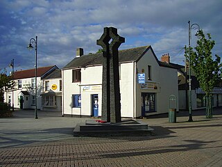
Caldicot is a market town and community in Monmouthshire, Wales. The town is located between Chepstow and the city of Newport. The site adjoins the Caldicot Levels, on the north side of the Severn Estuary. The population of the built-up area was around 11,000. It has a large school, Caldicot School, and is known for its medieval castle. The built-up area includes Portskewett. Caldicot had a population of 9,604 in 2011.

The A48 is a trunk road in Great Britain running from the A40 at Highnam, 3 miles (4.8 km) west of Gloucester, England, to the A40 at Carmarthen, Wales. Before the Severn Bridge opened on 8 September 1966, it was a major route between England and South Wales. For most of its route, it runs almost parallel to the M4 motorway. During times of high winds at the Severn Bridge, the A48 is used as part of the diversion route and is still marked as a Holiday Route.

The M48 is a 13-mile (21 km) long motorway in Great Britain, which crosses the Severn near Chepstow, Monmouthshire, linking England with Wales via the Severn Bridge. This road used to be the M4, and as a result is anomalously numbered: as it lies to the north of the M4 and to the west of the M5, it is in the Motorway Zone 5. The M4, M48 and the A48(M) motorway are the only motorways in Wales.

Severn Tunnel Junction railway station is a minor station on the western side of the Severn Tunnel in the village of Rogiet, Monmouthshire, Wales. It is 123.5 miles (198.8 km) from London Paddington and lies at the junction of the South Wales Main Line from London and the Gloucester to Newport Line.


Caldicot Castle is an extensive stone medieval castle in the town of Caldicot, Monmouthshire, in southeast Wales, built near the site of Harold Godwinson's former Saxon castle by the Norman earls of Hereford from about 1100. The castle became a Grade I listed building on 10 June 1953.

Rogiet Welsh: Rhosied is a small village and community in Monmouthshire, south east Wales, between Caldicot and Magor, 8 miles (13 km) west of Chepstow and 11 miles (18 km) east of Newport, which covers an area of 847 hectares (3.27 sq mi). It lies close to the M4 and M48 motorways, and the Second Severn Crossing. It has a railway station named Severn Tunnel Junction. Rogiet only has a population of 1,813 (2011).

The Gloucester–Newport line is a railway line that runs along the west bank of the River Severn in the United Kingdom between Gloucester and Newport.

Monmouth District was one of five local government districts in the county of Gwent in Wales between 1974 and 1996. In 1988 the district was granted a charter conferring borough status, becoming the Borough of Monmouth.
Caldicot School is a coeducational and non-selective secondary school in Caldicot, Monmouthshire, South Wales, with around 1,400 students. In 2013, the school was rated 'Good' by Estyn. At the time of the inspection in November 2013, 11% of pupils were eligible for free school meals against the national average of 17.7%.

Caldicot railway station is a part of the British railway system owned by Network Rail and is operated by Transport for Wales. It serves the town of Caldicot in Monmouthshire, Wales. It is located between Chepstow and the city of Newport on the Gloucester line; the line to Bristol via the Severn Tunnel runs just to the north but there are no platforms here; however, Severn Tunnel Junction station is within walking distance for those wanting to travel to Bristol.
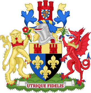
Monmouthshire County Council is the governing body for the Monmouthshire principal area – one of the unitary authorities of Wales.
Striguil or Strigoil is the name that was used from the 11th century until the late 14th century for the port and Norman castle of Chepstow, on the Welsh side of the River Wye which forms the boundary with England. The name was also applied to the Marcher lordship which controlled the area in the period between the Norman conquest and the formation of Monmouthshire under the Laws in Wales Acts 1535–1542.
Gwent Wildlife Trust (GWT) is a wildlife trust covering the area between the lower Wye and Rhymney rivers which forms the vice county of Monmouthshire in south-east Wales. It is a registered charity and a member of the Wildlife Trusts Partnership.
West End is an electoral ward in the town of Caldicot, Monmouthshire, Wales. The ward elects councillors to Caldicot Town Council and Monmouthshire County Council.
References
- ↑ Archives Network Wales – Chepstow Rural District Council Records [ permanent dead link ]
- ↑ "Caldicot Town Council Website Home Page". Archived from the original on 9 May 2008. Retrieved 14 March 2008.