Llanwern

Last updated

Llanwern
Church of St Mary, Llanwern - geograph.org.uk - 1449730.jpg
St Mary's Church
Newport UK location map.svg
Red pog.svg
Llanwern
Location within Newport
Population2,961 (2011 census) [1]
OS grid reference ST368863
Principal area
Country Wales
Sovereign state United Kingdom
Post town NEWPORT
Postcode district NP18
Postcode district NP19
Dialling code 01633
Police Gwent
Fire South Wales
Ambulance Welsh
UK Parliament
List of places
UK
Wales
Newport
51°34′19″N2°54′48″W / 51.57201°N 2.91331°W / 51.57201; -2.91331

Llanwern is a village and community in the eastern part of the City of Newport, South East Wales.

Contents

Location and populace

Llanwern is bounded by the M4 and Langstone to the north, Ringland, Lliswerry and the River Usk to the west, the River Severn to the south and the city boundary to the east. The population of the Llanwern community in 2011 was 333, [2] [ failed verification ] which contains Llanwern village and the western half of the site of Llanwern steelworks. [3] The community population dropped to 289 in 2011.[ clarification needed ] [4] The community also includes the area of Glan Llyn.

Notable features

Church of St Mary

The Church is dedicated to St Mary and is a Grade II* listed building. It dates from the 14th century. [5]

The church has a particularly good collection of stained glass. The west tower, stylistically more elaborate than most local churches, contains five bells of various dates. The bells were restored in the 1990's. [6]

Llanwern House

Llanwern House was the home of Lord Rhondda of Llanwern, David Alfred Thomas, who was Minister of Food during the First World War. In 1887, a year before his election to Parliament, Thomas took the lease of the house, where he lived the life of a country squire, riding to hounds and breeding prize Hereford cattle. He bought the house in 1900 and acquired the neighbouring Pencoed estate shortly before his death, the purchase making Thomas the largest landowner in Monmouthshire after Lord Tredegar. Despite his fortune Thomas was content to retain the mansion at Llanwern, a large square house on a hilltop overlooking the village. The house, dating to 1760, was old-fashioned in its appearance but that appearance concealed a "delicate and beautiful interior" with Chinoiserie influences. [7] The house was demolished in the 1950s, although the site is still visible, [8] and the parkland intact. Thomas is buried in the graveyard of the church. [6]

Governance

Llanwern has a community council, represented by up to 7 community councillors. [9]

Llanwern is covered by a Newport City Council electoral ward, also called Llanwern, though also including Goldcliff, Nash, Whitson and Redwick, as well as the community of Llanwern. It elects one city councillor, since 2008 this has been Conservative Martyn Kellway. [10]

Regeneration

A £115m renewal project called Glan Llyn, led by St. Modwen Properties Limited, is transforming the former steel-producing part of the Llanwern steelworks site. Started in 2004, the masterplan envisages 34 acres (14 ha) of employment-generating accommodation hosting 6,000 jobs, 4,000 new dwellings, community facilities and open space including three new lakes. Full completion is anticipated by 2026–2028.

See also

Related Research Articles

<span class="mw-page-title-main">Caldicot</span> Town in Wales

Caldicot is a market town and community in Monmouthshire, Wales. The town is located between Chepstow and the city of Newport. The site adjoins the Caldicot Levels, on the north side of the Severn Estuary. The population of the built-up area was around 11,000. It has a large school, Caldicot School, and is known for its medieval castle. The built-up area includes Portskewett. Caldicot had a population of 9,604 in 2011.

Stow Hill is a community civil parish and coterminous electoral district (ward) of the City of Newport, South Wales.

<span class="mw-page-title-main">Rogiet</span> Human settlement in Wales

Rogiet is a small village and community in Monmouthshire, south east Wales, between Caldicot and Magor, 8 miles (13 km) west of Chepstow and 11 miles (18 km) east of Newport, which covers an area of 847 hectares (3.27 sq mi). It lies close to the M4 and M48 motorways, and the Second Severn Crossing. It has a railway station named Severn Tunnel Junction. Rogiet only has a population of 1,813 (2011).

<span class="mw-page-title-main">Lliswerry</span> Human settlement in Wales

Lliswerry, or Liswerry is an electoral district (ward) and community of the city of Newport, South Wales. The area is governed by Newport City Council. It is the largest community/ward in the city.

St Julians is a community and coterminous electoral district (ward) of the City of Newport, South Wales.

<span class="mw-page-title-main">Taff's Well</span> Human settlement in Wales

Taff's Well is a semi-rural village, community and electoral ward located at the south easterly tip of Rhondda Cynon Taf, 6 miles (9.7 km) to the north of Cardiff, the capital city of Wales. Known locally as the 'Gates to the Valleys', it is separated from Gwaelod-y-Garth by the River Taff. Taff's Well is distinguished because it contains the only thermal spring in Wales. The tepid water is thought to rise along a fault-line from the Carboniferous Limestone, in somewhat similar manner to the warm springs at Bristol and Bath. Various religious groups regard it as a spiritual site.

<span class="mw-page-title-main">Llanmartin</span>

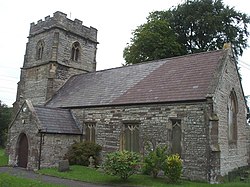
Llanmartin is a village and parish in the city of Newport, Wales.

Underwood is a settlement in the city of Newport, South East Wales. It is an early 1960s council housing estate that consists of houses, shops, a leisure centre, Baptist church and social club called "Iscoed Tavern" owned by the company red dragon pubs. There is a community centre which has a gym attached to it. The leisure centre is now up for sale.

<span class="mw-page-title-main">Whitson</span> Human settlement in Wales

Whitson is a village on the outskirts of the city of Newport, South Wales. It is located about 7 miles (11 km) south east of Newport city centre on the Caldicot Levels, a large area of coastal land reclaimed from the sea. Administratively, Whitson is part of the community of Goldcliff.

<span class="mw-page-title-main">Marshfield, Newport</span> Human settlement in Wales

Marshfield is a village and community of Newport, Wales. It sits approximately 5 miles southwest of Newport, and 7 miles northeast of Cardiff. The area is governed by Newport City Council. The community includes Castleton. Its population in 2011 was 3,054.

<span class="mw-page-title-main">Langstone, Newport</span> Human settlement in Wales

Langstone is a community and village of the city of Newport, Wales. The area is governed by the Newport City Council. The community had a population of 3,279 in 2011.

<span class="mw-page-title-main">Bishton</span> Human settlement in Wales

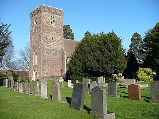
Bishton or Bishopston is a small rural community in the east of the city of Newport, South Wales. It lies in the Llanwern electoral district (ward) and contains the eastern end of Llanwern steelworks, the Underwood estate as well as Bishton itself. The population in the 2001 census was 2,181; dropping to 2,137 in 2011.

<span class="mw-page-title-main">Goldcliff</span> Village in the city of Newport, South Wales

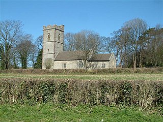
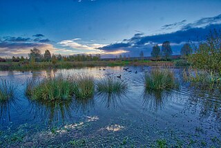
Goldcliff is a village, parish and community to the south east of the city of Newport in South Wales. It lies within the Newport city boundaries in the historic county of Monmouthshire and the preserved county of Gwent. Administratively, the community of Goldcliff includes the village/parish of Whitson. The population in 2001 was 233; by 2011 it had risen to 329.

<span class="mw-page-title-main">Redwick, Newport</span> Human settlement in Wales

Redwick is a small village and community (parish) to the south east of the city of Newport, in Wales, United Kingdom. It lies within the Newport city boundaries, in the historic county of Monmouthshire and the preserved county of Gwent. In 2011 the population was 206.

<span class="mw-page-title-main">Llanengan</span> Human settlement in Wales

Llanengan is a small village and community 1.2 mi (1.9 km) around Abersoch in Gwynedd in north-west Wales. It had a population of 2,024 at the 2001 census, which had been reduced to 1,989 at the 2011 Census. The popular seaside resort village of Abersoch falls within the community, as do the villages of Llangian, Mynytho, Machroes and Llanengan. The local public house is called the Sun.

<span class="mw-page-title-main">Nash, Newport</span> Village and community in Wales

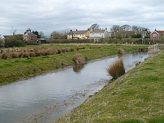
Nash is a village and community to the south of the city of Newport, South Wales, in the Lliswerry ward.

<span class="mw-page-title-main">Llanwern steelworks</span>

Llanwern steelworks is located in Llanwern, east of the City of Newport, South Wales.

<span class="mw-page-title-main">Glan Llyn</span> Human settlement in Wales

Glan Llyn is the name of a mixed-use community development, to the south-east of Newport, South Wales, at the western end of the former Llanwern steelworks, on the A4810 road at the edge of the Caldicot Levels.

Llanwern is the name of an electoral ward for Newport City Council in south Wales. It covers several rural communities to the east of the city. It is represented by one city councillor.

References

  1. "Newport ward 2011" . Retrieved 4 April 2015.
  2. Office for National Statistics Parish Headcounts: Llanwern
  3. "Community Well-being Profile: Llanwern Final" (PDF). Newport City Council. May 2017. p. 5. Retrieved 7 May 2022.
  4. "Custom report - Nomis - Official Labour Market Statistics".
  5. Cadw. "Parish Church of St Mary (Grade II*) (2926)". National Historic Assets of Wales . Retrieved 27 March 2024.
  6. 1 2 https://netherwent.church/llanwern/
  7. Lloyd, T. (1989), The Lost Houses of Wales: A Survey if Country Houses in Wales Demolished since c.1900, London: SAVE Britain's Heritage, ISBN   9780905978277, p.103
  8. "Geograph:: St Mary's Church, Llanwern © Adrian and Janet Quantock cc-by-sa/2.0". www.geograph.org.uk.
  9. "Community council election nominees for Newport revealed". South Wales Argus . 6 April 2022. Retrieved 1 September 2022.
  10. "Newport City Council Election Result 1995-2012" (PDF). The Elections Centre. Plymouth University . Retrieved 1 September 2022.