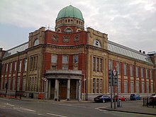
Newport Technical Institute is a Grade II-listed building in the city centre of Newport, Wales.

A listed building, or listed structure, is one that has been placed on one of the four statutory lists maintained by Historic England in England, Historic Environment Scotland in Scotland, Cadw in Wales, and the Northern Ireland Environment Agency in Northern Ireland.
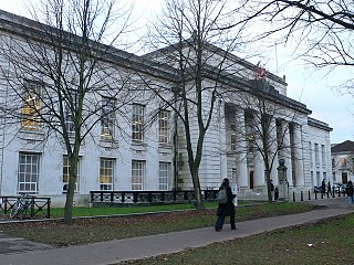
Newport city centre is traditionally regarded as the area of Newport, Wales bounded by the west bank of the River Usk, the George Street Bridge, the eastern flank of Stow Hill and the South Wales Main Line. Most of the city centre is contained within two conservation areas: the central area and the area around Lower Dock Street. Most of the city centre is located in the Stow Hill district.

Newport is a city and unitary authority area in south east Wales, on the River Usk close to its confluence with the Severn Estuary, 12 miles (19 km) northeast of Cardiff. At the 2011 census, it was the third largest city in Wales, with a population of 145,700. The city forms part of the Cardiff-Newport metropolitan area, with a population of 1,097,000.
The red-brick building with a copper dome stands in Clarence Place on the east bank of the River Usk, close to Newport Bridge. It was built on land purchased from Lord Tredegar and opened in September 1910. Known locally as the former "Art College" or "School of Art", the Newport Technical Institute and its School of Art evolved from the Newport Mechanics Institute.[ citation needed ]

The River Usk rises on the northern slopes of the Black Mountain, Wales, in the westernmost part of the Brecon Beacons National Park. Initially forming the boundary between Carmarthenshire and Powys, it flows north into Usk Reservoir, then east by Sennybridge to Brecon before turning southeast to flow by Talybont-on-Usk, Crickhowell and Abergavenny after which it takes a more southerly course.

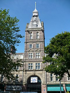
Newport Bridge connects High Street and Clarence Place across the River Usk adjacent to Newport Castle in Newport city centre.
After the School of Art relocated to the University of Wales, Newport Caerleon campus, the building fell into serious disrepair. In 2008 redevelopment began to convert the building into luxury apartments and was completed in 2012. [1]

The University of Wales, Newport, was a university based in Newport, South Wales, prior to the merger that formed the University of South Wales in April 2013. The university had two campuses in Newport, Caerleon on the northern outskirts of the city, which was subsequently closed during July 2016, and a £35 million campus on the east bank of the River Usk in the Newport city centre which opened in 2011. In 2012 the university was ranked 111th out of 120 UK universities in the Guardian League Table for university rankings, 105th out of 116 in The Complete University Guide and 104th out of 116 UK universities in the Times Good University Guide.