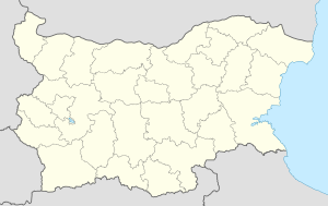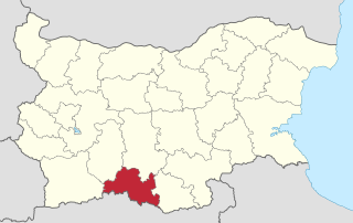
Smolyan Province is a province in Southern-central Bulgaria, located in the Rhodope Mountains, neighbouring Greece to the south. It is named after its administrative and industrial centre—the city of Smolyan. The province embraces a territory of 3,192.8 km². that is divided into 10 municipalities with a total population of 124,795 inhabitants, as of December 2009.
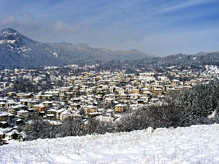
Shiroka Laka is a village in the very south of Bulgaria, located in Smolyan municipality, Smolyan Province. It is a proclaimed architectural and folklore reserve and lies in the central Rhodope Mountains, 23 km northwest of Smolyan, 16 km west of Pamporovo and 22 km southeast of Devin.

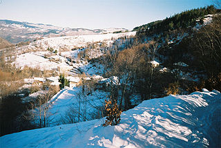
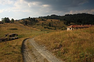
Mogilitsa is a village in the Rhodope Mountains in southernmost Bulgaria, part of Smolyan municipality, Smolyan Province. As of September 2005, it has a population of 483. Mogilitsa lies at 41°30′N24°39′E, 1,041 m above mean sea level, near the border with Greece and the upper course of the river Arda, 35 kilometres southeast of Smolyan.
Laki is a small town in Laki Municipality in Plovdiv Province, southern Bulgaria. As of 2006 it has 2,615 inhabitants. It is located in the Rhodope mountains, 54 km to the south of the province capital Plovdiv, and 88 km to the north of Smolyan. There is a lead-zinc flotation factory, several textile plants and timber workshops.

Aligovska is a village in Smolyan Municipality, located in the Smolyan Province of southern Bulgaria. It is located 174.91 km from Sofia. As of 2007, the village has a population of 15 people.

Arda is a village in Smolyan Municipality, located in the Smolyan Province of southern Bulgaria. It is located 173.424 km from Sofia and the village covers an area of 17.928 km². As of 2007, the village had a population of 314 people.
Belev dol is a village in Smolyan Municipality, located in the Smolyan Province of southern Bulgaria. The village covers an area of 3.764 km² and is located 178.3 km from Sofia. As of 2007, the village had a population of 87 people.
Bilyanska is a village in Smolyan Municipality, located in the Smolyan Province of southern Bulgaria. The village is located 174.093 km from Sofia. As of 2007, the village had a population of 29 people.
Borikovo is a village in the municipality of Smolyan, located in the Smolyan Province of southern Bulgaria. The village covers an area of 22.267 km² and is located 171.2 km from Sofia. As of 2007, the village had a population of 46 people.
Bostina is a village in the municipality of Smolyan, located in the Smolyan Province of southern Bulgaria. The village covers an area of 4.77 km² and is located 168.3 km from Sofia. In 2007, the village had a population of 137.
Bukata is a village in the municipality of Smolyan, located in the Smolyan Province of southern Bulgaria. The village covers an area of 7.63 km² and is located 171.46 km from Sofia. As of 2007, the village had a population of 82 people.
Bukatsite is a village in the municipality of Smolyan, located in the Smolyan Province of southern Bulgaria. The village covers an area of 10.048 km² and is located 171.46 km from Sofia. As of 2007, the village had a population of 44 people.
Chamla is an abandoned village in the municipality of Smolyan, located in the Smolyan Province of southern Bulgaria. The village is located 150.9 km from Sofia.
Chepleten is a village in the municipality of Smolyan, located in the Smolyan Province of southern Bulgaria. The village covers an area of 6.76 km² and is located 179.63 km from Sofia. As of 2007, the village had a population of 67 people.
Chereshovska Reka is a village in the municipality of Smolyan, located in the Smolyan Province of southern Bulgaria. The village is located 171.46 km from Sofia. As of 2007, the village had a population of 15 people.
Chereshovo is a village in the municipality of Smolyan, located in the Smolyan Province of southern Bulgaria. The village is located 170 km from Sofia. As of 2007, the village had a population of 13 people.
Chuchur is a hamlet in the municipality of Smolyan, located in the Smolyan Province of southern Bulgaria. The village is located 177.9 km from Sofia. As of 2007, the village had a population of 6 people.
Dimovo is a small village in the municipality of Smolyan, located in the Smolyan Province of southern Bulgaria. The village is located 166.88 km from Sofia. As of 2007, the village had a population of 11 people.
Smilyan is a village in Smolyan Municipality, located in the Smolyan Province of southern Bulgaria. It is located 176.862 km from Sofia and the village covers an area of 29.248 km2. As of 2007, the village had a population of 1794 inhabitants.

22nd Multi-member Constituency – Smolyan is a constituency whose borders are the same as Smolyan Province in Bulgaria.