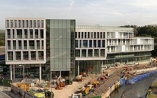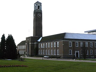
The Metropolitan Borough of Rochdale is a metropolitan borough of Greater Manchester in North West England. It is named after its largest town, Rochdale, but spans a far larger area which includes the towns of Middleton, Heywood, Littleborough and Milnrow, and the village of Wardle.

Tyne and Wear ( ) is a metropolitan county in the North East region of England around the mouths of the rivers Tyne and Wear. It came into existence in 1974 after the passage of the Local Government Act 1972. It consists of the five metropolitan boroughs of South Tyneside, North Tyneside, City of Newcastle upon Tyne, Gateshead and City of Sunderland. It is bounded on the east by the North Sea, and has borders with Northumberland to the north and County Durham to the south.

Merseyside is a metropolitan county in North West England, with a population of 1.38 million. It encompasses the metropolitan area centred on both banks of the lower reaches of the Mersey Estuary and comprises five metropolitan boroughs: Knowsley, St Helens, Sefton, Wirral, and the city of Liverpool. Merseyside, which was created on 1 April 1974 as a result of the Local Government Act 1972, takes its name from the River Mersey.

Ellesmere Port and Neston was, from 1974 to 2009, a local government district with borough status in Cheshire, England. It covered the southern part of the Wirral Peninsula, namely that part which is not included in the Metropolitan Borough of Wirral.

Halton is a local government district in the ceremonial county of Cheshire in North West England, with borough status and administered by a unitary authority. It was created in 1974 as a district of the non-metropolitan county of Cheshire, and became a unitary authority area on 1 April 1998 under Halton Borough Council. Since 2014 it has been a member of the Liverpool City Region Combined Authority. The borough consists of the towns of Runcorn and Widnes and the civil parishes of Hale, Daresbury, Moore, Preston Brook, Halebank and Sandymoor. The district borders Merseyside, Warrington and Cheshire West and Chester. The borough straddles the River Mersey – the area to the north is historically part of Lancashire, that to the south part of Cheshire.

South Ribble is a non-metropolitan district and borough of Lancashire, England. Its council is based in Leyland. The population, at the 2011 Census, was 109,057.
In May 2007, the council was officially declared "Excellent" by the Audit Commission, of the best five district councils in the country. The council is the only district council not to be part of the District Councils' Network.

Chester was a non-metropolitan local government district of Cheshire, England, with the status of a city and a borough.

The Borough of Chorley is a local government district with borough status in Lancashire, England. The population of the Borough at the 2011 census was 104,155. It is named after its largest settlement, the town of Chorley.

The Metropolitan Borough of Gateshead is a metropolitan borough in Tyne and Wear, in North East England. The borough forms the south west part of the county. It is named after its largest town, Gateshead, but also spans the towns of Rowlands Gill, Whickham, Blaydon and Ryton; suburban areas include Felling, Pelaw, Dunston and Low Fell.

Blaydon is a constituency represented in the House of Commons of the UK Parliament since 2017 by Liz Twist of the Labour Party.

Pelton is a village and electoral ward in County Durham, in England. The population of the village and ward taken at the 2011 census was 8,250. It is located about two miles to the northwest of Chester-le-Street. The village of West Pelton is located to the west; separated from it by a few villages between and closer to Stanley than to central Chester-le-Street. Pelton has a newly built community centre updated in 2012, one public house and a small range of convenience stores, including a CO OP, three general stores, a Post Office, chemist, doctors surgery, dentist, library, two parks and some take-away food outlets, and some hair salons. Local schools in the area include a primary school. Pelton is served by public transport, with links to Stanley, Sunderland, Newcastle upon Tyne, Chester-le-Street and Consett with buses running up to every 30 minutes or so to 5 bus stops throughout the village.

Chester was a rural district of Cheshire, England, from 1894 to 1974. It was located near the city and county borough of Chester but did not include it. The district saw various boundary changes throughout its life. It included the small civil parish of Chester Castle, an exclave of the rural district within the boundaries of the county borough of Chester.

Swinton and Pendlebury was a local government district of the administrative county of Lancashire, England. It was created in 1894 as an urban district and enlarged in 1934, gaining the status of a municipal borough.
Stokesley was a rural district in the North Riding of Yorkshire from 1894 to 1974. It was named after the town of Stokesley, which it contained.

Darlington is a unitary authority area in the ceremonial county of County Durham, north-east England. It borders the non-metropolitan county of County Durham to the north and west, Stockton-on-Tees to the east and North Yorkshire to the south along the line of the River Tees. The urban centre and the base of the borough is the town of Darlington. In 2011 it had a resident population of 106,000. The borough is a member of the Tees Valley combined authority area.
The County Borough of Wigan was, from 1889 to 1974, a local government district centred on Wigan in the northwest of England. It was alternatively known as Wigan County Borough.

Harraton was a township in Chester-le-Street parish, and a sub-district in Chester-le-Street registration district, Durham. Since 1974 it is located in the City of Sunderland in the county of Tyne and Wear. The township lies on the river Wear, and on the North-eastern railway; now a cyclist route/footpath, 3 miles north-east of Chester-le-Street; includes the villages of Chaters-Hough, Fatfield, and Picktree; and forms part of the chapelry of Birtley. The soil and subsoil are clay. The chief crops are wheat, oats and turnips. A considerable portion of Lambton Park, the seat of the Earl of Durham, and the castle and gardens, being on the north side of the river Wear, are in the township of Harraton, but for particulars see Lambton Castle.


