Chhatri are semi-open, elevated, dome-shaped pavilions used as an element in Indo-Islamic architecture and Indian architecture. They are most commonly square, octagonal, and round. Originating as a canopy above tombs, they largely serve as decorative elements as opposed to functional elements. The earliest examples of chhatri being used in the Indian Subcontinent were found in the Shrine of Ibrahim in Bhadreswar, constructed between 1159 and 1175 AD.

Haldighati is a historical mountain pass between Khamnore and Balicha village situated at Aravalli Range of Rajasthan in western India which connects Rajsamand and Udaipur districts. Haldighati also known as Haldighati Darra.The pass is located at a distance of 44 kilometres from Udaipur and 367 kilometres from Jaipur. The name 'Haldighati' is believed to have originated from the turmeric-coloured yellow soil of the area..

The Archaeological Survey of India (ASI) is an Indian government agency that is responsible for archaeological research and the conservation and preservation of cultural historical monuments in the country. It was founded in 1861 by Alexander Cunningham during the British Raj who also became its first Director-General.

Pali district is a district in Rajasthan, India. The city of Pali is its administrative headquarters. Pali is also known as the Industrial/Textile City and has been a hub for merchant activities for centuries. It has a rich heritage and culture, including beautiful Jain temples and other elaborate monuments.

The Aga Khan Palace was built by Sultan Muhammed Shah Aga Khan III in the city of Pune, India.

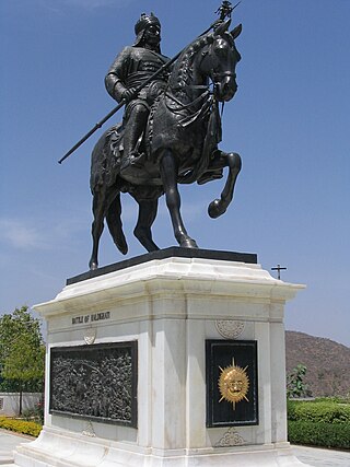
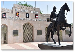
Chetak or Cetak is the name given in traditional literature to the horse ridden by Maharana Pratap at the Battle of Haldighati, fought on 18 June 1576 at Haldighati, in the Aravalli Mountains of Rajasthan, in western India.

Moti Magri is a hill in India. It overlooks the Fateh Sagar Lake in the city of Udaipur, Rajasthan.

X Corps is a corps of the Indian Army. It is based in Bathinda and is a part of South Western Command.

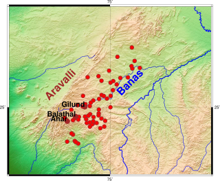
Balathal is an archaeological site located in Vallabhnagar tehsil of Udaipur district of Rajasthan state in western India. It is one of the ninety Ahar-Banas culture sites located in the Basins of the Banas river and its tributaries.
Balicha is a village located near Udaipur, in Rajasthan, India. It is the location of the future permanent campus of Indian Institute of Management Udaipur. The memorial site Chetak Smarak is also located there.

Baror is an archeological site in Sri Ganganagar district of Rajasthan, India. It belongs with ancient Indus Valley civilization. Pre Harappan and Harappan pottery has been found after excavation.

Kolvi Caves, or Kholvi Caves, are located at Kolvi village of Jhalawar district in the state of Rajasthan, India. They are carved out in laterite rock hill. This Buddhist site has stupas, chaityas containing figures of Buddha. An architectural style shows dominance of Mahyana sect in this region in the 8th-9th century CE. Around 50 caves have been found here. The caves has statues of Buddha in the meditation and standing position. The stupas and colossal statues of Buddha are archaeologically significant. Around Kolvi village similar caves have been discovered which proves existence of prosperous Buddhist civilization in the region. Though the evidence of Kolvi is very important to register presence of Buddhsim in Rajasthan, the caves are very similar to the Bagh Caves and show cultural affinity with a region that is geaographically close.
The 20474/ 20473 Chetak Express is a Superfast Express express train belonging to Indian Railways – North Western Railway zone that runs between Udaipur City and Delhi Sarai Rohilla in India.
Tourism in Haryana relates to tourism in the state of Haryana, India. There are 21 tourism hubs created by Haryana Tourism Corporation (HTC), which are located in Ambala, Bhiwani Faridabad, Fatehabad, Gurgaon, Hisar, Jhajjar, Jind, Kaithal, Karnal, Kurukshetra, Panchkula, Sirsa, Sonipat, Panipat, Rewari, Rohtak, Yamunanagar, Palwal and Mahendergarh.
Mogra Kalan is a village in Luni tehsil of Jodhpur, India, near National Highway 62 the Pali to Jodhpur route in Rajasthan. The village is 18 kilometres (11 mi) from Jodhpur. The postal code is 342802. According to the 2011 census of India, the population of the village was 4,049 people.
Hathipole is a locality in the Udaipur city of Rajasthan state. This is among the largest and popular market in the city.
Chetak Circle is a locality, embarked by a large roundabout in the Udaipur city of Rajasthan state. This is among the popular shopping area in the city.

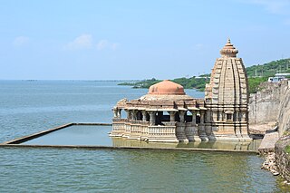
Bisaldeo temple, also known as Bisaldev temple or Bisal Deoji's temple, is a Hindu temple in Bisalpur, India. It is located beside the Bisalpur Dam on the Banas River, in the Tonk district of Rajasthan state. The temple is dedicated to Gokarneshvara, an aspect of Shiva. A Monument of National Importance, it was commissioned by the 12th century Chahamana ruler Vigraharaja IV, who is also known as Bisal Deo.
Renwal railway station is a railway station in Jaipur district, Rajasthan, India. Its code is RNW. It serves Renwal village. The station consists of 2 platforms. Passenger and express trains halt here.


