
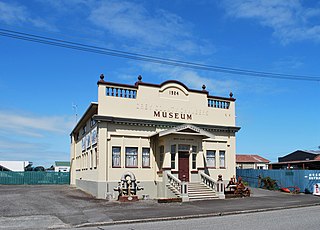
Cheviot is a town in the Hurunui District of north Canterbury, on the east coast of the South Island of New Zealand. It is located on State Highway 1, approximately 112 kilometres (70 mi) north of Christchurch and 68 kilometres (42 mi) south of Kaikōura.

A system of counties of New Zealand was instituted after the country dissolved its provinces in 1876, and these counties were similar to other countries' systems, lasting with little change until 1989, when they were reorganised into district and city councils within a system of larger regions.
The Hundalee Hills are located close to the borders of Hurunui District and Kaikōura District in Canterbury in the South Island of New Zealand.

The Kaikōura District is a territorial authority district in Canterbury Region on the South Island of New Zealand. The district encompasses the eponymous town of Kaikōura, a number of small towns and settlements and the surrounding rural area in northern Canterbury. The district had an estimated population of 4,230 as of June 2023.

Hurunui District is a territorial local government district within the Canterbury Region on the east coast of New Zealand's South Island, north of Christchurch. It stretches from the east coast to the Main Divide. Its land area is 8,640.96 square kilometres (3,336.29 sq mi).
Ashley was a New Zealand electorate situated north of Christchurch. It was in use from 1866 to 1902, and was replaced with the Hurunui electorate.

Nelson Province was constituted in 1853 under the New Zealand Constitution Act 1852, and originally covered the entire upper South Island, including all of present-day Buller, Kaikoura, Marlborough, and Tasman districts, along with Nelson City, Grey District north of the Grey River, and the Hurunui District north of the Hurunui River. It was reduced in size by the creation of Marlborough Province in November 1859, then abolished in 1876, along with all the provinces of New Zealand.

The Westland Province was a province of New Zealand from 1873 until the abolition of provincial government in 1876. The capital was Hokitika.

Tasman District Council is the unitary local authority for the Tasman District of New Zealand.

Culverden is a small town in the northern Canterbury region of New Zealand's South Island. It lies at the centre of the Amuri Plain. Culverden has traditionally been surrounded by sheep farms. Dairy farms have now become more common as a result of irrigation schemes in the area. The Waiau Plains Irrigation Scheme was completed in 1980. It provides irrigation to 17,000 hectares of farmland and the Balmoral Scheme provides irrigation to a further 5500 hectares.
Mt Lyford (1590m) is the home of an alpine village and ski resort in the South Island of New Zealand. It is 146 kilometres by road north of Christchurch on the Inland Kaikōura Road (SH70) between Culverden and Kaikōura. The resort is a 40-minute drive to Hanmer Springs and a 45-minute drive to Kaikōura. The nearby township of Waiau, Canterbury has a small supermarket, DIY store and petrol station. The Inland Kaikōura Road is very scenic and windy from Waiau through to Kaikōura and forms part of the Alpine Pacific Touring Route.

Amuri County is one of the former counties of New Zealand, in the area that is now the north of Canterbury region.
The Greta River is a river in the Hurunui District of New Zealand. It flows north-east into the Hurunui River, which runs into the Pacific Ocean south of Cheviot, New Zealand. State Highway 1 follows the river for part of its route between Cheviot and Waipara. The locality of Greta Valley is to the east of the Greta River on the banks of the Waikari River. The river was named by local runholders Sir Charles Clifford and Sir Frederick Weld in the 1850s after the Greta River in Yorkshire.
Wairau was a parliamentary electorate in the Marlborough Region of New Zealand. It was one of the initial 24 New Zealand electorates and existed from 1853 until its abolition in 1938, when it was succeeded by the Marlborough electorate. The electorate had 13 representatives during its existence. The 1861 election in the Wairau electorate was notable in that a later Premier, Frederick Weld, was unexpectedly and narrowly defeated by William Henry Eyes.
Grey County was one of the counties of New Zealand in the South Island.
Waimea County was one of the counties of New Zealand on the South Island.
Hurunui District Council is the territorial authority for the Hurunui District of New Zealand.
The Nelson-Marlborough Regional Council was one of 13 regional councils established through the passing of the Local Government Act 1987. The council was established in the 1989 local government reforms, but disestablished only three years later in 1992, when its functions went to the unitary authorities of Nelson City Council, Tasman District Council, and Marlborough District Council. Kaikoura District had belonged to the Nelson-Marlborough Regional Council, but with the 1992 reform was transferred to the Canterbury Regional Council.
Kaikoura County was one of the counties of New Zealand on the South Island.

Inangahua County was one of the counties of New Zealand on the South Island.