Nelson Province

Last updated

Nelson Province
Nelson in New Zealand (1852).svg
Nelson Province as constituted in 1853
Nelson Province seal.png
Motto(s): 
Palmam qui meruit ferat Latin Let him, who has earned it, bear the palm
Nelson Province
Coordinates: 41°16′15″S173°17′2″E / 41.27083°S 173.28389°E / -41.27083; 173.28389
Country New Zealand
Provinces of New Zealand Nelson Province
Founded1853
Abolished1876
Named after Horatio Nelson
Seat Nelson
Demonym Nelsonian
Time zone UTC+12 (NZST)
  Summer (DST) UTC+13 (NZDT)

Nelson Province was constituted in 1853 under the New Zealand Constitution Act 1852, and originally covered the entire upper South Island, including all of present-day Buller, Kaikoura, Marlborough, and Tasman districts, along with Nelson City, Grey District north of the Grey River, and the Hurunui District north of the Hurunui River. It was reduced in size by Marlborough Province splitting off in November 1859. It was abolished in 1876, along with all the provinces of New Zealand.

Contents

Area

Map showing Nelson Province after Marlborough Province split off in 1859 Nelson in New Zealand (1873).svg
Map showing Nelson Province after Marlborough Province split off in 1859

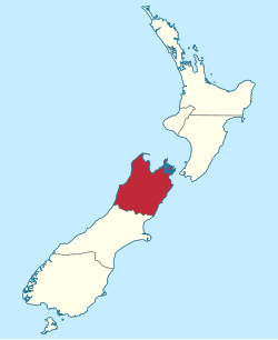
Nelson Province initially covered the entire upper South Island. Marlborough Province split off from Nelson Province on 1 November 1859 because the majority of the income of the provincial council came from land sales in the Marlborough region, but the funds were mostly used in the Nelson region. Land sales in Nelson and Marlborough netted the Nelson Provincial Council £33,000 and £160,000, respectively. Of that, £200 was expended benefiting the Marlborough region. [1] There was considerable conflict between Superintendent John Perry Robinson's policies of supporting smaller landholders, and the objectives of the large pastoral runholders in the Wairau Valley. The New Provinces Act 1858 allowed for parts of a province to break away if the area was large enough, and enough voters supported such a move. The petition was signed by almost all settlers in the Wairau; only six withholding their support for a split. Marlborough Province was gazetted on 4 October 1859. [2]

History

Nelson Provincial Council buildings Nelson Provincial buildings.jpg
Nelson Provincial Council buildings

The Nelson Provincial Council was established with fifteen members, and the province was divided into electoral districts for the election of the Superintendent and members of the council. The seven districts were: Town of Nelson, five members; Suburban Districts, one member; Waimea East District, two members; Waimea West District, one member; Waimea South District, two members; Motueka and Massacre Bay District, two members; Wairau District, two members. [3]

Three candidates, Edward Stafford, Francis Jollie and John Waring Saxton, ran for election as Nelson's first superintendent on 1 August 1853. Stafford won, with vote counts being: Stafford (251), Saxton (206), Jollie (130). Stafford is remembered for his free, secular and compulsory education system that became the model for New Zealand, with this 'Nelson system' introduced to all state primary schools in 1877.

Nelson was the designated seat of government and Superintendent John Perry Robinson laid the foundation stone for the Provincial Government buildings in Nelson on 26 August 1859. [4] The building was in Albion Square in Bridge Street. It was designed by visiting architect Maxwell Bury and modeled on Aston Hall near Birmingham, although the Government buildings were built in timber, whereas Aston Hall was in stone. When the buildings were demolished in 1969, amidst much controversy, they were run down and had stood empty for some years. The Nelson District Court building now stands on the site. [5]

During the First Taranaki War in 1860 nearly 1,200 Taranaki settlers, including women and children, were relocated to Nelson. The Nelson Provincial Council funded the building of cottages known as the "Taranaki Buildings" to house them. Upon the cessation of hostilities the war refugees were offered free passage back to Taranaki. The majority took up the offer, but some chose to remain in Nelson.

From 1853 to 1873, the area that would later become Grey County was partly in Nelson Province and partly in Canterbury Province. The boundary between the provinces had been set as a straight line from the head of the Hurunui River to Lake Brunner at a time when the area was virtually uninhabited. The West Coast gold rush of the 1860s straddled that boundary, with a population boom also straddling the boundary. [6] In 1866, there had been a proposal for the portion in Canterbury Province, including the urban area of Greymouth and the rural area south, to be annexed and solely administered by Nelson Province. [7] The Canterbury portion was transferred to a newly created Westland Province in 1873 and the other portion remained in Nelson Province until the abolition of the provinces in 1876. [6]

Abolition

Nelson Province was abolished under the Abolition of Provinces Act 1875, with its former area then being administered by a number of newly constituted boroughs and counties, effective 1 January 1877.

Borough / CountyEstablishedDisestablishedArea [8] HeadquartersNotes
Amuri County 1876198911,000 km2 Culverden Merged into Hurunui District
Buller County 1876198915,000 km2 Westport Merged into Buller District
Cheviot County 18761989847.28 km2 Cheviot Merged into Hurunui District
Collingwood County 18761956In 1903, the New Zealand Government voted to reduce the original Collingwood County to its western Aorere area, with the eastern area being constituted as Takaka County, effective April 1904. [9] The two counties were re-amalgamated in 1956 to form Golden Bay County, [10] which merged into Tasman District in 1989.
Grey County 187619894,091 km2 Greymouth Merged, along with Greymouth Borough, to form Grey District
Inangahua County 187619892,440.8 km2 Reefton Merged into Buller District
Motueka Borough1900 [11] 198947.9 km2 Motueka Merged into Tasman District
Murchison County 1 April 1909 [12] 1989 Murchison Merged into Tasman District
Richmond Borough1891 [13] 198910.52 km2 Richmond Merged into Tasman District
Takaka County 1904 [9] [14] 1956 Takaka Created from eastern portion of original area of Collingwood County in 1904. [9] Re-amalgamated with Collingwood County to form Golden Bay County, [10] which merged into Tasman District in 1989.
Waimea County 187619897,547 km2RichmondMerged into Tasman District
Westport Borough1873 [13] 19893.44 km2 Westport Merged into Buller District

Demographics

In 1851 the statistics of the area that was to become the Nelson Province was 4,587 and by 1869 it had a population of 22,501. [15]

Anniversary day

New Zealand law provides for a provincial anniversary day.

Provincial districtincludesActual dayObservance day
Nelson Nelson, Tasman, Buller and parts of North Canterbury 1 FebruaryMonday nearest to the actual day

Superintendents

Model of the Nelson Provincial Government building on display in the Nelson Provincial Museum (building existed 1859-1969) Nelson Provincial buildings model.JPG
Model of the Nelson Provincial Government building on display in the Nelson Provincial Museum (building existed 1859–1969)

Nelson Province had four superintendents: [16]

No.fromtoSuperintendent
11 August 1853Sep 1856 Edward Stafford
212 December 185628 January 1865 John Perry Robinson
3Mar 18654 February 1867 Alfred Saunders
4Apr 18671 January 1877 Oswald Curtis

Elected members

NameFromToElectorate
Acton Adams 18731876 Nelson
John Barnicoat 18531861
William Cautley 18531854 Waimea
Oswald Curtis 18571867
Nathaniel Edwards 18681869Nelson
Nathaniel Edwards18751876Nelson
George Horne 18681869Grey
Joseph Ivess 21 January 187331 October 1876Inangahua
Carl Friederich Christian Kelling 18621869Moutere
Carl Friederich Christian Kelling18691873Waimea West
Fedor Kelling 18571876Waimea East
David Luckie 18691873
James Mackay 18571861Nelson
Charles Parker 18531857 Motueka and Massacre Bay
Albert Pitt 18671876Nelson
Richard Reeves 28 April 187631 October 1876Grey
James Crowe Richmond
John Perry Robinson 18531865Motueka and Massacre Bay
William Robinson 5 October 18572 April 1859Amuri
Andrew Rutherford 18691871Amuri
Alfred Saunders 18551865Waimea East
John Sharp Waimea East
John SharpAmuri
Edward Stafford 1 August 1853September 1856
Samuel Stephens 19 June 185426 June 1855Town of Nelson
William Travers 18531854Town of Nelson
Thomas Henry Wigley

Legislation

Subordinate boards

See also

References

  1. "Superintendents of Marlborough". The Cyclopedia of New Zealand: Nelson, Marlborough & Westland Provincial Districts. Christchurch: Cyclopedia Company. 1906. Retrieved 21 May 2010.
  2. "The separation of Nelson and Marlborough". The Prow. Retrieved 21 March 2025.
  3. The Jubilee History of Nelson by L. Broad.
  4. Broad, Lowther (1892). The Jubilee History of Nelson: From 1842 to 1892. Nelson: Bond, Finney, and Co. pp. 121–22. Retrieved 18 September 2010.
  5. Explanatory panel next to a model of the Government buildings in the Nelson Colonial Museum.
  6. 1 2 McCaskill, Murray (1966). "Westland Province and Provincial District". In McLintock, A. H. (ed.). An Encyclopaedia of New Zealand . Retrieved 19 March 2025 via Te Ara – the Encyclopedia of New Zealand.
  7. "Proposal to Join the Grey District to Nelson Province". Grey River Argus. 21 March 1866. Retrieved 5 November 2018.
  8. Unless otherwise noted, area is per 1986 boundaries
  9. 1 2 3 "Collingwood County Bill 1903 (143–1) (Local)". New Zealand Parliament . 1903. Retrieved 5 November 2018.
  10. 1 2 "Collingwood County Council". National Register of Archives and Manuscripts. Archives New Zealand. 4 August 2006. Archived from the original on 16 October 2008. Retrieved 5 November 2018.
  11. Davis, Brian Newton (1966). "Motueka". In McLintock, A. H. (ed.). An Encyclopaedia of New Zealand . Retrieved 19 March 2025 via Te Ara – the Encyclopedia of New Zealand.
  12. "Murchison County Act 1908 (Local) (8 EDW VII 1908 No 31)".
  13. 1 2 Fraser, Bryce; McLauchlan, Gordon (1986). The New Zealand Book of Events. Auckland: Methuen Publishing. ISBN   978-0474001239. Note that dates given in this book appear to be the date of the first municipal corporation (city, borough or town district)
  14. The Cyclopedia of New Zealand: Nelson, Marlborough & Westland Provincial Districts. Christchurch: Cyclopedia Company. 1906. Retrieved 5 November 2018 via Victoria University of Wellington.
  15. Bowman, Ian (2005). "New Zealand Historic Places Trust, Nelson branch". William Beatson, a Colonial Architect. p. 35. ISBN   0-9582625-4-3.
  16. "Provinces 1848–77". Rulers.org. Retrieved 16 September 2010.
  17. "Nelson Examiner and New Zealand Chronicle — 29 March 1856 — EDUCATION ACT. [March 26, 1856.]" . Retrieved 17 January 2015 via Papers Past.
  18. "Nelson Examiner and New Zealand Chronicle — 26 April 1856 — NELSON IMPROVEMENT ACT" . Retrieved 17 January 2015 via Papers Past.
  19. "Nelson Examiner and New Zealand Chronicle — 23 July 1859 — NELSON INSTITUTE ACT" . Retrieved 17 January 2015 via Papers Past.
  20. "Nelson Waterworks Act 1863". Legislation.govt.nz. Retrieved 17 January 2015.
  21. "Nelson Waterworks Act Amendment Act 1875 (N)". Legislation.govt.nz. Retrieved 17 January 2015.
  22. "Education in Nelson 1842–2002". Theprow.org.nz. Retrieved 17 January 2015.
  23. "Nelson Board of Works" . Retrieved 27 February 2015.