Related Research Articles

Nelson is a city on the eastern shores of Tasman Bay / Te Tai-o-Aorere. It is the oldest city in the South Island and the second-oldest settled city in New Zealand; it was established in 1841 and became a city by royal charter in 1858.

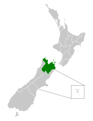
Tasman District is a local government district in the northwest of the South Island of New Zealand. It borders the Canterbury Region, West Coast Region, Marlborough Region and Nelson City. It is administered by the Tasman District Council, a unitary authority, which sits at Richmond, with community boards serving outlying communities in Motueka and Golden Bay / Mohua. The city of Nelson has its own unitary authority separate from Tasman District, and together they comprise a single region in some contexts, but not for local government functions or resource management (planning) functions.

The Buller River is a river in the South Island of New Zealand. The Buller has the highest flow of any river in the country during floods, though it is only the 13th longest river; it runs for 177 km (110 mi) from Lake Rotoiti through the Buller Gorge and into the Tasman Sea near the town of Westport. A saddle at 710 m (2,330 ft) separates the Buller from the Motupiko River and that is divided from the Wairau River by a 695 m (2,280 ft) saddle, both aligned along the Alpine Fault, as is the top of the Buller valley.

Murchison is a town in the Tasman Region of the South Island of New Zealand. It is near the western end of the "Four Rivers Plain", at the confluence of the Buller River and the Matakitaki River. The other two rivers are the Mangles River, and the Matiri River. It is a rural service town for the surrounding mixed farming district, approximately halfway between Westport and Nelson. Murchison was named after the Scottish geologist Roderick Murchison, one of the founders of the Royal Geographical Society.

The Mangles River is in the South Island of New Zealand. Its main tributary is the Tutaki River but it is also fed by water flowing off the Braeburn Range. It feeds into the Buller River near the town of Murchison. The river is popular destination for kayaking and trout fishing.

Richmond is a town and the seat of the Tasman District Council in New Zealand. It lies 13 kilometres (8 mi) south of Nelson in the South Island, close to the southern extremity of Tasman Bay / Te Tai-o-Aorere. The town, first settled by Europeans in 1842, was named in 1854 after the town of Richmond on Thames near London. The town has an estimated population of 18,450 as of June 2022.
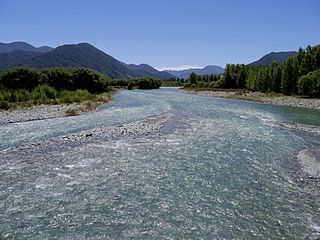
The Mātakitaki River is located in the north of New Zealand's South Island. An upper tributary of the Buller River, it flows north and west for 65 kilometres from its source north of the Lewis Pass, joining the Buller at Murchison. It has one major tributary, the Glenroy River.

Nelson Province was constituted in 1853 under the New Zealand Constitution Act 1852, and originally covered the entire upper South Island, including all of present-day Buller, Kaikoura, Marlborough, and Tasman districts, along with Nelson City, Grey District north of the Grey River, and the Hurunui District north of the Hurunui River. It was reduced in size by the creation of Marlborough Province in November 1859, then abolished in 1876, along with all the provinces of New Zealand.
Tasman District Council is the unitary local authority for the Tasman District of New Zealand.
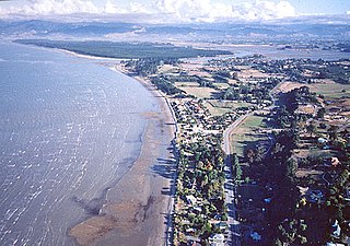
Māpua is a small town in the South Island of New Zealand. It is to the west of Nelson on State Highway 60 and on the coastline of Tasman Bay.
Waimea County was one of the counties of New Zealand on the South Island.
Takaka County was one of the counties of New Zealand in the South Island.

State Highway 60 is a state highway servicing the far northwest of the South Island of New Zealand. Running between the settlements of Richmond and Collingwood, it is 116 kilometres (72 mi) long and lies entirely within the Tasman District. It is the northernmost highway in the South Island and is a popular tourist route, servicing Motueka, Abel Tasman National Park, Golden Bay, and Farewell Spit.
Golden Bay County was one of the counties of New Zealand on the South Island.
Collingwood County was one of the counties of New Zealand on the South Island.
The Nelson Marlborough District Health Board was a district health board with the focus on providing healthcare to the Nelson, Tasman and Marlborough districts of New Zealand. In July 2022, it was merged into the national health service Te Whatu Ora.
Brooklyn is a settlement and rural valley in the Tasman District of New Zealand's upper South Island. It is located on the outskirts of Motueka, and is dominated by orchards.

Tarakohe, in older sources referred to as Terekohe, is a locality in the Tasman District of New Zealand's upper South Island, located east of Pōhara in Golden Bay.
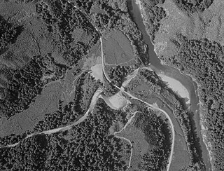
Newton River in the Tasman District ), flows west and then south for about 20 km (12 mi) from Mount Newton to the Buller River, 17 km (11 mi) west of Murchison. Near its mouth it is crossed by SH6 on a steel truss bridge with a 120 ft (37 m) main span and two 30 ft (9.1 m) side spans.
References
- ↑ "Murchison County Act 1908 (Local) (8 EDW VII 1908 No 31)".
- ↑ Walrond, Carl (3 August 2015). "Nelson region - Government". Te Ara - the Encyclopedia of New Zealand. New Zealand Ministry for Culture and Heritage . Retrieved 5 November 2018.
Coordinates: 41°48′S172°20′E / 41.800°S 172.333°E
| | This Tasman District geography article is a stub. You can help Wikipedia by expanding it. |