Bannockburn is a village in West Deerfield and Vernon townships in Lake County, Illinois, United States. Per the 2020 census, the population was 1,013. The village is generally considered part of the Chicago area's North Shore region. The Friedman house by Frank Lloyd Wright is located in Bannockburn.

A system of counties of New Zealand was instituted after the country dissolved its provinces in 1876, and these counties were similar to other countries' systems, lasting with little change until 1989, when they were reorganised into district and city councils within a system of larger regions.

The Awarau River, usually known as Larry's Creek is located within the South Island of New Zealand. The river is about 27 kilometres (17 mi) long and runs northwest from its headwaters in the Victoria Range to its confluence with the Inangahua River north of Reefton. It also drains part of the Brunner Range and there was a track along that range linking to Lyell by 1901, though none existed in 1874. A track also ran south over Kirwan Hill to the Montgomerie River.

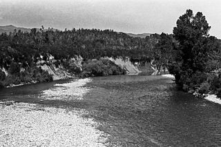
The Buller River is a river in the South Island of New Zealand. The Buller has the highest flow of any river in the country during floods, though it is only the 13th longest river; it runs for 177 km (110 mi) from Lake Rotoiti through the Buller Gorge and into the Tasman Sea near the town of Westport. A saddle at 710 m (2,330 ft) separates the Buller from the Motupiko River and that is divided from the Wairau River by a 695 m (2,280 ft) saddle, both aligned along the Alpine Fault, as is the top of the Buller valley.
The Inangahua River is located in the north-west of New Zealand’s South Island. It is a major tributary of the Buller River, where it joins at the town of Inangahua Junction.

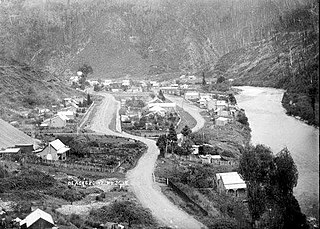
Inangahua is a small settlement in the northwest of New Zealand's South Island. It consists of three settled areas: Inangahua Junction at the confluence of the Inangahua and Buller Rivers, 34 kilometres (21 mi) north of Reefton and 46 kilometres (29 mi) southeast of Westport; Inangahua Landing, 10 km further up the Inangahua River; and Inangahua township, 2 km east of the Junction. Murchison is 52 kilometres (32 mi) further east. After the 1968 Inangahua Earthquake, most of the inhabitants left the area or shifted to the township, which is now the population centre and known simply as Inangahua.

Buller District is one of 53 districts of New Zealand, and is within the West Coast Region. It covers Westport, Karamea, Reefton and Inangahua Junction.
Buller District Council is the territorial authority for the Buller District of New Zealand.
Gmina Żarnowiec is a rural gmina in Zawiercie County, Silesian Voivodeship, in southern Poland. Its seat is the village of Żarnowiec, which lies approximately 32 kilometres (20 mi) east of Zawiercie and 67 km (42 mi) north-east of the regional capital Katowice.
Buller is a former New Zealand parliamentary electorate, from 1871 to 1972. It was represented by eleven Members of Parliament.
Grey Valley is a former parliamentary electorate in the West Coast region of New Zealand. The electorate was created for the 1871 general election as a single-member electorate, became a two-member electorate for the 1876 general election, and was split between the single-member electorates of Greymouth and Inangahua for the 1881 general election.
Inangahua is a former parliamentary electorate in the Buller District, which is part of the West Coast region of New Zealand, from 1881 to 1896. The town of Inangahua Junction, which gave the electorate its name, was located in the adjacent Buller electorate until 1887.
The Little Grey River, also known as the Māwheraiti is a river of the West Coast Region of New Zealand. It is a major tributary of the Grey River / Māwheranui which it joins at Ikamatua.
Buller County was one of the counties of New Zealand on the South Island.
Grey County was one of the counties of New Zealand in the South Island.

The Mayor of Buller is the head of the municipal government of Buller District, New Zealand. The mayor is directly elected using the first-past-the-post electoral system.
Murchison County was one of the counties of New Zealand on the South Island.
Blacks Point is a locality near Reefton on the West Coast of the South Island of New Zealand.
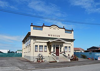
Reefton Hospital is a hospital in Reefton on the West Coast of New Zealand. It was founded in 1872 and its closure was announced in 2024.

The Blackwater River is located in the Buller District of New Zealand. It flows north-northwest for 19 kilometres (12 mi) from the northern slopes of Mount Copernicus in the Paparoa Range, reaching the Buller River 16 kilometres (9.9 mi) west of Inangahua in the lower Buller Gorge.
