Related Research Articles

Nelson is a city on the eastern shores of Tasman Bay. Nelson is the oldest city in the South Island and the second-oldest settled city in New Zealand – it was established in 1841 and became a city by royal charter in 1858.

Tasman District is a local government district in the northwest of the South Island of New Zealand. It borders the Canterbury Region, West Coast Region, Marlborough Region and Nelson City. It is administered by the Tasman District Council, a unitary authority, which sits at Richmond, with community boards serving outlying communities in Motueka and Golden Bay / Mohua. The city of Nelson has its own unitary authority separate from Tasman District, and together they comprise a single region in some contexts, but not for local government functions or resource management (planning) functions.

Motueka is a town in the South Island of New Zealand, close to the mouth of the Motueka River on the western shore of Tasman Bay / Te Tai-o-Aorere. It is the second largest in the Tasman Region, with a population of 8,280 as of June 2021.

Richmond is a town and the seat of the Tasman District Council in New Zealand. It lies 13 kilometres (8 mi) south of Nelson in the South Island, close to the southern extremity of Tasman Bay / Te Tai-o-Aorere. The town, first settled by Europeans in 1842, was named in 1854 after the town of Richmond on Thames near London. The town has an estimated population of 18,000 as of June 2021.

Tākaka is a small town situated at the southeastern end of Golden Bay, at the northern end of New Zealand's South Island, located on the lower reaches of the Tākaka River. State Highway 60 runs through Takaka and follows the river valley before climbing over Tākaka Hill, to Motueka linking Golden Bay with the more populated coast of Tasman Bay / Te Tai-o-Aorere to the southeast. The town is served by Takaka Aerodrome.
Golden Bay Air Limited is a small airline based in Takaka, New Zealand. The airline currently operates three light aircraft from Takaka to Wellington and Karamea, and also from Nelson to Takaka and Karamea with connecting road shuttle services to the Abel Tasman National Park, the Heaphy Track in the Kahurangi National Park and to and from Takaka township. Other services provided by the airline include charter flights around New Zealand flown on demand and preset scenic routes around the National Parks as well as Farewell Spit.

Nelson Province was constituted in 1853 under the New Zealand Constitution Act 1852, and originally covered the entire upper South Island, including all of present-day Buller, Kaikoura, Marlborough, and Tasman districts, along with Nelson City, Grey District north of the Grey River, and the Hurunui District north of the Hurunui River. It was reduced in size by the creation of Marlborough Province in November 1859, then abolished in 1876, along with all the provinces of New Zealand.
Tasman District Council is the unitary local authority for the Tasman District of New Zealand.
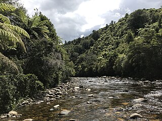
The Ōtere River is a short river of the Tasman Region of New Zealand's South Island. It flows north to reach Golden Bay approximately halfway between Tākaka and Collingwood, flowing into an inlet at the remnants of Onekaka Wharf.
The Parapara River is a river of the Tasman Region of New Zealand's South Island. It flows generally north from its watershed in the Kahurangi National Park, reaching Golden Bay at the small settlement of Parapara, 5 kilometres south of Collingwood.
Waimea County was one of the counties of New Zealand on the South Island.

State Highway 60 is a state highway servicing the far northwest of the South Island of New Zealand. Running between the settlements of Richmond and Collingwood, it is 116 kilometres (72 mi) long and lies entirely within the Tasman District. It is the northernmost highway in the South Island and is a popular tourist route, servicing Motueka, Abel Tasman National Park, Golden Bay, and Farewell Spit.

Golden Bay / Mohua is a shallow, paraboloid-shaped bay in New Zealand, near the northern tip of the South Island. An arm of the Tasman Sea, the bay lies northwest of Tasman Bay / Te Tai-o-Aorere and Cook Strait. It is protected in the north by Farewell Spit, a 26 km long arm of fine golden sand that is the country's longest sandspit. The Aorere and Tākaka rivers are the major waterways to flow into the bay from the south and the west.

Wainui Bay is within Golden Bay, and at the south-eastern end of Golden Bay, in the Tasman Region of the South Island, New Zealand. Bordering the Abel Tasman National Park, it is approximately 24 kilometres (15 mi) north-east of Tākaka, the nearest town. There are several Department of Conservation walking tracks that start in Wainui Bay, including the Wainui Falls track, the Taupo Point track, and other tracks leading into the Abel Tasman National Park.
Murchison County was one of the counties of New Zealand on the South Island.
Golden Bay County was one of the counties of New Zealand on the South Island.
Collingwood County was one of the counties of New Zealand on the South Island.

The Abel Tasman Monument is a memorial to the first recorded contact between Europeans—led by the Dutch explorer Abel Tasman—and Māori in New Zealand's Golden Bay on 18 and 19 December 1642. It was unveiled 300 years later on the tercentenary of the encounter by the prime minister, several government ministers, and a Dutch delegation. Originally referred to as the Abel Tasman Memorial and designed by the architect Ernst Plischke, the centrepiece of the monument is a concrete monolith painted white and symbolising a sail. Located on a bluff at Tarakohe just east of the popular holiday resort of Pōhara, the land for the monument was gifted by the Golden Bay Cement Company. The dignitaries opened the Abel Tasman National Park the following day and the area holding the monument is part of the national park, although physically separate from it. As was typical for the 1940s, the original inscription focused on the European experience only and overlooked the Māori perspective.
Patons Rock is a coastal settlement in the Tasman District of New Zealand. It is located in Golden Bay, northwest of Tākaka.

Tarakohe, in older sources referred to as Terekohe, is a locality in the Tasman District of New Zealand's upper South Island, located east of Pōhara in Golden Bay.
References
- ↑ "Collingwood County Bill 1903 (143–1) (Local)". Government of New Zealand . 1903. Retrieved 5 November 2018.
- ↑ "Collingwood County Council". National Register of Archives and Manuscripts. Archives New Zealand. 4 August 2006. Archived from the original on 16 October 2008. Retrieved 5 November 2018.
- ↑ Walrond, Carl (3 August 2015). "Nelson region – Government". Te Ara – the Encyclopedia of New Zealand. New Zealand Ministry for Culture and Heritage . Retrieved 5 November 2018.
Coordinates: 40°51′15″S172°48′25″E / 40.85417°S 172.80694°E
| | This Tasman District geography article is a stub. You can help Wikipedia by expanding it. |