
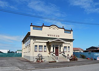
Cheviot is a town in the Hurunui District of north Canterbury, on the east coast of the South Island of New Zealand. It is located on State Highway 1, approximately 112 kilometres (70 mi) north of Christchurch and 68 kilometres (42 mi) south of Kaikōura.

Hanmer Springs is a small town in the Canterbury region of the South Island of New Zealand. The Māori name for Hanmer Springs is Te Whakatakanga o te Ngārahu o te ahi a Tamatea, which means “where the ashes of Tamate’s (sic) fire lay”, referring to Tamatea, the captain of the canoe Tākitimu.

The Kaikōura District is a territorial authority district in Canterbury Region on the South Island of New Zealand. The district encompasses the eponymous town of Kaikōura, a number of small towns and settlements and the surrounding rural area in northern Canterbury. The district had an estimated population of 4,230 as of June 2023.

Hurunui District is a territorial local government district within the Canterbury Region on the east coast of New Zealand's South Island, north of Christchurch. It stretches from the east coast to the Main Divide. Its land area is 8,640.96 square kilometres (3,336.29 sq mi).

Nelson Province was constituted in 1853 under the New Zealand Constitution Act 1852, and originally covered the entire upper South Island, including all of present-day Buller, Kaikoura, Marlborough, and Tasman districts, along with Nelson City, Grey District north of the Grey River, and the Hurunui District north of the Hurunui River. It was reduced in size by the creation of Marlborough Province in November 1859, then abolished in 1876, along with all the provinces of New Zealand.

Tasman District Council is the unitary local authority for the Tasman District of New Zealand.
The Waiau Branch was a branch line railway in the northern Canterbury region of New Zealand's South Island. Known as the Great Northern Railway for its first few decades of life, the Waiau Branch was seen as part of a main line north but was ultimately superseded by a coastal route. Opened in stages from 1882 to 1919, the line closed in 1978 but a portion has been retained as the Weka Pass Railway.

Culverden is a small town in the northern Canterbury region of New Zealand's South Island. It lies at the centre of the Amuri Plain. Culverden has traditionally been surrounded by sheep farms. Dairy farms have now become more common as a result of irrigation schemes in the area. The Waiau Plains Irrigation Scheme was completed in 1980. It provides irrigation to 17,000 hectares of farmland and the Balmoral Scheme provides irrigation to a further 5500 hectares.

Tophouse, also known as Tophouse Settlement, is a rural locality in the Tasman District of New Zealand's South Island, some 8 km northeast of Saint Arnaud. It is named after a hotel established in the 19th century to service drovers transporting their sheep between Canterbury and Marlborough. The hotel is still in operation today and has an eventful history, including a double murder suicide in October 1894. For many years, "Tophouse" referred specifically to the hotel, but it has also been used to refer to the general vicinity, and on 20 February 2001, the New Zealand Geographic Board assigned the name "Tophouse Settlement" to the area.

Rotherham is a small village in the Hurunui District of the Canterbury region in New Zealand's South Island. It is between Culverden and Waiau on the Inland Kaikōura Road, on the northernmost part of the Amuri Plain. It lies near the south bank of the Waiau Uwha River, a popular location for trout and salmon fishing.

The Hope Fault is an active dextral strike-slip fault in the northeastern part of South Island, New Zealand. It forms part of the Marlborough Fault System, which accommodates the transfer of displacement along the oblique convergent boundary between the Indo-Australian Plate and Pacific Plate, from the transform Alpine Fault to the Hikurangi Trench subduction zone.

Mt Lyford (1590m) is the home of an alpine village and ski resort in the South Island of New Zealand. It is 146 kilometres by road north of Christchurch on the Inland Kaikōura Road (SH70) between Culverden and Kaikōura. The resort is a 40-minute drive to Hanmer Springs and a 45-minute drive to Kaikōura. The nearby township of Waiau, Canterbury has a small supermarket, DIY store and petrol station. The Inland Kaikōura Road is very scenic and windy from Waiau through to Kaikōura and forms part of the Alpine Pacific Touring Route.

The Hanmer River is a river in the Hurunui District of New Zealand. It originates in the Hossack Saddle between the Hanmer Range and the Amuri Range, and flows south-west into the Waiau Uwha River about 8 kilometres (5.0 mi) south-west of Hanmer Springs.
Grey County was one of the counties of New Zealand in the South Island.
Cheviot County was one of the counties of New Zealand in the South Island.
Hurunui District Council is the territorial authority for the Hurunui District of New Zealand.
MainPower New Zealand Limited is an electricity distribution company, based in Rangiora, New Zealand, responsible for electricity distribution to nearly 42,000 customers in the Canterbury region north of the Waimakariri River. MainPower was formed in 1993, after the Energy Companies Act 1992 required the North Canterbury Electric Power Board to reform into a commercial power company. More reforms in 1998 required electricity companies nationally to split their lines and retail businesses, with MainPower retaining its lines business and selling its retail business to Contact Energy.
Kaikoura County was one of the counties of New Zealand on the South Island.

The mayor of Hurunui officiates over the Hurunui District of New Zealand's South Island. The district is administered by a district council. The current mayor is Marie Black, elected in the 2019 New Zealand local elections.
The Amuri Plain is the northernmost extension of New Zealand's Canterbury Plains. It lies between the Waiau Uwha and Hurunui Rivers and is centred on the town of Culverden. Other population centres on the plain include Rotherham. The plains cover approximately 60,000 hectares.

