
Basti district is one of the districts of Uttar Pradesh state, India, and a part of Basti Division. Basti city is the district headquarters.
Chitbara Gaon is a town and a nagar panchayat of Ballia district, Uttar Pradesh, India.
Gormi is a block and a nagar panchayat in Bhind district in the Indian state of Madhya Pradesh. Gormi is located at 26.6°N 78.52°E..
Harraiya is a town and tehsil in Basti district in the Indian state of Uttar Pradesh.
Kora Jahanabad is a town in Fatehpur district and in Indian state of Uttar Pradesh. It is located on Kora Road, about 6 km east of Jahanabad, about 43 km south of Kanpur, 78 km west by northwest of Fatehpur, and 480 km southeast of Delhi. Local people also call it "Jahanabad".
Obra is a town, Tehsil, and Assembly constituency of the Indian state of Uttar Pradesh. It is located in the Sonebhadra district. It has been upgraded from the stature of Nagar Panchayat, and was previously a part of the Mirzapur District. Obra is located 137 km from Varanasi at the Banks of Renu & Sone River with population of 46,574 as per the 2011 India Census. State-owned UPRVUNL and UPJVUNL have a coal-fired thermal power plant and a hydroelectric power plant in Obra, respectively. The thermal and hydroelectric power industries are the major source of employment, either directly or indirectly. Obra is not very well connected by rail. The nearest railway station is Chopan, which is about 10 kilometers from Obra, and has connectivity to other major cities of India. Recreational places in Obra include Jawahar Bal Udayan, Ambedkar Stadium, Lord Shiva's temple, Sone river banks, and Parsoi and Kharatiya villages. Restructuring of government residential colony is ongoing as new power plants are being constructed.
Reoti is a town and a nagar panchayat in Ballia district in the Indian state of Uttar Pradesh. Known for got freedom before 1947 As usual India had got freedom on 15 Aug 1947 but all across the India Reoti town got freedom in 1942.
Basti is a city, municipal board and administrative headquarters of Basti district in the Indian state of Uttar Pradesh. The district is part of Basti division. It is situated 202 kilometres east of the state capital, Lucknow.
Aryapur Khera is the village. Mainpuri city is an administrative headquarters of this village. Mainpuri is located to the north-east of Agra.
Jihuli is a village in the East Champaran district of Bihar, India.

Amorha Khas is a gram panchayat in Basti district in the Indian state of Uttar Pradesh. In the freedom struggle of 1857, about 250 martyrs of Amorha State were hanged by the British Government from peepal trees located at Chhawani.
Injuwarampur is a village in Kanpur Dehat district in the state of Uttar Pradesh, India.
Paina is a village and Nyaya Panchayat situated along the bank of Sarayu (Ghaghra) river in the eastern part of the state of Uttar Pradesh in India. It comes under administration of Barhaj Tehsil of Deoria District and Gorakhpur Division. It is located 33 km towards South from District headquarters Deoria and 340 km from State capital Lucknow.
Ramrekha Mandir is a Hindu temple of Lord Ram and Goddess Sita.
Shriram Kuti is a villa and landmark in Amorha Khas village near Ram Janki Marg near Chhawani in Basti district in the Indian state of Uttar Pradesh..
Fatehpur Gayand is a village situated in Shahabad sub district of District Hardoi, Uttar Pradesh. Population of the village is lump som 8000. Fatehpur Gayand is a Gram Panchayat and Nyay Panchayat under Todarpur Block of District Hardoi.
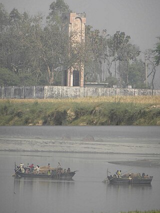
Makhauda Dham is one of the place in Harraiya tehsil in Basti district.Makhauda Dham is situated on the banks of Manorama river, 15 km north of Ayodhya.
Gothawn is a town located in the Azamgarh district of Uttar Pradesh, India. It comes under the Martinganj subdistrict There are three main religions Hinduism, Buddhism and Islam. International Buddhist Temple is the most important place here. It was founded by Venerable Chandrajeet Gautam.
Bhadon is a village and Gram Panchayat located in Martinganj tehsil of the Azamgarh District in the Indian state of Uttar Pradesh, near the border with Jaunpur District. It is 37.7 kilometres (23.4 mi) north-east of the district headquarters in Azamgarh and 229.9 kilometres (142.9 mi) from the state capital of Lucknow.
Harraiya is a constituency of the Uttar Pradesh Legislative Assembly covering the city of Harraiya in the Basti district of Uttar Pradesh India.


