
Ghaghara, also called Karnali is a perennial trans-boundary river originating on the Tibetan Plateau near Lake Manasarovar. The Karnali cuts through the Himalayas in Nepal and joins the Sharda River at Brahmaghat in India. Together they form the Ghaghara River, a major left bank tributary of the Ganges. With a length of 507 kilometres (315 mi) it is the longest river in Nepal. The total length of Ghaghara River up to its confluence with the Ganges at Revelganj in Bihar is 1,080 kilometres (670 mi). It is the largest tributary of the Ganges by volume and the second longest tributary of the Ganges by length after Yamuna.

The Gandaki River, also known as the Narayani and the Gandak, is one of the major rivers in Nepal and a left bank tributary of the Ganges in India. Its total catchment area amounts to 46,300 km2 (17,900 sq mi), most of it in Nepal. In the Nepal Himalayas, it is notable for its deep canyon. The basin also contains three mountains over 8,000 m (26,000 ft), namely Dhaulagiri, Manaslu and Annapurna I. Dhaulagiri is the highest point of the Gandaki basin.

The Burhi Gandak River is a tributary of the Ganges. It is known as Narayani in its upper reaches. The Burhi (“Old”) Gandak flows parallel to and east of the Gandak River in an old channel.

Valmiki National Park is a Tiger Reserve in the West Champaran District of Bihar, India. It is the only national park in Bihar. Valmiki Tiger Reserve covers 898.45 km2 (346.89 sq mi), which is 17.4% of the total geographical area of the district. As of 2018, there were 40 tigers in the Reserve.

Shuswap Lake Marine Provincial Park is a provincial park in British Columbia, Canada, comprising 894 ha. The Park has a variety of amenities including boat launch ramps, picnic areas, and 27 campsites around the perimeter of Shuswap Lake. The lake's name and that of the surrounding Shuswap Country is from the Shuswap people (Secwepemc), the most northern of the Salishan speaking people.

Motipur is a town and a notified area in Muzaffarpur district in the Indian state of Bihar.
The Kluskus First Nation is the band government of the Lhoosk’uz, a Dakelh people whose main reserve located on the Chilcotin Plateau 130 km west of the city of Quesnel, British Columbia, Canada. The First Nation is a member of the Carrier-Chilcotin Tribal Council, which includes both Tsilhqot'in and Carrier (Dakelh) communities.
Oda is the name of several places in western Ghana, though most are known by a second name as well. From east to west:
The Nazko First Nation is a First Nations government of the Dakelh people in the north-central Interior of British Columbia. Its reserves are located around the community of Nazko, British Columbia, which is 120 km west of Quesnel and southwest of Prince George.
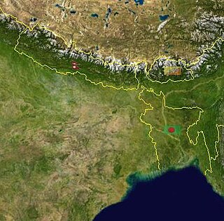
Bihar is located in the eastern region of India, between latitudes 24°20'10"N and 27°31'15"N and longitudes 83°19'50"E and 88°17'40"E. It is an entirely land–locked state, in a subtropical region of the temperate zone. Bihar lies between the humid West Bengal in the east and the sub humid Uttar Pradesh in the west, which provides it with a transitional position in respect of climate, economy and culture. It is bounded by Nepal in the north and by Jharkhand in the south. Bihar plain is divided into two unequal halves by the river Ganges which flows through the middle from west to east. Bihar's land has average elevation above sea level of 173 feet.
The Tahltan First Nation, also known as the Tahltan Indian Band, is a band government of the Tahltan people. Their main community and reserves are located at Telegraph Creek, British Columbia. Their language is the Tahltan language, which is an Athabaskan language also known as Nahanni, is closely related to Kaska and Dunneza. Their Indian and Northern Affairs Canada band number is 682. The Tahltan First Nation is joined with the Iskut First Nation in a combined tribal council-type organization known as the Tahltan Nation.

Bandheri Ritesh खराड़ी सिंगर is a town in Dhar district of Madhya Pradesh, India.
Kiliyanur is a village in Villupuram district, Tamil Nadu, India.

Limkheda is a village in Dahod district, Gujarat, India.
Oba Hills Forest Reserve is a reserve in Osun State, Nigeria that covers about 52 km2 of hilly terrain with deep gorges. A 2003 report by the UICN said about 12% of the reserve had been planted with teak. Some chimpanzee sightings had been reported, and in 1999 a dead chimp was offered for sale in a local market. A 2009 report said that almost all of the reserve had been converted to plantations and farms, with only two gullies remaining forest-covered. Chimpanzees are now thought to be almost extinct in the reserve.

Sekayam River is a river of Borneo, West Kalimantan province, Indonesia. It is a tributary of the Kapuas River. The Public Forest System Utility Program has a scheme on the river aimed at reducing the level of mercury content absorbed by humans.
Belwania is a small village situated between Padrauna and Chhitauni on the National Highway 28B in the Kushinagar District of Uttar Pradesh State in India. It is under the Gram Panchayat of Dargauli and the current Gram Pradhan of the Dargauli Gram Panchayat is Mr. Phul Badan 'Saroj'. The village is situated almost on the border of Uttar Pradesh and Bihar.
Khairwa is a village in West Champaran district in the Indian state of Bihar. The village is situated on the banks of river Bhudi Gandak, which is tributary of river Gandak.
Goshpur Ezra is a Gram panchayat in Hajipur, Vaishali district, Bihar.
ishmailpur is a Gram panchayat in hajipur, vaishali district, bihar.

