Related Research Articles

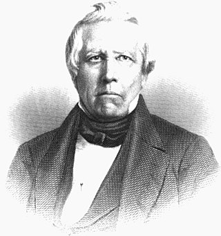
James McBride (1788–1859) was a prominent pioneer statesman in Butler County, Ohio. He was Hamilton's first Mayor, and a prominent State Representative associated with the canals, archaeologist who supplied a considerable number of sketches of earthworks for early texts on the Mississippi Valley, Ohio's leading pioneer author and antiquarian, Miami University Secretary and President of the Board of Trustees, Butler County's fifth Sheriff, a surveyor, and an officer of other various entities. James McBride married the daughter of Judge Lytle, of the Lytle family of the Ohio River Valley, and was through her kinsman with Sen. Homer T. Bone, and Governor of Ohio Andrew L. Harris. McBride's son in law was Roger N. Stembel, a commander of the Pacific Fleet.

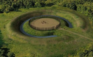
Hopewell Culture National Historical Park is a United States national historical park with earthworks and burial mounds from the Hopewell culture, indigenous peoples who flourished from about 200 BC to 500 AD. The park is composed of four separate sites open to the public in Ross County, Ohio, including the former Mound City Group National Monument. The park includes archaeological resources of the Hopewell culture. It is administered by the United States Department of the Interior's National Park Service. It was designated a part of Hopewell Ceremonial Earthworks World Heritage Site in 2023.

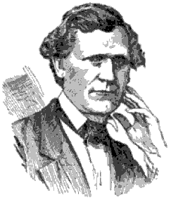
Ephraim George Squier, usually cited as E. G. Squier, was an American archaeologist, history writer, painter and newspaper editor.

Ancient Monuments of the Mississippi Valley (1848) by the Americans Ephraim George Squier and Edwin Hamilton Davis is a landmark in American scientific research, the study of the prehistoric indigenous mound builders of North America, and the early development of archaeology as a scientific discipline. Published in 1848, it was the Smithsonian Institution's first publication and the first volume in its Contributions to Knowledge series. The book had 306 pages, 48 lithographed maps and plates, and 207 wood engravings. The book was reissued in 1998 in paperback, with an introduction by David J. Meltzer, professor of anthropology at Southern Methodist University.

Bourneville is a census-designated place in central Twin Township, Ross County, Ohio, United States. It has a post office with the ZIP code 45617. It lies along U.S. Route 50. The population of the CPD was 241 at the 2020 census.

Fortified Hill Works is a registered historic site near Hamilton, Ohio, listed in the National Register on July 12, 1974.

The Alligator Effigy Mound is an effigy mound in Granville, Ohio, United States. The mound is believed to have been built between AD 800 and 1200 by people of the Fort Ancient culture. The mound was likely a ceremonial site, as it was not used for burials.

The Hopeton Earthworks are an Ohio Hopewell culture archaeological site consisting of mounds and earthwork enclosures. It is located on the eastern bank of the Scioto River just north of Chillicothe in Ross County, Ohio, about 1 mile (1.6 km) east of the Mound City Group and Shriver Circle on a terrace of the Scioto River. The site is a detached portion of the Hopewell Culture National Historic Park, along with the Mound City Group, Hopewell Mound Group, Seip Earthworks, Spruce Hill Earthworks, and the High Bank Works. The site is open to the public.

The Portsmouth Earthworks are a large prehistoric mound complex constructed by the Native American Adena and Ohio Hopewell cultures of eastern North America. The site was one of the largest earthwork ceremonial centers constructed by the Hopewell and is located at the confluence of the Scioto and Ohio Rivers, in present-day Ohio.

Edwin Hamilton Davis was an American physician and self taught archaeologist who completed pioneering investigations of the mound builders in the Mississippi Valley. Davis gathered what, at that time, was the largest privately held collection of prehistoric Indian artifacts in the United States.

Charles Whittlesey was a soldier, geologist, historian, and an investigator of mounds relics of the United States. He is described by Ephraim George Squier and Edwin Hamilton Davis in their book Ancient Monuments of the Mississippi Valley as a "zealous investigator" in the field of "American antiquarian research."

The Highbanks Metropolitan Park Mounds I and II are two archaeological sites located within Highbanks Metro Park in Central Ohio in the United States. The park is in southernmost Delaware County on the east bank of the Olentangy River. The subconical mounds are believed to have been built by the Adena culture.

The Mount Horeb Earthworks Complex is an Adena culture group of earthworks in Lexington, Kentucky. It consists of two major components, the Mount Horeb Site 1 and the Peter Village enclosure, and several smaller features including the Grimes Village site, Tarleton Mound, and Fisher Mound. The Peter Village and Grimes Village enclosures were mapped by Rafinesque and featured in Squier and Davis's landmark publication Ancient Monuments of the Mississippi Valley in 1848 as Plate XIV Figures 3 and 4.

Fort Hill State Memorial is a Native American earthwork located in Highland County, Ohio, United States. Built by the Hopewell culture, it is maintained by the Arc of Appalachia Preserve System and the Ohio History Connection.
Howard Baum Site is a Hopewell tradition earthworks site located in Ross County, Ohio, in the United States. The work is located near the north fork of Paint Creek. It was described, in 1848, as "one of the largest and most interesting in the Scioto valley."

Cedar-Bank Works is group of Adena culture earthworks located in Ross County, Ohio in the United States. It is located approximately five miles north of the town of Chillicothe, Ohio.
The Junction Group is a site of earthworks located two miles southwest of Chillicothe, Ohio in the United States. The earthworks are associated with the Hopewell tradition. The site has been described as "unusual" by contemporary archaeologists. Excavations in the early 19th-century state that the site was not for fortification, but was used for religious purposes, including for burials.
The Dunlap Works are a group of Hopewell tradition earthworks located in Ross County, Ohio in the United States. It is located approximately 6 miles (9.7 km) north of the city of Chillicothe, Ohio on the left bank of the Scioto River. The site should not be confused with the earthworks in Hamilton County on the Great Miami River near Dunlap's Station, the former site of a pioneer fort.

The Piketon Mounds are a group of earthworks located in Piketon, Ohio in the United States. The site is listed on the National Register of Historic Places. The specific age of the site is unknown. Some mounds were created by the Adena culture, while other mounds were built by the Hopewell culture.

The Shriver Circle Earthworks are an Ohio Hopewell culture archaeological site located in Chillicothe in Ross County, Ohio. At 1,200 feet (370 m) in diameter the site is one of the largest Hopewell circular enclosures in the state of Ohio.
References
- ↑ "Remarkable Ohio: Marker Details". The Ohio Channel. 2008. Archived from the original on September 27, 2011. Retrieved April 27, 2011.
- ↑ Squier, Ephraim George; Davis, Edwin Hamilton (1848). Ancient Monuments of the Mississippi Valley. Smithsonian Institution. pp. 135–139.