
The geography of Mozambique consists mostly of coastal lowlands with uplands in its center and high plateaus in the northwest. There are also mountains in the western portion. The country is located on the east coast of southern Africa, directly west of the island of Madagascar. Mozambique has a tropical climate with two seasons, a wet season from October to March and a dry season from April to September.

Modes of transport in Mozambique include rail, road, water, and air. There are rail links serving principal cities and connecting the country with Malawi, Zimbabwe and South Africa. There are over 30,000km of roads, but much of the network is unpaved.

Mutare is the most populous city in the province of Manicaland, and the third most populous city in Zimbabwe, having surpassed Gweru in the 2012 census, with an urban population of 188,243 and approximately 260,567 in the surrounding districts giving the wider metropolitan area a total population of over 500,000 people. Mutare is also the capital of Manicaland province and the largest city in Eastern Zimbabwe.
The Lubombo Transfrontier Conservation Area was born out of the Peace Park Foundation’s vision to establish a network of transfrontier conservation areas in southern Africa. It straddles the border between South Africa’s KwaZulu-Natal province, southern Mozambique, and Eswatini.

The Eastern Highlands, also known as the Manica Highlands, is a mountain range on the border of Zimbabwe and Mozambique. The Eastern Highlands extend north and south for about 300 kilometres (190 mi) through Zimbabwe's Manicaland Province and Mozambique's Manica Province.

Chimanimani District is a mountainous district in Manicaland Province of eastern Zimbabwe. The district headquarters is the town of Chimanimani.
Chipinge District is a district in Manicaland Province of Zimbabwe. The administrative headquarters is Chipinge.

Zimbabwe Parks and Wildlife Management Authority (Zimparks) is an agency of the Zimbabwe government managing national parks. Zimbabwe's game reserves are managed by the government. They were initially founded as a means of using unproductive land.
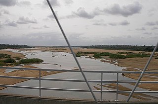
The Save River, or Sabi River is a 400 mi (640 km) river of southeastern Africa, flowing through Zimbabwe and Mozambique. The river has its source in Zimbabwe, some 80 km (50 mi) south of Harare, then flows south and then east, from the Zimbabwean highveld to its confluence with the Odzi River. It then turns south, drops over the Chivirira Falls, and flows down the western side of Zimbabwe's Eastern Highlands forming a dry river valley in the rain shadow of these mountains. It is joined by the Runde River or Lundi at the Mozambique border, forming a dramatic confluence at Mahenya. It then crosses Mozambique to flow into the Indian Ocean at about 21°S.

The Bvumba Mountains or Vumba Mountains straddle the Zimbabwe-Mozambique border, and are situated some 10 km south east of Mutare. The Bvumba rise to Castle Beacon at 1,911 metres, and are, together with the Chimanimani Mountains to the south and Nyanga Mountains to the north, part of the Eastern Highlands of the Manicaland and adjacent Manica provinces. They are referred to as the "Mountains of the Mist", as so often the early morning starts with a mist which clears by mid-morning. Although lying mostly within Zimbabwe, the mountains extend north-eastward to Mount Vumba in Mozambique. They are capped by cool, green hills which shelter country hotels, a casino and golf course at the Leopard Rock Hotel and a Botanical Garden with one of the best views in Africa. The mountains are also known for their coffee plantations.

The wildlife of Mozambique consists of the flora and fauna of this country in southeastern Africa. Mozambique has a range of different habitat types and an ecologically rich and diverse wildlife. This includes 236 species of mammal, 740 species of bird and 5,692 species of vascular plant. The Maputaland-Pondoland-Albany hotspot, with significantly high levels of biodiversity, stretches from the southern tip of Mozambique into northeastern South Africa.

Sussundenga District is a district of Manica Province in western Mozambique. The principal town is Sussundenga. The district is located in the center of the province, and borders with Manica District in the north, Gondola District in the northeast, Buzi District of Sofala Province in the east, Chibabava District of Sofala Province in the southeast, Mossurize District in the south, and with Zimbabwe in the west. The area of the district is 7,057 square kilometres (2,725 sq mi). It has a population of 129,851 as of 2007.

Chimanimani is a town in Zimbabwe.
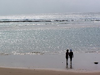
The tourism assets of Mozambique include the country's natural environment, wildlife, and cultural heritage, which provide opportunities for beach, cultural, and eco-tourism.

The Southern Zanzibar-Inhambane coastal forest mosaic, also known as the Southern Swahili coastal forests and woodlands, is a tropical moist broadleaf forest ecoregion of eastern Africa. It is a southern variation of Northern Zanzibar-Inhambane coastal forest mosaic. The ecoregion supports habitats of forest, savanna and swamps. The southern portion of the ecoregion is not as well studied due to the 1977-1992 civil war in Mozambique.
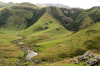
The Chimanimani Mountains are a mountain range on the border of Zimbabwe and Mozambique. The mountains are in the southern portion of the Eastern Highlands, or Manica Highlands, a belt of highlands that extend north and south along the international border, between the Zambezi and Save rivers.

The 144 km2Moribane Forest Reserve which was proclaimed in 1957, is a natural forest in the buffer zone of the 640 km2 Chimanimani National Reserve, and is situated 24 km north of Dombé, in Sussundenga District of central Mozambique. The mid to low-altitude tropical rain forest covers hilly country, from 400 to 550 metres in altitude, on the eastern verges of the largest southern African forest of this type, altogether 820 km2 in extent. It can be reached using public transport from Sussundenga.

The South Malawi montane forest-grassland mosaic is a montane grasslands and shrublands ecoregion of Tanzania, Malawi, Mozambique, and Zambia.
Mutare District is a district in Manicaland Province of eastern Zimbabwe. The district headquarters is the city of Mutare.

