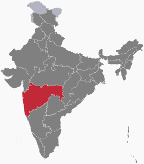
Nandurbar is an administrative district in the northwest corner of Maharashtra state in India. On 1 July 1998 Dhule was bifurcated as two separate districts now known as Dhule and Nandurbar. The district headquarters are located at Nandurbar city. The district occupies an area of 5035 km² and has a population of 1,311,709 of which 15.45% were urban.

Nandurbarpronunciation (help·info) is a city and a municipal council in Nandurbar district in the Indian state of Maharashtra. Nandurbar municipal corportaion is the first municipal corporation. Nandurbar is an administrative district in the northwest corner of of Maharashtra. On 1 July 1998 Dhule was bifurcated as two separate districts now known as Dhule and Nandurbar. The district headquarters is located at Nandurbar city. The district occupies an area of 5034 km² and has a population of 1,311,709 of which 15.45% is urban. Nandurbar district is bounded to the south and south-east by Dhule district, to the west and north is the state of Gujarat, to the north and north-east is the state of Madhya Pradesh. The northern boundary of the district is defined by the great Narmada river. It came into limelight during February 2006 bird flu crisis which struck many of its poultry farms. Thousand of chickens from the farms had to be killed and buried in nearby grounds to stop the virus spreading. Earlier of 2016, Nandurbar [Maharashtra]].now a day nandurbar is one of the devolping district.from independence congress government run the nagarpalika.
Sakri is a census town in the Dhule District of the Nashik division, Maharashtra state, India. The town of Sakri is the administrative headquarters for Sakri Taluka. Another Sakri is in Bihar, which is now a railway junction.
Ajnale is a small village in the state of Maharashtra, India. It is located in the Dhule taluka of Dhule District in Maharashtra.
Gotane is a small village in the state of Maharashtra, India. It is located in the Dhule taluka of Dhule District in Maharashtra.
Khede is a small village in the state of Maharashtra, India. It is located in the Dhule taluka of Dhule District in Maharashtra.

Laling Killa is a small fort (killa) situated in the present day Dhule district of Maharashtra state in India. The fort is situated on top of Laling hill about 9.65 km (6.00 mi) south of Dhule city. It was one of the important forts in the Khandesh region during the time of the Faruqi Kings.
Khede or Mauje Khede is a small village in Niphad Taluka of Nashik district in Maharashtra State of India. Located on the left bank of Vinata River, Khede is also known for temple of Shri Hinglaj Mata.
Ajang is a small village in the state of Maharashtra, India. It is located in the Dhule taluka of Dhule District in Maharashtra.
Aklad is a small village situated beside the Panzra river where most people speak Aahirani. The village is in the state of Maharashtra, India. It is located in the Dhule taluka of Dhule District in Maharashtra.
Amdad is a small village in the state of Maharashtra, India. It is located in the Dhule taluka of Dhule District in Maharashtra.
Nimgul is a small village in the state of Maharashtra, India. It is located in the Sindkheda taluka of Dhule District.
Kapadne is a small village in the state of Maharashtra, India. It is located in the Dhule taluka of Dhule district in Maharashtra.
Kusumba is a small village in the state of Maharashtra, India. It is located in the Dhule taluka of Dhule District in Maharashtra at dhule- sakri road on Gujarat-Nagpur highway.

Chinchakhede is a village in India, Located in the north-west region of the Maharashtra state in Dhule district. Near banks of river 'Kanher'. Agriculture and Animal husbandry is main source of income for the village. It is located 1,128 km from national capital Delhi, 288 km distance from its State Capital Mumbai & 22 km from district place Dhule.
Sakri Taluka' i s a taluka/tahasil in Dhule Subdivision of Dhule District of Maharashtra state in India. Headquarters for the taluka is the town of Sakri. In Sakri Taluka there is a large village named Pimpalner that has historical importance. Pimpalner hosts a religious fair in the name of Khandoji Maharaj, every year during the time of the Ganesh Festival in the month of Bhadra. Pimpalner is located alongside the Panzara River, which is the lifeline of Dhule District.
Kasare, is a panchayat village in Dhule district of Maharashtra, India. Administratively, Kasare is under Sakri Taluka of Dhule District in Maharashtra. There is only the single village of Kasare in the Kasare gram panchayat. This village is located 10 km by road southwest of the town of Sakri, on the right (south) bank of the Panjhra River.
Udane is a small village in the state of Maharashtra, India. It is located in the Dhule taluka of Dhule District in Maharashtra.
Betawad is a village in Sindkheda Taluka in Dhule District of Maharashtra State, India. It belongs to Khandesh and Northern Maharashtra region. It belongs to Nashik Division.