
Ariyalur district is an administrative district, one of the 38 districts in the state of Tamil Nadu in India. The district headquarters is located at Ariyalur. The district encompasses an area of 1,949.31 km².

Perambalur is one of the 38 districts in the state of Tamil Nadu, India. The district headquarters is located at Perambalur. The district occupies an area of 1,752 km² and had a population of 565,223 with a sex-ratio of 1,003 females for every 1,000 males in 2011.

Jayankondam is a First Grade Municipality in Ariyalur district of Tamil Nadu in India. As of 2022, the town had a population of 45,000.
Lalgudi is a town in Tiruchirapalli district in the Indian state of Tamil Nadu. The town of Lalgudi heads the Lalgudi taluk, Lalgudi division, Lalgudi Educational District, Lalgudi DSP and Lalgudi Constituency.

Thuraiyur is a town and a municipality in the Tiruchirappalli district in the Indian state of Tamil Nadu. It was upgraded to a III Grade Municipality from Town Panchayat on 17 January 1970, and to a II Grade Municipality in May 1998. It was upgraded to Selection Grade Municipality in the year 2008. It is also a taluka. It is located 310 km away from Chennai.

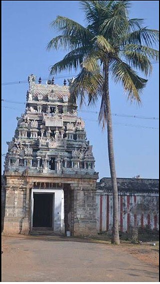
Udayarpalayam is a panchayat town in the Ariyalur district of the Indian state of Tamil Nadu, near Jayankondam.

Ariyalur is a town and district headquarters of Ariyalur district in the South Indian state of Tamil Nadu and is rich in limestone, surrounded with seven cement factories and two sugar factories. The town is located at a distance of 310 km (190 mi) from the state capital Chennai.
Sengipatti is a village in Budalur taluk on the Tanjore–Trichy National Highway of Tanjore district, Tamil Nadu. It is located 23 kilometers from Thanjavur 33 kilometers from Tiruchirapalli 46 kilometers from Pudukkottai 65 kilometers from Ariyalur and 66 kilometers from kumbakonam. It is the main junction of bus routes for Thanjavur, Trichy and Pudukottai districts.
Marungulam is a village in the Thanjavur taluk of Thanjavur district, Tamil Nadu, India.
Kallankurichi is a village in the Ariyalur taluk of Ariyalur district, Tamil Nadu, India.

Pudukkottai is a village in the Ariyalur taluk of Ariyalur district, Tamil Nadu, India. The village has a population of 1856 in 2001 making it smallest settlement in Ariyalur. The Village is close to the Tiruchirapplli District and Thanjavur District border and is within a short distance of locations such as Tiruchirappalli, the Ariyalur and Thanjavur.
Melapalur is a village in the Ariyalur taluk of Ariyalur district, Tamil Nadu, India.Melapalur is located 15 km west from the District headquarters Ariyalur.
Periyathirukonam is a village on the bank of maruthai aaru in the Ariyalur taluk of Ariyalur district, Tamil Nadu, India. The famous gods are Iyanar, Adaikka Karuppu, Nondi Karuppu, Malayala Karuppu. A temple build in 765AD is located on the South West corner of the village. It is located 20 km away from its district headquarters Ariyalur.
Reddipalayam is a village in the Ariyalur taluk of Ariyalur district, Tamil Nadu, India.
Thirumanur is a village in the Ariyalur taluk of Ariyalur district, Tamil Nadu, India.
Andimadam is a town in Tamil Nadu. It is one of the blocks in the Ariyalur district and Taluk in the Ariyalur district "Land Of Cement", Tamil Nadu, India. It has three State Highways running across.
Devanur is a village in the Andimadam taluk of Ariyalur district, Tamil Nadu, India.
Kumbakonam block is a community development block in the Kumbakonam taluk of Thanjavur District, Tamil Nadu, India. There are a total of 47 villages in this block. The block is surrounded by the Thirumanur and T.Palur blocks of Ariyalur District to the north, Thiruvidaimarudur and Thiruppanandal blocks of Thanjavur District to the east and Tiruvarur block of Tiruvarur District to the south and Papanasam block of Thanjavur district to the west. It is one of the six blocks of Thanjavur district watered by the Kaveri River.
Thirumanur block is a revenue block of Ariyalur district of the Indian state of Tamil Nadu. This revenue block consist of 36 panchayat villages.
Kaiperambalur is a panchayat village of the Kizhamathdur district in Perambalur, Tamil Nadu, India. It was formally part of the Tiruchirappalli district.

